 |
|
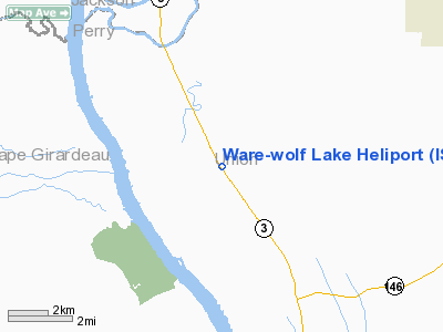
Location
& QuickFacts
|
FAA
Information Effective: |
2007-12-20 |
|
Airport
Identifier: |
IS99 |
|
Airport
Status: |
Operational |
|
Longitude/Latitude: |
089-26-20.0000W/37-30-27.0000N
-89.438889/37.507500 (Estimated) |
|
Elevation: |
350 ft / 106.68 m (Estimated) |
|
Land: |
0 acres |
|
From nearest
city: |
0 nautical miles SW of Wolf Lake, IL |
|
Location: |
Union County, IL |
|
Magnetic
Variation: |
00E (1995) |
Owner
& Manager
|
Ownership: |
Privately
owned |
|
Owner: |
Ware-wolf Lake Fire Dept |
|
Address: |
Po Box 126
Wolf
Lake, IL 62998 |
|
Phone
number: |
618-833-5770 |
|
Manager: |
Harold Smith |
|
Address: |
Po Box 126
Wolf
Lake, IL 62998 |
|
Phone
number: |
618-833-3405 |
Airport Operations
and Facilities
|
Airport
Use: |
Private |
|
Segmented
Circle: |
No |
|
Control
Tower: |
No |
|
Lighting
Schedule: |
PHONE REQ
FOR PERIMETER AND FLOOD LGTS CALL 618-833-5770. |
|
Sectional
chart: |
St Louis |
|
Region: |
AGL - Great Lakes |
|
Boundary
ARTCC: |
ZKC - Kansas City |
|
Tie-in
FSS: |
COU - Columbia |
|
FSS on
Airport: |
No |
|
FSS Toll
Free: |
1-800-WX-BRIEF |
|
Runway Information
Helipad H1
|
Dimension: |
40 x 40 ft /
12.2 x 12.2 m |
|
Surface: |
CONC, Good Condition |
|
|
Runway H1 |
Runway |
|
Traffic
Pattern: |
Left |
Left |
|
Radio Navigation
Aids
|
ID |
Type |
Name |
Ch |
Freq |
Var |
Dist |
|
PJY |
NDB |
Pinckneyville |
|
215.00 |
00E |
28.3 nm |
|
CIR |
NDB |
Cairo |
|
397.00 |
00E |
28.7 nm |
|
CHQ |
NDB |
Charleston |
|
208.00 |
01E |
40.0 nm |
|
SAR |
NDB |
Sparta |
|
239.00 |
01E |
40.3 nm |
|
BDD |
NDB |
Bellgrade |
|
254.00 |
00E |
42.7 nm |
|
HSB |
NDB |
Harrisburg-raleigh |
|
230.00 |
00E |
46.3 nm |
|
DXE |
NDB |
Dexter |
|
423.00 |
00E |
49.5 nm |
|
PRI |
NDB |
Perrine |
|
367.00 |
02E |
49.6 nm |
|
CGI |
VOR/DME |
Cape Girardeau |
076X |
112.90 |
01E |
18.0 nm |
|
MWA |
VOR/DME |
Marion |
041X |
110.40 |
04E |
25.2 nm |
|
FAM |
VORTAC |
Farmington |
104X |
115.70 |
01E |
39.2 nm |
|
CNG |
VORTAC |
Cunningham |
078X |
113.10 |
03E |
41.6 nm |
Remarks
- SEE
AIRSPACE CASE 96-AGL-265-NRA.
Ware-wolf Lake Heliport
Address:
Union County, IL
Tel: 618-833-5770,
618-833-3405
Images
and information placed above are from
http://www.airport-data.com/airport/IS99/
We
thank them for the data!
| General
Info |
| Country |
United
States |
| State |
ILLINOIS
|
| FAA ID |
IS99 |
| Latitude |
37-30-27.000N
|
| Longitude |
089-26-20.000W
|
| Elevation |
350 feet
|
| Near City |
WOLF LAKE
|
We don't guarantee the information is fresh and accurate. The data may
be wrong or outdated.
For more up-to-date information please refer to other sources.
|
|


