 |
|
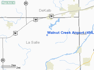
Location
& QuickFacts
|
FAA
Information Effective: |
2007-12-20 |
|
Airport
Identifier: |
49IL |
|
Airport
Status: |
Operational |
|
Longitude/Latitude: |
088-41-30.0000W/41-35-36.0000N
-88.691667/41.593333 (Estimated) |
|
Elevation: |
666 ft / 203.00 m (Estimated) |
|
Land: |
0 acres |
|
From nearest
city: |
3 nautical miles S of Somonauk, IL |
|
Location: |
La Salle County, IL |
|
Magnetic
Variation: |
01W (1995) |
Owner
& Manager
|
Ownership: |
Privately
owned |
|
Owner: |
Thomas Warren |
|
Address: |
3805 Victor Line Road
Somonauk,
IL 60552 |
|
Phone
number: |
815-498-2517 |
|
Manager: |
Thomas Warren |
|
Address: |
3805 Victor Line Road
Somonauk,
IL 60552 |
|
Phone
number: |
815-498-2517 |
Airport Operations
and Facilities
|
Airport
Use: |
Private |
|
Wind indicator: |
Yes |
|
Segmented
Circle: |
No |
|
Control
Tower: |
No |
|
Sectional
chart: |
Chicago |
|
Region: |
AGL - Great Lakes |
|
Boundary
ARTCC: |
ZAU - Chicago |
|
Tie-in
FSS: |
IKK - Kankakee |
|
FSS Toll
Free: |
1-800-WX-BRIEF |
|
Runway Information
Runway 09/27
|
Dimension: |
2200 x 100 ft
/ 670.6 x 30.5 m |
|
Surface: |
TURF, |
|
|
Runway 09 |
Runway 27 |
|
Traffic
Pattern: |
Left |
Left |
|
Obstruction: |
35 ft pline, 100.0 ft from runway |
40 ft trees, 100.0 ft from runway |
|
Radio Navigation
Aids
|
ID |
Type |
Name |
Ch |
Freq |
Var |
Dist |
|
OIX |
NDB |
Ottawa |
|
266.00 |
01E |
15.7 nm |
|
DKB |
NDB |
Dekalb |
|
209.00 |
02W |
20.5 nm |
|
VYS |
NDB |
Valley |
|
230.00 |
00W |
25.1 nm |
|
ME |
NDB |
Deana |
|
350.00 |
00E |
37.3 nm |
|
HK |
NDB |
Ermin |
|
332.00 |
01W |
39.1 nm |
|
MX |
NDB |
Kedzi |
|
248.00 |
01W |
45.9 nm |
|
BOZ |
NDB |
Whiteside |
|
254.00 |
01E |
49.6 nm |
|
DPA |
VOR/DME |
Dupage |
021X |
108.40 |
02E |
23.5 nm |
|
ORD |
VOR/DME |
Chicago O'hare |
086X |
113.90 |
02E |
42.5 nm |
|
PLL |
VOR/DME |
Polo |
049X |
111.20 |
03E |
43.5 nm |
|
RFD |
VOR/DME |
Rockford |
045X |
110.80 |
01E |
44.3 nm |
|
PNT |
VOR/DME |
Pontiac |
033X |
109.60 |
03E |
46.4 nm |
|
IKK |
VOR/DME |
Kankakee |
053X |
111.60 |
00E |
49.2 nm |
|
JOT |
VORTAC |
Joliet |
070X |
112.30 |
02E |
17.0 nm |
|
EON |
VORTAC |
Peotone |
079X |
113.20 |
02E |
45.0 nm |
|
BDF |
VORTAC |
Bradford |
094X |
114.70 |
00E |
48.1 nm |
|
ORD |
VOT |
Chicago O'hare Intl |
|
112.00 |
|
42.2 nm |
|
MDW |
VOT |
Chicago Midway |
|
111.00 |
|
43.7 nm |
Walnut Creek Airport
Address:
La Salle County, IL
Tel:
815-498-2517
Images
and information placed above are from
http://www.airport-data.com/airport/49IL/
We
thank them for the data!
| General
Info |
| Country |
United
States |
| State |
ILLINOIS
|
| FAA ID |
49IL |
| Latitude |
41-35-36.000N
|
| Longitude |
088-41-30.000W
|
| Elevation |
666 feet
|
| Near City |
SOMONAUK
|
We don't guarantee the information is fresh and accurate. The data may
be wrong or outdated.
For more up-to-date information please refer to other sources.
|
|


