 |
|
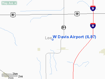
Location
& QuickFacts
|
FAA
Information Effective: |
2007-12-20 |
|
Airport
Identifier: |
IL87 |
|
Airport
Status: |
Operational |
|
Longitude/Latitude: |
089-06-44.3260W/41-42-40.1110N
-89.112313/41.711142 (Estimated) |
|
Elevation: |
930 ft / 283.46 m (Surveyed) |
|
Land: |
98 acres |
|
From nearest
city: |
2 nautical miles NW of Compton, IL |
|
Location: |
Lee County, IL |
|
Magnetic
Variation: |
00E (1985) |
Owner
& Manager
|
Ownership: |
Privately
owned |
|
Owner: |
Wallace F. Davis |
|
Address: |
875 Carnahan R
West Brooklyn, IL 61378 |
|
Phone
number: |
815-497-3893 |
|
Address: |
|
Airport Operations
and Facilities
|
Airport Use: |
Private |
|
Wind
indicator: |
Yes |
|
Segmented
Circle: |
No |
|
Control
Tower: |
No |
|
Landing
fee charge: |
No |
|
Sectional
chart: |
Chicago |
|
Region: |
AGL - Great Lakes |
|
Boundary
ARTCC: |
ZAU - Chicago |
|
Tie-in
FSS: |
IKK - Kankakee |
|
FSS on
Airport: |
No |
|
FSS Toll
Free: |
1-800-WX-BRIEF |
Airport Services
|
Airframe
Repair: |
NONE |
|
Power
Plant Repair: |
NONE |
|
Runway Information
Runway N/S
|
Dimension: |
2000 x 200 ft
/ 609.6 x 61.0 m |
|
Surface: |
TURF, |
|
|
Runway N |
Runway S |
|
Traffic
Pattern: |
Left |
Left |
|
Radio Navigation
Aids
|
ID |
Type |
Name |
Ch |
Freq |
Var |
Dist |
|
VYS |
NDB |
Valley |
|
230.00 |
00W |
21.5 nm |
|
DKB |
NDB |
Dekalb |
|
209.00 |
02W |
22.6 nm |
|
OIX |
NDB |
Ottawa |
|
266.00 |
01E |
24.0 nm |
|
BOZ |
NDB |
Whiteside |
|
254.00 |
01E |
30.2 nm |
|
FEP |
NDB |
Freeport |
|
335.00 |
00E |
38.5 nm |
|
EZI |
NDB |
Kewanee |
|
245.00 |
01E |
48.9 nm |
|
PLL |
VOR/DME |
Polo |
049X |
111.20 |
03E |
24.0 nm |
|
RFD |
VOR/DME |
Rockford |
045X |
110.80 |
01E |
31.2 nm |
|
DPA |
VOR/DME |
Dupage |
021X |
108.40 |
02E |
35.8 nm |
|
JOT |
VORTAC |
Joliet |
070X |
112.30 |
02E |
37.0 nm |
|
BDF |
VORTAC |
Bradford |
094X |
114.70 |
00E |
39.5 nm |
Remarks
- OWNER
LIVES AT ARPT.
- RESTRICTED
TO PVT USE.
Based Aircraft
|
Aircraft
based on field: |
3 |
|
Single Engine
Airplanes: |
3 |
W Davis Airport
Address:
Lee County, IL
Tel:
815-497-3893
Images
and information placed above are from
http://www.airport-data.com/airport/IL87/
We
thank them for the data!
| General
Info |
| Country |
United
States |
| State |
ILLINOIS
|
| FAA ID |
IL87 |
| Latitude |
41-42-40.111N
|
| Longitude |
089-06-44.326W
|
| Elevation |
930 feet
|
| Near City |
COMPTON
|
We don't guarantee the information is fresh and accurate. The data may
be wrong or outdated.
For more up-to-date information please refer to other sources.
|
|


