|
|
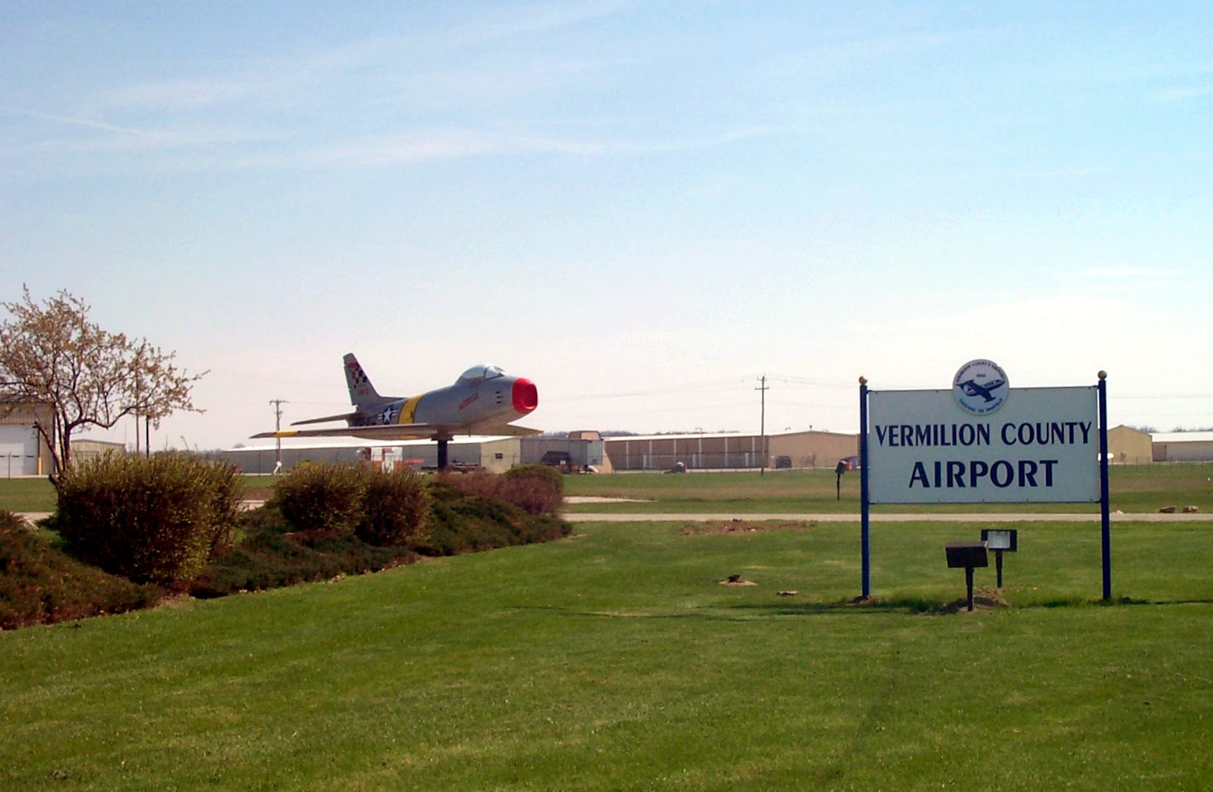
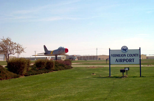
| Vermilion Regional Airport |
 |
| IATA: DNV â ICAO: KDNV |
| Summary |
| Airport type |
Public |
| Operator |
City of Danville, Illinois |
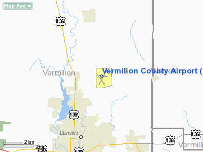
| Location |
Danville, Illinois |
| Elevation AMSL |
697 ft / 212.4 m |
| Coordinates |
40°11â²57.1â³N 87°35â²43.9â³W / 40.199194°N 87.595528°W / 40.199194; -87.595528Coordinates: 40°11â²57.1â³N 87°35â²43.9â³W / 40.199194°N 87.595528°W / 40.199194; -87.595528 |
| Website |
www.vrairport.com |
| Runways |
| Direction |
Length |
Surface |
| ft |
m |
| 3/21 |
6,004 |
1,830 |
Asphalt |
| 16/34 |
3,999 |
1,219 |
Asphalt |
Vermilion Regional Airport (IATA: DNV, ICAO: KDNV) is a public airport located four miles northeast of the city of Danville, in Vermilion County, Illinois.
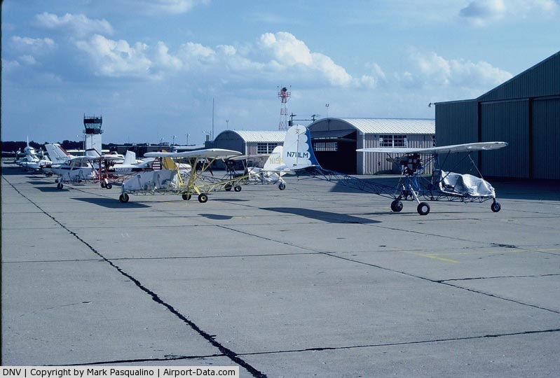
Facilities
Vermilion Regional Airport has two runways:
- Runway 3/21: 6,004 x 100 ft. (1,830 x 30 m.), Surface: Asphalt, ILS equipped.
- Runway 16/34: 3,999 x 100 ft. (1,219 x 30 m.), Surface: Asphalt
The above content comes from Wikipedia and is published under free licenses – click here to read more.
|
 |
(Click on the photo to enlarge) |
Location
& QuickFacts
|
FAA
Information Effective: |
2007-12-20 |
|
Airport
Identifier: |
DNV |
|
Airport
Status: |
Operational |
|
Longitude/Latitude: |
087-35-43.8856W/40-11-58.9092N
-87.595524/40.199697 (Estimated) |
|
Elevation: |
697 ft / 212.45 m (Surveyed) |
|
Land: |
817 acres |
|
From nearest
city: |
4 nautical miles NE of Danville, IL |
|
Location: |
Vermilion County, IL |
|
Magnetic
Variation: |
01W (1985) |
Owner
& Manager
|
Ownership: |
Publicly
owned |
|
Owner: |
Vermilion County Arpt Auth |
|
Address: |
22633 N. Bowman Ave. Ate 1
Danville, IL 61832 |
|
Phone
number: |
217-442-4624 |
|
Manager: |
R. Gagnon |
|
Address: |
22633 N. Bowman Ave. Ate 1
Danville, IL 61832 |
|
Phone
number: |
217-442-4624 |
Airport Operations
and Facilities
|
Airport
Use: |
Open
to public |
|
Wind indicator: |
Yes |
|
Control
Tower: |
No |
|
Lighting
Schedule: |
DUSK-DAWN
HIRL RY 03/21 PRESET LOW INTST - TO INCR INTST & ACTVT
MALSR RY 21, MIRL RY 16/34, VASI RYS 03, 16 & 34, PAPI
RY 21, REIL RYS 16 & 34 - CTAF. |
|
Beacon
Color: |
Clear-Green (lighted land airport) |
|
Landing
fee charge: |
No |
|
Sectional
chart: |
Chicago |
|
Region: |
AGL - Great Lakes |
|
Boundary
ARTCC: |
ZAU - Chicago |
|
Tie-in
FSS: |
STL - Saint Louis |
|
FSS on
Airport: |
No |
|
FSS Toll
Free: |
1-800-WX-BRIEF |
|
NOTAMs
Facility: |
DNV (NOTAM-d service avaliable) |
|
Federal
Agreements: |
NGY |
Airport Communications
|
CTAF: |
122.700 |
|
Unicom: |
122.700
|
Airport
Services
|
Fuel
available: |
100LLA |
|
Airframe
Repair: |
MAJOR |
|
Power
Plant Repair: |
MAJOR |
|
Bottled
Oxygen: |
NONE |
|
Bulk Oxygen: |
NONE |
|
Runway Information
Runway 03/21
|
Dimension: |
6002 x 100 ft
/ 1829.4 x 30.5 m |
|
Surface: |
ASPH, Good Condition |
|
Surface Treatment: |
Porous Friction Course |
|
Weight Limit: |
Single wheel: 50000 lbs.
Dual wheel: 75000 lbs. |
|
Edge Lights: |
High |
|
|
Runway 03 |
Runway 21 |
|
Longitude: |
087-35-58.6500W |
087-35-20.9200W |
|
Latitude: |
40-11-37.6100N |
40-12-29.3800N |
|
Elevation: |
651.00 ft |
697.00 ft |
|
Alignment: |
29 |
127 |
|
ILS Type: |
|
ILS |
|
Traffic
Pattern: |
Left |
Left |
|
Markings: |
Non-precision instrument, Good Condition |
Precision instrument, Fair Condition |
|
Crossing
Height: |
41.00 ft |
0.00 ft |
|
VASI: |
4-box on left side |
4-light PAPI on left side |
|
Visual Glide
Angle: |
3.00° |
0.00° |
|
Approach
lights: |
|
MALSR |
|
Runway End
Identifier: |
No |
No |
|
Centerline
Lights: |
No |
No |
|
Touchdown
Lights: |
No |
No |
|
Obstruction: |
51 ft tree, 1450.0 ft from runway, 146 ft right
of centerline, 24:1 slope to clear |
, 50:1 slope to clear |
|
Runway 16/34
|
Dimension: |
3999 x 100 ft
/ 1218.9 x 30.5 m |
|
Surface: |
ASPH, Good Condition |
|
Surface Treatment: |
Saw-cut or plastic Grooved |
|
Weight Limit: |
Single wheel: 40000 lbs.
Dual wheel: 50000 lbs. |
|
Edge Lights: |
Medium |
|
|
Runway 16 |
Runway 34 |
|
Longitude: |
087-35-57.0540W |
087-35-43.0260W |
|
Latitude: |
40-12-11.0410N |
40-11-33.0120N |
|
Elevation: |
682.00 ft |
656.00 ft |
|
Alignment: |
127 |
127 |
|
Traffic
Pattern: |
Left |
Left |
|
Markings: |
Basic, Fair Condition |
Non-precision instrument, Fair Condition |
|
Crossing
Height: |
26.00 ft |
26.00 ft |
|
VASI: |
2-box on left side |
2-box on left side |
|
Visual Glide
Angle: |
3.00° |
3.00° |
|
Runway End
Identifier: |
Yes |
Yes |
|
Centerline
Lights: |
No |
No |
|
Touchdown
Lights: |
No |
No |
|
Obstruction: |
120 ft tree, 3399.0 ft from runway, 27 ft left
of centerline, 26:1 slope to clear |
59 ft road, 1746.0 ft from runway, 339 ft left
of centerline, 26:1 slope to clear |
|
Radio Navigation
Aids
|
ID |
Type |
Name |
Ch |
Freq |
Var |
Dist |
|
HMJ |
NDB |
Homer |
|
281.00 |
01E |
19.5 nm |
|
PRG |
NDB |
Paris |
|
341.00 |
01E |
30.4 nm |
|
CFJ |
NDB |
Crawfordsville |
|
388.00 |
02W |
33.9 nm |
|
TVX |
NDB |
Greencastle |
|
521.00 |
03W |
46.6 nm |
|
FKR |
NDB |
Frankfort |
|
278.00 |
02W |
47.6 nm |
|
RZL |
NDB |
Rensselaer |
|
362.00 |
02W |
48.7 nm |
|
MCX |
NDB |
White County |
|
377.00 |
03W |
48.9 nm |
|
HU |
NDB |
Yinno |
|
245.00 |
02W |
49.6 nm |
|
RBS |
VOR/DME |
Roberts |
115X |
116.80 |
02E |
34.7 nm |
|
DNV |
VORTAC |
Danville |
047X |
111.00 |
02E |
5.9 nm |
|
BVT |
VORTAC |
Boiler |
098X |
115.10 |
01E |
32.2 nm |
|
CMI |
VORTAC |
Champaign |
037X |
110.00 |
03E |
32.8 nm |
|
TTH |
VORTAC |
Terre Haute |
100X |
115.30 |
02E |
45.6 nm |
Based Aircraft
|
Aircraft
based on field: |
80 |
|
Single Engine
Airplanes: |
64 |
|
Multi Engine Airplanes: |
13 |
|
Helicopters: |
2 |
|
Ultralights: |
1 |
Operational Statistics
Time
Period: 2005-01-01 - 2005-12-31
|
Aircraft
Operations: |
193/Week |
|
Air Taxi: |
10.0% |
|
General Aviation
Local: |
48.5% |
|
General Aviation
Itinerant: |
40.0% |
|
Military: |
1.5% |
Vermilion County Airport
Address:
Vermilion County, IL
Tel:
217-442-4624
Images
and information placed above are from
http://www.airport-data.com/airport/DNV/
We
thank them for the data!
| General
Info |
| Country |
United
States |
| State |
ILLINOIS
|
| FAA ID |
DNV |
| Latitude |
40-11-58.087N
|
| Longitude |
087-35-43.927W
|
| Elevation |
696 feet
|
| Near City |
DANVILLE
|
We don't guarantee the information is fresh and accurate. The data may
be wrong or outdated.
For more up-to-date information please refer to other sources.
|
|