 |
|
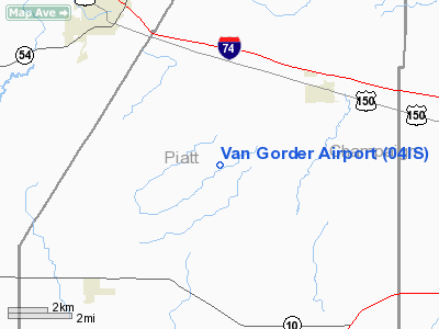
Location
& QuickFacts
|
FAA
Information Effective: |
2007-12-20 |
|
Airport
Identifier: |
04IS |
|
Airport
Status: |
Operational |
|
Longitude/Latitude: |
088-34-08.2290W/40-10-43.1210N
-88.568952/40.178645 (Estimated) |
|
Elevation: |
728 ft / 221.89 m (Estimated) |
|
Land: |
10 acres |
|
From nearest
city: |
4 nautical miles SW of Mansfield, IL |
|
Location: |
Piatt County, IL |
|
Magnetic
Variation: |
00E (1985) |
Owner & Manager
|
Ownership: |
Privately
owned |
|
Owner: |
S. B. Van Gorder |
|
Address: |
Po Box 182
Mansfield,
IL 61854 |
|
Phone
number: |
309-928-3343 |
|
Address: |
|
Airport Operations
and Facilities
|
Airport Use: |
Private |
|
Wind
indicator: |
Yes |
|
Segmented
Circle: |
No |
|
Control
Tower: |
No |
|
Sectional
chart: |
Chicago |
|
Region: |
AGL - Great Lakes |
|
Boundary
ARTCC: |
ZAU - Chicago |
|
Tie-in
FSS: |
STL - Saint Louis |
|
FSS Toll
Free: |
1-800-WX-BRIEF |
Airport Services
|
Runway Information
Runway 09/27
|
Dimension: |
2200 x 150 ft
/ 670.6 x 45.7 m |
|
Surface: |
TURF, |
|
|
Runway 09 |
Runway 27 |
|
Traffic
Pattern: |
Left |
Left |
|
Displaced
threshold: |
400.00 ft |
0.00 ft |
|
Obstruction: |
30 ft pline, 600.0 ft from runway |
|
|
Radio Navigation
Aids
|
ID |
Type |
Name |
Ch |
Freq |
Var |
Dist |
|
HMJ |
NDB |
Homer |
|
281.00 |
01E |
29.8 nm |
|
AAA |
NDB |
Abraham |
|
329.00 |
00E |
35.3 nm |
|
MT |
NDB |
Zebre |
|
347.00 |
00E |
47.9 nm |
|
SYZ |
NDB |
Shelbyville |
|
365.00 |
01E |
48.1 nm |
|
BMI |
VOR/DME |
Bloomington |
019X |
108.20 |
03E |
24.6 nm |
|
RBS |
VOR/DME |
Roberts |
115X |
116.80 |
02E |
30.5 nm |
|
PNT |
VOR/DME |
Pontiac |
033X |
109.60 |
03E |
39.3 nm |
|
MTO |
VOR/DME |
Mattoon |
031X |
109.40 |
03E |
44.1 nm |
|
CMI |
VORTAC |
Champaign |
037X |
110.00 |
03E |
16.0 nm |
|
DEC |
VORTAC |
Decatur |
119X |
117.20 |
03E |
29.6 nm |
|
DNV |
VORTAC |
Danville |
047X |
111.00 |
02E |
46.9 nm |
Based Aircraft
|
Aircraft
based on field: |
2 |
|
Single Engine
Airplanes: |
2 |
Van Gorder Airport
Address:
Piatt County, IL
Tel:
309-928-3343
Images
and information placed above are from
http://www.airport-data.com/airport/04IS/
We
thank them for the data!
| General
Info |
| Country |
United
States |
| State |
ILLINOIS
|
| FAA ID |
04IS |
| Latitude |
40-10-43.121N
|
| Longitude |
088-34-08.229W
|
| Elevation |
728 feet
|
| Near City |
MANSFIELD
|
We don't guarantee the information is fresh and accurate. The data may
be wrong or outdated.
For more up-to-date information please refer to other sources.
|
|


