 |
|
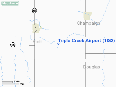
Location
& QuickFacts
|
FAA
Information Effective: |
2007-12-20 |
|
Airport
Identifier: |
1IS2 |
|
Airport
Status: |
Operational |
|
Longitude/Latitude: |
088-31-20.2190W/39-53-47.1190N
-88.522283/39.896422 (Estimated) |
|
Elevation: |
666 ft / 203.00 m (Surveyed) |
|
Land: |
0 acres |
|
From nearest
city: |
3 nautical miles SE of Bement, IL |
|
Location: |
Piatt County, IL |
|
Magnetic
Variation: |
00E (1985) |
Owner
& Manager
|
Ownership: |
Privately
owned |
|
Owner: |
John R. Funk |
|
Address: |
1164 E. 700 North Road
Bement, IL 61813 |
|
Phone
number: |
217-678-8407 |
|
Address: |
|
Airport
Operations and Facilities
|
Airport
Use: |
Private |
|
Wind indicator: |
No |
|
Segmented
Circle: |
No |
|
Control
Tower: |
No |
|
Landing
fee charge: |
No |
|
Sectional
chart: |
St Louis |
|
Region: |
AGL - Great Lakes |
|
Boundary
ARTCC: |
ZKC - Kansas City |
|
Tie-in
FSS: |
STL - Saint Louis |
|
FSS on
Airport: |
No |
|
FSS Toll
Free: |
1-800-WX-BRIEF |
|
Runway Information
Runway N/S
|
Dimension: |
2375 x 70 ft
/ 723.9 x 21.3 m |
|
Surface: |
TURF, |
|
|
Runway N |
Runway S |
|
Traffic
Pattern: |
Left |
Left |
|
Radio Navigation
Aids
|
ID |
Type |
Name |
Ch |
Freq |
Var |
Dist |
|
HMJ |
NDB |
Homer |
|
281.00 |
01E |
27.4 nm |
|
MT |
NDB |
Zebre |
|
347.00 |
00E |
31.7 nm |
|
SYZ |
NDB |
Shelbyville |
|
365.00 |
01E |
33.0 nm |
|
AAA |
NDB |
Abraham |
|
329.00 |
00E |
40.7 nm |
|
PRG |
NDB |
Paris |
|
341.00 |
01E |
40.9 nm |
|
TAZ |
NDB |
Taylorville |
|
395.00 |
00E |
42.9 nm |
|
CZB |
NDB |
Casey |
|
359.00 |
00E |
42.9 nm |
|
LQ |
NDB |
Licol |
|
375.00 |
01W |
49.8 nm |
|
MTO |
VOR/DME |
Mattoon |
031X |
109.40 |
03E |
27.4 nm |
|
BMI |
VOR/DME |
Bloomington |
019X |
108.20 |
03E |
39.8 nm |
|
RBS |
VOR/DME |
Roberts |
115X |
116.80 |
02E |
44.3 nm |
|
CMI |
VORTAC |
Champaign |
037X |
110.00 |
03E |
14.1 nm |
|
DEC |
VORTAC |
Decatur |
119X |
117.20 |
03E |
18.1 nm |
Based Aircraft
|
Aircraft
based on field: |
1 |
|
Single Engine
Airplanes: |
1 |
Triple Creek Airport
Address:
Piatt County, IL
Tel:
217-678-8407
Images
and information placed above are from
http://www.airport-data.com/airport/1IS2/
We
thank them for the data!
| General
Info |
| Country |
United
States |
| State |
ILLINOIS
|
| FAA ID |
1IS2 |
| Latitude |
39-53-47.119N
|
| Longitude |
088-31-20.219W
|
| Elevation |
666 feet
|
| Near City |
BEMENT
|
We don't guarantee the information is fresh and accurate. The data may
be wrong or outdated.
For more up-to-date information please refer to other sources.
|
|


