|
|
|
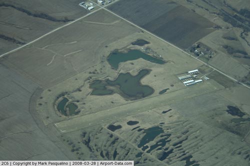 |
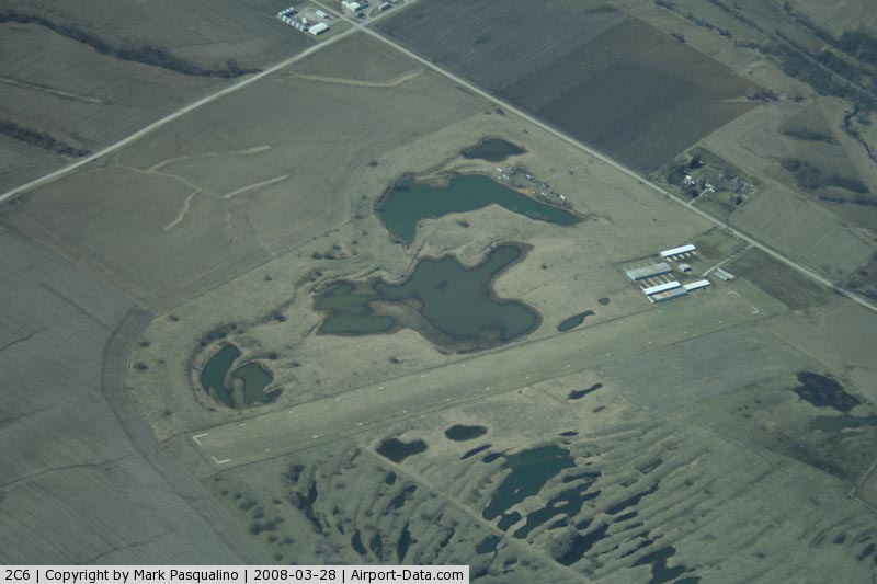
(Click on the photo to enlarge) |
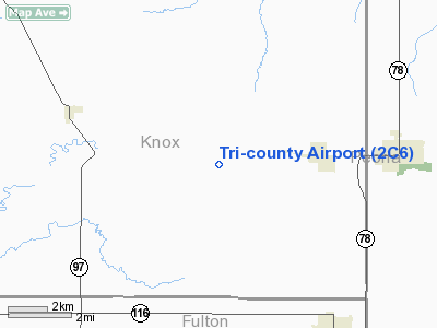
Location
& QuickFacts
|
FAA
Information Effective: |
2007-12-20 |
|
Airport
Identifier: |
2C6 |
|
Airport
Status: |
Operational |
|
Longitude/Latitude: |
090-04-27.9000W/40-46-26.4000N
-90.074417/40.774000 (Estimated) |
|
Elevation: |
661 ft / 201.47 m (Surveyed) |
|
Land: |
27 acres |
|
From nearest
city: |
3 nautical miles W of Yates City, IL |
|
Location: |
Knox County, IL |
|
Magnetic
Variation: |
01E (1985) |
Owner
& Manager
|
Ownership: |
Privately
owned |
|
Owner: |
Tri County Arpt Devel Corp |
|
Address: |
10825 Mc Clellan Rd
Elmwood, IL 61529 |
|
Phone
number: |
309-358-1168 |
|
Manager: |
Dave Shipley |
|
Address: |
10825 Mcclellan Rd
Elmwood, IL 61529 |
|
Phone
number: |
309-742-8668 |
Airport
Operations and Facilities
|
Airport
Use: |
Open
to public |
|
Wind indicator: |
Yes |
|
Segmented
Circle: |
No |
|
Control
Tower: |
No |
|
Lighting
Schedule: |
RDO-CTL
ACTVT LIRL RY 02/20 - CTAF. |
|
Landing
fee charge: |
No |
|
Sectional
chart: |
Chicago |
|
Region: |
AGL - Great Lakes |
|
Boundary
ARTCC: |
ZAU - Chicago |
|
Tie-in
FSS: |
IKK - Kankakee |
|
FSS on
Airport: |
No |
|
FSS Toll
Free: |
1-800-WX-BRIEF |
|
NOTAMs
Facility: |
IKK (NOTAM-d service avaliable) |
Airport
Communications
Airport
Services
|
Airframe
Repair: |
NONE |
|
Power
Plant Repair: |
NONE |
|
Runway Information
Runway 02/20
|
Dimension: |
2809 x 150 ft
/ 856.2 x 45.7 m |
|
Surface: |
TURF, Good Condition |
|
Edge Lights: |
Non-standard lighting system
RY 02/20 NSTD LIRL DUE TO SPACING. |
|
|
Runway 02 |
Runway 20 |
|
Longitude: |
090-04-33.7479W |
090-04-22.0291W |
|
Latitude: |
40-46-13.2313N |
40-46-39.5210N |
|
Elevation: |
658.00 ft |
654.00 ft |
|
Alignment: |
19 |
127 |
|
Traffic
Pattern: |
Left |
Left |
|
Obstruction: |
90 ft trees, 2274.0 ft from runway, 116 ft
right of centerline, 25:1 slope to clear |
23 ft trees, 553.0 ft from runway, 92 ft left
of centerline, 24:1 slope to clear |
|
Radio Navigation
Aids
|
ID |
Type |
Name |
Ch |
Freq |
Var |
Dist |
|
CTK |
NDB |
Canton |
|
236.00 |
02E |
12.5 nm |
|
PI |
NDB |
Tungg |
|
356.00 |
01E |
24.2 nm |
|
EZI |
NDB |
Kewanee |
|
245.00 |
01E |
26.2 nm |
|
JZY |
NDB |
Macomb |
|
251.00 |
01E |
27.0 nm |
|
AAA |
NDB |
Abraham |
|
329.00 |
00E |
50.0 nm |
|
GBG |
VOR/DME |
Galesburg |
035X |
109.80 |
03E |
19.1 nm |
|
PIA |
VORTAC |
Peoria |
099X |
115.20 |
04E |
14.0 nm |
|
BDF |
VORTAC |
Bradford |
094X |
114.70 |
00E |
32.0 nm |
|
BRL |
VORTAC |
Burlington |
051X |
111.40 |
05E |
38.9 nm |
|
MZV |
VORTAC |
Moline |
091X |
114.40 |
05E |
41.6 nm |
Remarks
- GEESE
ON & INVOF ARPT.
- PRVDD
OBS ARE REMOVED/LOWERED TO PRVD 20:1 APCH/CLNC, 125' EITHER SIDE OF
CNTRLN BE CLEAR OF OBS.
Based Aircraft
|
Aircraft
based on field: |
28 |
|
Single Engine
Airplanes: |
20 |
|
Gliders: |
1 |
|
Ultralights: |
7 |
Operational Statistics
Time
Period: 2005-01-01 - 2005-12-31
|
Aircraft
Operations: |
193/Week |
|
General Aviation
Local: |
50.0% |
|
General Aviation
Itinerant: |
50.0% |
Tri-county Airport
Address:
Knox County, IL
Tel:
309-358-1168,
309-742-8668
Images
and information placed above are from
http://www.airport-data.com/airport/2C6/
We
thank them for the data!
| General
Info |
| Country |
United
States |
| State |
ILLINOIS
|
| FAA ID |
2C6 |
| Latitude |
40-46-26.400N
|
| Longitude |
090-04-27.900W
|
| Elevation |
661 feet
|
| Near City |
YATES
CITY |
We don't guarantee the information is fresh and accurate. The data may
be wrong or outdated.
For more up-to-date information please refer to other sources.
|
|