 |
|
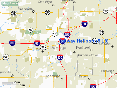
Location
& QuickFacts
|
FAA
Information Effective: |
2007-12-20 |
|
Airport
Identifier: |
5IL8 |
|
Airport
Status: |
Operational |
|
Longitude/Latitude: |
088-03-06.2330W/41-48-18.1080N
-88.051731/41.805030 (Estimated) |
|
Elevation: |
736 ft / 224.33 m (Surveyed) |
|
Land: |
0 acres |
|
From nearest
city: |
2 nautical miles W of Downers Grove, IL |
|
Location: |
Du Page County, IL |
|
Magnetic
Variation: |
01W (1990) |
Owner
& Manager
|
Ownership: |
Publicly
owned |
|
Owner: |
Illinois State Toll Hwy Auth |
|
Address: |
One Authority Drive
Downers Grove, IL 60515-1703 |
|
Phone
number: |
630-241-6800 |
|
Manager: |
Edward C. Quedens Sr |
|
Address: |
One Authority Drive
Downers Grove, IL 60515-1703 |
|
Phone
number: |
630-241-6800 |
Airport
Operations and Facilities
|
Airport Use: |
Private |
|
Wind
indicator: |
Yes |
|
Segmented
Circle: |
No |
|
Control
Tower: |
No |
|
Sectional
chart: |
Chicago |
|
Region: |
AGL - Great Lakes |
|
Boundary
ARTCC: |
ZAU - Chicago |
|
Tie-in
FSS: |
IKK - Kankakee |
|
FSS
Toll Free: |
1-800-WX-BRIEF |
Airport
Communications
|
Runway Information
Helipad H1
|
Dimension: |
46 x 46 ft /
14.0 x 14.0 m |
|
Surface: |
CONC, |
|
|
Runway H1 |
Runway |
|
Traffic
Pattern: |
Left |
Left |
|
Radio Navigation
Aids
|
ID |
Type |
Name |
Ch |
Freq |
Var |
Dist |
|
ME |
NDB |
Deana |
|
350.00 |
00E |
9.8 nm |
|
HK |
NDB |
Ermin |
|
332.00 |
01W |
11.0 nm |
|
MX |
NDB |
Kedzi |
|
248.00 |
01W |
16.7 nm |
|
DKB |
NDB |
Dekalb |
|
209.00 |
02W |
30.4 nm |
|
OIX |
NDB |
Ottawa |
|
266.00 |
01E |
44.8 nm |
|
ORD |
VOR/DME |
Chicago O'hare |
086X |
113.90 |
02E |
12.8 nm |
|
DPA |
VOR/DME |
Dupage |
021X |
108.40 |
02E |
14.3 nm |
|
OBK |
VOR/DME |
Northbrook |
077X |
113.00 |
02W |
25.4 nm |
|
IKK |
VOR/DME |
Kankakee |
053X |
111.60 |
00E |
44.8 nm |
|
ENW |
VOR/DME |
Kenosha |
029X |
109.20 |
02W |
48.0 nm |
|
JOT |
VORTAC |
Joliet |
070X |
112.30 |
02E |
19.6 nm |
|
CGT |
VORTAC |
Chicago Heights |
089X |
114.20 |
02E |
27.9 nm |
|
EON |
VORTAC |
Peotone |
079X |
113.20 |
02E |
34.3 nm |
|
ORD |
VOT |
Chicago O'hare Intl |
|
112.00 |
|
12.5 nm |
|
MDW |
VOT |
Chicago Midway |
|
111.00 |
|
13.5 nm |
Remarks
- PRVDD
APCH/DEP ROUTE HELICOPTER OPRS 080-100 DEGS & FM 260-280 DEGS. TKOF/LDG
AREA IS APPROPRIATELY MKD. A NON-OBSTRUCTING WIND INDICATOR IS MAINTAINED.
Based Aircraft
|
Aircraft
based on field: |
1 |
|
Helicopters: |
1 |
Tollway Heliport
Address:
Du Page County, IL
Tel:
630-241-6800
Images
and information placed above are from
http://www.airport-data.com/airport/5IL8/
We
thank them for the data!
| General
Info |
| Country |
United
States |
| State |
ILLINOIS
|
| FAA ID |
5IL8 |
| Latitude |
41-48-18.108N
|
| Longitude |
088-03-06.233W
|
| Elevation |
736 feet
|
| Near City |
DOWNERS
GROVE |
We don't guarantee the information is fresh and accurate. The data may
be wrong or outdated.
For more up-to-date information please refer to other sources.
|
|


