 |
|
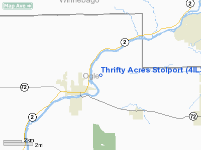
Location
& QuickFacts
|
FAA
Information Effective: |
2007-12-20 |
|
Airport
Identifier: |
4IL3 |
|
Airport
Status: |
Operational |
|
Longitude/Latitude: |
089-13-42.3810W/42-08-34.0870N
-89.228439/42.142802 (Estimated) |
|
Elevation: |
725 ft / 220.98 m (Estimated) |
|
Land: |
0 acres |
|
From nearest
city: |
3 nautical miles NW of Stillman Valley (byron),
IL |
|
Location: |
Ogle County, IL |
|
Magnetic
Variation: |
00W (1990) |
Owner
& Manager
|
Ownership: |
Privately
owned |
|
Owner: |
Merle Bruce Haselton |
|
Address: |
5800 E. Skinner Road
Stillman Valley, IL 61084 |
|
Phone
number: |
815-234-3099 |
|
Manager: |
Bruce Haselton |
|
Address: |
5800 E. Skinner Road
Stillman Valley, IL 61084 |
|
Phone
number: |
815-234-3099 |
Airport
Operations and Facilities
|
Airport
Use: |
Private |
|
Wind indicator: |
Yes |
|
Segmented
Circle: |
No |
|
Control
Tower: |
No |
|
Sectional
chart: |
Chicago |
|
Region: |
AGL - Great Lakes |
|
Boundary
ARTCC: |
ZAU - Chicago |
|
Tie-in
FSS: |
IKK - Kankakee |
|
FSS Toll
Free: |
1-800-WX-BRIEF |
|
Runway Information
Runway 01/19
|
Dimension: |
1650 x 70 ft
/ 502.9 x 21.3 m |
|
Surface: |
TURF, |
|
|
Runway 01 |
Runway 19 |
|
Traffic
Pattern: |
Left |
Left |
|
Displaced
threshold: |
430.00 ft |
480.00 ft |
|
Obstruction: |
30 ft trees, 50.0 ft from runway |
80 ft trees, 770.0 ft from runway |
|
Radio Navigation
Aids
|
ID |
Type |
Name |
Ch |
Freq |
Var |
Dist |
|
FEP |
NDB |
Freeport |
|
335.00 |
00E |
17.1 nm |
|
DKB |
NDB |
Dekalb |
|
209.00 |
02W |
26.4 nm |
|
JVL |
NDB |
Janesville |
|
375.00 |
03E |
29.6 nm |
|
BOZ |
NDB |
Whiteside |
|
254.00 |
01E |
36.0 nm |
|
LVV |
NDB |
Lake Lawn |
|
404.00 |
00W |
43.7 nm |
|
VYS |
NDB |
Valley |
|
230.00 |
00W |
47.5 nm |
|
OIX |
NDB |
Ottawa |
|
266.00 |
01E |
49.8 nm |
|
RFD |
VOR/DME |
Rockford |
045X |
110.80 |
01E |
5.1 nm |
|
PLL |
VOR/DME |
Polo |
049X |
111.20 |
03E |
17.0 nm |
|
JVL |
VOR/DME |
Janesville |
090X |
114.30 |
03E |
25.5 nm |
|
DPA |
VOR/DME |
Dupage |
021X |
108.40 |
02E |
42.1 nm |
Remarks
- LIMITED
TO STOL AIRCRAFT; 125 FT EITHER SIDE & 200 FT OFF THE ENDS OF RY
BE CLEAR OF OBSTNS OR OBSTNS REMOVED/LOWERED OR THR DSPLCD TO PRVD 20:1
CLNC.
Based Aircraft
|
Aircraft
based on field: |
1 |
|
Single Engine
Airplanes: |
1 |
Thrifty Acres Stolport
Address:
Ogle County, IL
Tel:
815-234-3099
Images
and information placed above are from
http://www.airport-data.com/airport/4IL3/
We
thank them for the data!
| General
Info |
| Country |
United
States |
| State |
ILLINOIS
|
| FAA ID |
4IL3 |
| Latitude |
42-08-34.087N
|
| Longitude |
089-13-42.381W
|
| Elevation |
725 feet
|
| Near City |
STILLMAN
VALLEY (BYRON) |
We don't guarantee the information is fresh and accurate. The data may
be wrong or outdated.
For more up-to-date information please refer to other sources.
|
|


