 |
|
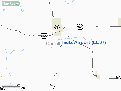
Location
& QuickFacts
|
FAA
Information Effective: |
2007-12-20 |
|
Airport
Identifier: |
LL07 |
|
Airport
Status: |
Operational |
|
Longitude/Latitude: |
089-58-10.4450W/42-03-50.0870N
-89.969568/42.063913 (Estimated) |
|
Elevation: |
853 ft / 259.99 m (Surveyed) |
|
Land: |
0 acres |
|
From nearest
city: |
2 nautical miles S of Mount Carroll, IL |
|
Location: |
Carroll County, IL |
|
Magnetic
Variation: |
01E (1985) |
Owner
& Manager
|
Ownership: |
Privately
owned |
|
Owner: |
Herbert Tautz |
|
Address: |
20832 Hwy 52
Mt Carroll, IL 61053 |
|
Phone
number: |
815-493-6611 |
|
Address: |
|
Airport
Operations and Facilities
|
Airport Use: |
Private |
|
Wind
indicator: |
Yes |
|
Segmented
Circle: |
No |
|
Control
Tower: |
No |
|
Landing
fee charge: |
No |
|
Sectional
chart: |
Chicago |
|
Region: |
AGL - Great Lakes |
|
Boundary
ARTCC: |
ZAU - Chicago |
|
Tie-in
FSS: |
IKK - Kankakee |
|
FSS
on Airport: |
No |
|
FSS
Toll Free: |
1-800-WX-BRIEF |
Airport
Services
|
Airframe
Repair: |
NONE |
|
Power
Plant Repair: |
NONE |
|
Runway Information
Runway E/W
|
Dimension: |
2400 x 80 ft
/ 731.5 x 24.4 m |
|
Surface: |
TURF, |
|
|
Runway E |
Runway W |
|
Traffic
Pattern: |
Left |
Left |
|
Radio Navigation
Aids
|
ID |
Type |
Name |
Ch |
Freq |
Var |
Dist |
|
FEP |
NDB |
Freeport |
|
335.00 |
00E |
20.3 nm |
|
CWI |
NDB |
Clinton |
|
377.00 |
01E |
21.4 nm |
|
BOZ |
NDB |
Whiteside |
|
254.00 |
01E |
22.7 nm |
|
OQW |
NDB |
Maquoketa |
|
386.00 |
02E |
34.4 nm |
|
PVB |
NDB |
Platteville |
|
203.00 |
01E |
42.9 nm |
|
PLL |
VOR/DME |
Polo |
049X |
111.20 |
03E |
20.7 nm |
|
RFD |
VOR/DME |
Rockford |
045X |
110.80 |
01E |
35.7 nm |
|
JVL |
VOR/DME |
Janesville |
090X |
114.30 |
03E |
48.6 nm |
|
CVA |
VORTAC |
Davenport |
085X |
113.80 |
04E |
31.4 nm |
|
DBQ |
VORTAC |
Dubuque |
105X |
115.80 |
04E |
38.7 nm |
|
DVN |
VOT |
Davenport Municipal |
|
111.80 |
|
38.8 nm |
Based Aircraft
|
Aircraft
based on field: |
2 |
|
Single Engine
Airplanes: |
2 |
Tautz Airport
Address:
Carroll County, IL
Tel:
815-493-6611
Images
and information placed above are from
http://www.airport-data.com/airport/LL07/
We
thank them for the data!
| General
Info |
| Country |
United
States |
| State |
ILLINOIS
|
| FAA ID |
LL07 |
| Latitude |
42-03-50.087N
|
| Longitude |
089-58-10.445W
|
| Elevation |
853 feet
|
| Near City |
MOUNT
CARROLL |
We don't guarantee the information is fresh and accurate. The data may
be wrong or outdated.
For more up-to-date information please refer to other sources.
|
|


