 |
|
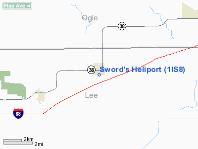
Location
& QuickFacts
|
FAA
Information Effective: |
2007-12-20 |
|
Airport
Identifier: |
1IS8 |
|
Airport
Status: |
Operational |
|
Longitude/Latitude: |
089-13-16.3510W/41-51-45.1100N
-89.221209/41.862531 (Estimated) |
|
Elevation: |
799 ft / 243.54 m (Surveyed) |
|
Land: |
0 acres |
|
From nearest
city: |
0 nautical miles S of Ashton, IL |
|
Location: |
Lee County, IL |
|
Magnetic
Variation: |
00E (1985) |
Owner
& Manager
|
Ownership: |
Privately
owned |
|
Owner: |
Robert Sword |
|
Address: |
Box 268
Ashton, IL 61006 |
|
Phone
number: |
815-453-2166 |
|
Manager: |
Robert Sword |
|
Address: |
Box 268
Ashton, IL 61006 |
|
Phone
number: |
815-453-2297 |
Airport
Operations and Facilities
|
Airport Use: |
Private |
|
Wind
indicator: |
No |
|
Segmented
Circle: |
No |
|
Control
Tower: |
No |
|
Landing
fee charge: |
No |
|
Sectional
chart: |
Chicago |
|
Region: |
AGL - Great Lakes |
|
Boundary
ARTCC: |
ZAU - Chicago |
|
Tie-in
FSS: |
IKK - Kankakee |
|
FSS
on Airport: |
No |
|
FSS
Toll Free: |
1-800-WX-BRIEF |
Airport
Services
|
Airframe
Repair: |
NONE |
|
Power
Plant Repair: |
NONE |
|
Runway Information
Helipad H1
|
Dimension: |
50 x 50 ft /
15.2 x 15.2 m |
|
Surface: |
TURF, |
|
|
Runway H1 |
Runway |
|
Traffic
Pattern: |
Left |
Left |
|
Radio Navigation
Aids
|
ID |
Type |
Name |
Ch |
Freq |
Var |
Dist |
|
DKB |
NDB |
Dekalb |
|
209.00 |
02W |
23.4 nm |
|
BOZ |
NDB |
Whiteside |
|
254.00 |
01E |
26.9 nm |
|
FEP |
NDB |
Freeport |
|
335.00 |
00E |
28.2 nm |
|
VYS |
NDB |
Valley |
|
230.00 |
00W |
30.7 nm |
|
OIX |
NDB |
Ottawa |
|
266.00 |
01E |
34.3 nm |
|
JVL |
NDB |
Janesville |
|
375.00 |
03E |
45.9 nm |
|
CWI |
NDB |
Clinton |
|
377.00 |
01E |
49.6 nm |
|
PLL |
VOR/DME |
Polo |
049X |
111.20 |
03E |
14.9 nm |
|
RFD |
VOR/DME |
Rockford |
045X |
110.80 |
01E |
21.8 nm |
|
DPA |
VOR/DME |
Dupage |
021X |
108.40 |
02E |
39.0 nm |
|
JVL |
VOR/DME |
Janesville |
090X |
114.30 |
03E |
42.1 nm |
|
JOT |
VORTAC |
Joliet |
070X |
112.30 |
02E |
44.7 nm |
|
BDF |
VORTAC |
Bradford |
094X |
114.70 |
00E |
45.4 nm |
Based Aircraft
|
Aircraft
based on field: |
1 |
|
Helicopters: |
1 |
Sword's Heliport
Address:
Lee County, IL
Tel:
815-453-2166,
815-453-2297
Images
and information placed above are from
http://www.airport-data.com/airport/1IS8/
We
thank them for the data!
| General
Info |
| Country |
United
States |
| State |
ILLINOIS
|
| FAA ID |
1IS8 |
| Latitude |
41-51-45.110N
|
| Longitude |
089-13-16.351W
|
| Elevation |
799 feet
|
| Near City |
ASHTON
|
We don't guarantee the information is fresh and accurate. The data may
be wrong or outdated.
For more up-to-date information please refer to other sources.
|
|


