 |
|
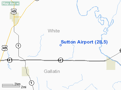
Location
& QuickFacts
|
FAA
Information Effective: |
2007-12-20 |
|
Airport
Identifier: |
2IL5 |
|
Airport
Status: |
Operational |
|
Longitude/Latitude: |
088-13-54.1420W/37-56-03.1660N
-88.231706/37.934213 (Estimated) |
|
Elevation: |
470 ft / 143.26 m (Estimated) |
|
Land: |
0 acres |
|
From nearest
city: |
4 nautical miles NE of Omaha, IL |
|
Location: |
White County, IL |
|
Magnetic
Variation: |
00E (1985) |
Owner
& Manager
|
Ownership: |
Privately
owned |
|
Owner: |
David Sutton |
|
Address: |
P.o. Box 98
Omaha, IL 62871 |
|
Phone
number: |
618-962-3136 |
|
Address: |
|
Airport
Operations and Facilities
|
Airport
Use: |
Private |
|
Segmented
Circle: |
No |
|
Control
Tower: |
No |
|
Sectional
chart: |
St Louis |
|
Region: |
AGL - Great Lakes |
|
Boundary
ARTCC: |
ZID - Indianapolis |
|
Tie-in
FSS: |
COU - Columbia |
|
FSS Toll
Free: |
1-800-WX-BRIEF |
|
Runway Information
Runway 06/24
|
Dimension: |
2300 x 70 ft
/ 701.0 x 21.3 m |
|
Surface: |
TURF, |
|
|
Runway 06 |
Runway 24 |
|
Traffic
Pattern: |
Left |
Left |
|
Radio Navigation
Aids
|
ID |
Type |
Name |
Ch |
Freq |
Var |
Dist |
|
CUL |
NDB |
Carmi |
|
332.00 |
01W |
10.9 nm |
|
HSB |
NDB |
Harrisburg-raleigh |
|
230.00 |
00E |
16.6 nm |
|
GVA |
NDB |
Geneva |
|
224.00 |
01W |
23.2 nm |
|
FWC |
NDB |
Wayne County |
|
257.00 |
01E |
28.1 nm |
|
TWT |
NDB |
Tradewater |
|
276.00 |
00E |
31.2 nm |
|
PDW |
NDB |
Evansville |
|
284.00 |
00E |
33.8 nm |
|
FOA |
NDB |
Elm River |
|
353.00 |
00E |
45.4 nm |
|
OLY |
NDB |
Olney |
|
272.00 |
00W |
47.2 nm |
|
AJG |
NDB |
Mount Carmel |
|
524.00 |
02W |
47.2 nm |
|
SAM |
VOR/DME |
Samsville |
113X |
116.60 |
03E |
33.8 nm |
|
VNN |
VOR/DME |
Mount Vernon |
085X |
113.80 |
02E |
37.4 nm |
|
MWA |
VOR/DME |
Marion |
041X |
110.40 |
04E |
38.6 nm |
|
PXV |
VORTAC |
Pocket City |
080X |
113.30 |
03E |
22.3 nm |
Based Aircraft
|
Aircraft
based on field: |
1 |
|
Single Engine
Airplanes: |
1 |
Sutton Airport
Address:
White County, IL
Tel:
618-962-3136
Images
and information placed above are from
http://www.airport-data.com/airport/2IL5/
We
thank them for the data!
| General
Info |
| Country |
United
States |
| State |
ILLINOIS
|
| FAA ID |
2IL5 |
| Latitude |
37-56-03.166N
|
| Longitude |
088-13-54.142W
|
| Elevation |
470 feet
|
| Near City |
OMAHA
|
We don't guarantee the information is fresh and accurate. The data may
be wrong or outdated.
For more up-to-date information please refer to other sources.
|
|


