 |
|
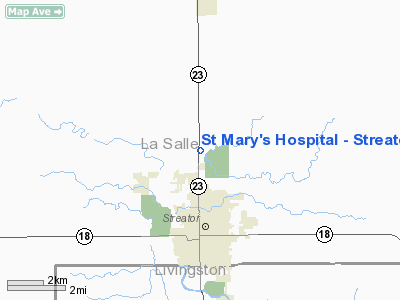
St Mary's Hospital - Streator Heliport |
Location
& QuickFacts
|
FAA
Information Effective: |
2007-12-20 |
|
Airport
Identifier: |
IS29 |
|
Airport
Status: |
Operational |
|
Longitude/Latitude: |
088-50-06.0000W/41-09-48.0000N
-88.835000/41.163333 (Estimated) |
|
Elevation: |
620 ft / 188.98 m (Estimated) |
|
Land: |
0 acres |
|
From nearest
city: |
3 nautical miles NE of Streator, IL |
|
Location: |
La Salle County, IL |
|
Magnetic
Variation: |
00E (1985) |
Owner
& Manager
|
Ownership: |
Privately
owned |
|
Owner: |
St Mary's Hospital |
|
Address: |
111 E Spring St
Streator, IL 61364 |
|
Phone
number: |
815-673-2311 |
|
Manager: |
Jimmie D. Lansford |
|
Address: |
111 E Spring St
Streator, IL 61364 |
|
Phone
number: |
815-673-2311 |
Airport
Operations and Facilities
|
Airport
Use: |
Private
MEDICAL USE. |
|
Wind indicator: |
Yes |
|
Segmented
Circle: |
No |
|
Control
Tower: |
No |
|
Lighting
Schedule: |
24 HRS. |
|
Beacon
Color: |
Clear-Green-Yellow (heliport) |
|
Sectional
chart: |
Chicago |
|
Region: |
AGL - Great Lakes |
|
Boundary
ARTCC: |
ZAU - Chicago |
|
Tie-in
FSS: |
IKK - Kankakee |
|
FSS Toll
Free: |
1-800-WX-BRIEF |
|
Runway Information
Helipad H1
|
Dimension: |
40 x 40 ft /
12.2 x 12.2 m |
|
Surface: |
CONC, |
|
|
Runway H1 |
Runway |
|
Traffic
Pattern: |
Left |
Left |
|
Radio Navigation
Aids
|
ID |
Type |
Name |
Ch |
Freq |
Var |
Dist |
|
OIX |
NDB |
Ottawa |
|
266.00 |
01E |
12.0 nm |
|
VYS |
NDB |
Valley |
|
230.00 |
00W |
18.2 nm |
|
DKB |
NDB |
Dekalb |
|
209.00 |
02W |
46.7 nm |
|
PI |
NDB |
Tungg |
|
356.00 |
01E |
48.1 nm |
|
PNT |
VOR/DME |
Pontiac |
033X |
109.60 |
03E |
21.1 nm |
|
BMI |
VOR/DME |
Bloomington |
019X |
108.20 |
03E |
41.3 nm |
|
IKK |
VOR/DME |
Kankakee |
053X |
111.60 |
00E |
44.9 nm |
|
RBS |
VOR/DME |
Roberts |
115X |
116.80 |
02E |
46.4 nm |
|
DPA |
VOR/DME |
Dupage |
021X |
108.40 |
02E |
48.8 nm |
|
JOT |
VORTAC |
Joliet |
070X |
112.30 |
02E |
32.8 nm |
|
BDF |
VORTAC |
Bradford |
094X |
114.70 |
00E |
34.1 nm |
|
EON |
VORTAC |
Peotone |
079X |
113.20 |
02E |
47.6 nm |
Remarks
- E111:
DUE TO THE CONGESTION IN THE AREA CAUSING THE LACK OF EMERGENCY LNDG
SITES.
St Mary's Hospital - Streator Heliport
Address:
La Salle County, IL
Tel:
815-673-2311
Images
and information placed above are from
http://www.airport-data.com/airport/IS29/
We
thank them for the data!
| General
Info |
| Country |
United
States |
| State |
ILLINOIS
|
| FAA ID |
IS29 |
| Latitude |
41-09-48.000N
|
| Longitude |
088-50-06.000W
|
| Elevation |
620 feet
|
| Near City |
STREATOR
|
We don't guarantee the information is fresh and accurate. The data may
be wrong or outdated.
For more up-to-date information please refer to other sources.
|
|


