 |
|
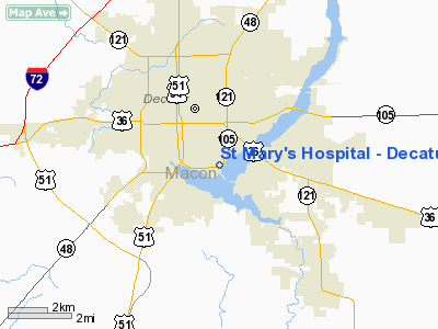
St Mary's Hospital - Decatur Heliport |
|
|
Location
& QuickFacts
|
FAA
Information Effective: |
2007-12-20 |
|
Airport
Identifier: |
9IS3 |
|
Airport
Status: |
Operational |
|
Longitude/Latitude: |
088-55-51.2760W/39-49-38.1320N
-88.930910/39.827259 (Estimated) |
|
Elevation: |
658 ft / 200.56 m (Estimated) |
|
Land: |
0 acres |
|
From nearest
city: |
0 nautical miles N of Decatur, IL |
|
Location: |
Macon County, IL |
|
Magnetic
Variation: |
01E (1985) |
Owner
& Manager
|
Ownership: |
Privately
owned |
|
Owner: |
St Marys Hospital |
|
Address: |
1800 E Lakeshore Dr
Decatur, IL 62525 |
|
Phone
number: |
217-464-2966 |
|
Manager: |
Jim Feriozzi |
|
Address: |
St Mary's Hospital, 1800 E Lakeshore Dr
Decatur, IL 62525 |
|
Phone
number: |
217-464-2172 |
Airport
Operations and Facilities
|
Airport Use: |
Private |
|
Wind
indicator: |
Yes |
|
Segmented
Circle: |
No |
|
Control
Tower: |
No |
|
Lighting
Schedule: |
24 HRS |
|
Beacon
Color: |
Clear-Green-Yellow (heliport) |
|
Landing
fee charge: |
No |
|
Sectional
chart: |
St Louis |
|
Region: |
AGL - Great Lakes |
|
Boundary
ARTCC: |
ZKC - Kansas City |
|
Tie-in
FSS: |
STL - Saint Louis |
|
FSS
on Airport: |
No |
|
FSS
Toll Free: |
1-800-WX-BRIEF |
Airport
Services
|
Airframe
Repair: |
NONE |
|
Power
Plant Repair: |
NONE |
|
Runway Information
Helipad H1
|
Dimension: |
48 x 48 ft /
14.6 x 14.6 m |
|
Surface: |
CONC, |
|
|
Runway H1 |
Runway |
|
Traffic
Pattern: |
Left |
Left |
|
Radio Navigation
Aids
|
ID |
Type |
Name |
Ch |
Freq |
Var |
Dist |
|
TAZ |
NDB |
Taylorville |
|
395.00 |
00E |
25.2 nm |
|
SYZ |
NDB |
Shelbyville |
|
365.00 |
01E |
25.6 nm |
|
AAA |
NDB |
Abraham |
|
329.00 |
00E |
27.4 nm |
|
LQ |
NDB |
Licol |
|
375.00 |
01W |
31.4 nm |
|
SP |
NDB |
Huskk |
|
382.00 |
01W |
38.4 nm |
|
MT |
NDB |
Zebre |
|
347.00 |
00E |
42.0 nm |
|
HMJ |
NDB |
Homer |
|
281.00 |
01E |
46.6 nm |
|
MTO |
VOR/DME |
Mattoon |
031X |
109.40 |
03E |
36.5 nm |
|
BMI |
VOR/DME |
Bloomington |
019X |
108.20 |
03E |
39.3 nm |
|
DEC |
VORTAC |
Decatur |
119X |
117.20 |
03E |
6.4 nm |
|
CAP |
VORTAC |
Capital |
074X |
112.70 |
04E |
32.3 nm |
|
CMI |
VORTAC |
Champaign |
037X |
110.00 |
03E |
32.7 nm |
|
SPI |
VORTAC |
Spinner |
74X |
112.70 |
01W |
34.5 nm |
|
VLA |
VORTAC |
Vandalia |
090X |
114.30 |
04E |
45.4 nm |
Remarks
- PRVDD
INGRESS/EGRESS OPNS CONDUCTED N OR WITHIN N SECTOR ESE CCW TO SW FM
HELIPAD.
St Mary's Hospital - Decatur Heliport
Address:
Macon County, IL
Tel:
217-464-2966,
217-464-2172
Images
and information placed above are from
http://www.airport-data.com/airport/9IS3/
We
thank them for the data!
| General
Info |
| Country |
United
States |
| State |
ILLINOIS
|
| FAA ID |
9IS3 |
| Latitude |
39-49-38.132N
|
| Longitude |
088-55-51.276W
|
| Elevation |
658 feet
|
| Near City |
DECATUR
|
We don't guarantee the information is fresh and accurate. The data may
be wrong or outdated.
For more up-to-date information please refer to other sources.
|
|


