 |
|
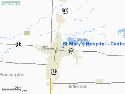
St Mary's Hospital - Centralia Heliport |
|
|
Location
& QuickFacts
|
FAA
Information Effective: |
2007-12-20 |
|
Airport
Identifier: |
98IL |
|
Airport
Status: |
Operational |
|
Longitude/Latitude: |
089-07-10.0000W/38-31-54.0000N
-89.119444/38.531667 (Estimated) |
|
Elevation: |
490 ft / 149.35 m (Estimated) |
|
Land: |
0 acres |
|
From nearest
city: |
0 nautical miles N of Centralia, IL |
|
Location: |
Marion County, IL |
|
Magnetic
Variation: |
01E (1995) |
Owner
& Manager
|
Ownership: |
Privately
owned |
|
Owner: |
St Mary's Hospital |
|
Address: |
400 North Pleasant
Centralia, IL 62801 |
|
Phone
number: |
618-532-6731 |
|
Manager: |
Bruce Merrell |
|
Address: |
400 North Pleasant
Centralia, IL 62801 |
|
Phone
number: |
618-532-6731 |
Airport
Operations and Facilities
|
Airport
Use: |
Private
MEDICAL USE. |
|
Wind indicator: |
Yes |
|
Segmented
Circle: |
No |
|
Control
Tower: |
No |
|
Lighting
Schedule: |
24 HRS
FOR PERIMETER LGTS CALL 618-532-6731. |
|
Beacon
Color: |
Clear-Green-Yellow (heliport) |
|
Sectional
chart: |
St Louis |
|
Region: |
AGL - Great Lakes |
|
Boundary
ARTCC: |
ZKC - Kansas City |
|
Tie-in
FSS: |
COU - Columbia |
|
FSS on
Airport: |
No |
|
FSS Toll
Free: |
1-800-WX-BRIEF |
|
Runway Information
Helipad H1
|
Dimension: |
40 x 40 ft /
12.2 x 12.2 m |
|
Surface: |
CONC, |
|
|
Runway H1 |
Runway |
|
Traffic
Pattern: |
Left |
Left |
|
Radio Navigation
Aids
|
ID |
Type |
Name |
Ch |
Freq |
Var |
Dist |
|
SLO |
NDB |
Salem |
|
400.00 |
01W |
9.8 nm |
|
BL |
NDB |
Belleville |
|
362.00 |
02E |
30.2 nm |
|
FOA |
NDB |
Elm River |
|
353.00 |
00E |
32.4 nm |
|
FWC |
NDB |
Wayne County |
|
257.00 |
01E |
34.6 nm |
|
PJY |
NDB |
Pinckneyville |
|
215.00 |
00E |
35.4 nm |
|
SAR |
NDB |
Sparta |
|
239.00 |
01E |
36.0 nm |
|
OLY |
NDB |
Olney |
|
272.00 |
00W |
45.8 nm |
|
LTD |
NDB |
Litchfield |
|
371.00 |
01E |
46.1 nm |
|
CVM |
NDB |
Civic Memorial |
|
263.00 |
02E |
49.0 nm |
|
SKE |
TACAN |
Scott |
059X |
|
02E |
34.4 nm |
|
VNN |
VOR/DME |
Mount Vernon |
085X |
113.80 |
02E |
17.9 nm |
|
MWA |
VOR/DME |
Marion |
041X |
110.40 |
04E |
47.0 nm |
|
SAM |
VOR/DME |
Samsville |
113X |
116.60 |
03E |
48.7 nm |
|
ENL |
VORTAC |
Centralia |
097X |
115.00 |
04E |
7.0 nm |
|
VLA |
VORTAC |
Vandalia |
090X |
114.30 |
04E |
33.8 nm |
|
BIB |
VORTAC |
Bible Grove |
027X |
109.00 |
03E |
37.9 nm |
|
TOY |
VORTAC |
Troy |
107X |
116.00 |
04E |
39.5 nm |
Remarks
- APCH/DEP
ROUTE OPNS ARE TO BE CONDUCTED FM 050 DEG CLOCKWISE TO 190 DEG FM PAD
CENTER; APPROP MKD; MAINTAINED WIND INDICATOR; COMPLIANCE WITH 14 CFR
PART 91 126(B)(2).
St Mary's Hospital - Centralia Heliport
Address:
Marion County, IL
Tel:
618-532-6731
Images
and information placed above are from
http://www.airport-data.com/airport/98IL/
We
thank them for the data!
| General
Info |
| Country |
United
States |
| State |
ILLINOIS
|
| FAA ID |
98IL |
| Latitude |
38-31-54.000N
|
| Longitude |
089-07-10.000W
|
| Elevation |
490 feet
|
| Near City |
CENTRALIA
|
We don't guarantee the information is fresh and accurate. The data may
be wrong or outdated.
For more up-to-date information please refer to other sources.
|
|


