 |
|
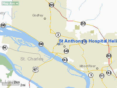
St Anthony's Hospital Heliport |
Location
& QuickFacts
|
FAA
Information Effective: |
2007-12-20 |
|
Airport
Identifier: |
03IS |
|
Airport
Status: |
Operational |
|
Longitude/Latitude: |
090-10-24.3930W/38-54-18.1720N
-90.173442/38.905048 (Estimated) |
|
Elevation: |
580 ft / 176.78 m (Estimated) |
|
Land: |
0 acres |
|
From nearest
city: |
0 nautical miles N of Alton, IL |
|
Location: |
Madison County, IL |
|
Magnetic
Variation: |
02E (1985) |
Owner
& Manager
|
Ownership: |
Privately
owned |
|
Owner: |
St Anthony's Hospital |
|
Address: |
St Anthony's Way
Alton, IL 62002 |
|
Phone
number: |
618-465-2571 |
|
Manager: |
John Lerner |
|
Address: |
1 Saint Anthony's Way
Alton, IL 62002 |
|
Phone
number: |
618-465-2571 |
Airport
Operations and Facilities
|
Airport
Use: |
Private
MEDICAL. |
|
Wind indicator: |
Yes |
|
Segmented
Circle: |
No |
|
Control
Tower: |
No |
|
Lighting
Schedule: |
DUSK-DAWN |
|
Beacon
Color: |
Clear-Green-Yellow (heliport) |
|
Sectional
chart: |
St Louis |
|
Region: |
AGL - Great Lakes |
|
Boundary
ARTCC: |
ZKC - Kansas City |
|
Tie-in
FSS: |
STL - Saint Louis |
|
FSS Toll
Free: |
1-800-WX-BRIEF |
|
Runway Information
Helipad H1
|
Dimension: |
40 x 40 ft /
12.2 x 12.2 m |
|
Surface: |
CONC, |
|
|
Runway H1 |
Runway |
|
Traffic
Pattern: |
Left |
Left |
|
Radio Navigation
Aids
|
ID |
Type |
Name |
Ch |
Freq |
Var |
Dist |
|
CVM |
NDB |
Civic Memorial |
|
263.00 |
02E |
5.5 nm |
|
LM |
NDB |
Oblio |
|
338.00 |
00E |
15.4 nm |
|
LTD |
NDB |
Litchfield |
|
371.00 |
01E |
28.0 nm |
|
BL |
NDB |
Belleville |
|
362.00 |
02E |
32.9 nm |
|
FES |
NDB |
Festus |
|
269.00 |
01E |
43.8 nm |
|
SKE |
TACAN |
Scott |
059X |
|
02E |
26.4 nm |
|
CSX |
VOR/DME |
Cardinal |
111Y |
116.45 |
00E |
12.7 nm |
|
STL |
VORTAC |
St Louis |
121X |
117.40 |
01E |
14.7 nm |
|
TOY |
VORTAC |
Troy |
107X |
116.00 |
04E |
15.6 nm |
|
FTZ |
VORTAC |
Foristell |
045X |
110.80 |
05E |
39.5 nm |
|
VLA |
VORTAC |
Vandalia |
090X |
114.30 |
04E |
48.6 nm |
|
STL |
VOT |
St Louis Lambert |
|
111.00 |
|
12.9 nm |
|
SUS |
VOT |
Spirit Of St Louis |
|
112.20 |
|
26.7 nm |
Remarks
- PRVDD
ALL APP/DEP ROUTES 155-315 DEGS; TKOF/LNDG AREA IS MKD; NON-OBSTG WIND
INDICATOR; CAUTION & WARNING SIGNS POSTED.
St Anthony's Hospital Heliport
Address:
Madison County, IL
Tel:
618-465-2571
Images
and information placed above are from
http://www.airport-data.com/airport/03IS/
We
thank them for the data!
| General
Info |
| Country |
United
States |
| State |
ILLINOIS
|
| FAA ID |
03IS |
| Latitude |
38-54-18.172N
|
| Longitude |
090-10-24.393W
|
| Elevation |
580 feet
|
| Near City |
ALTON
|
We don't guarantee the information is fresh and accurate. The data may
be wrong or outdated.
For more up-to-date information please refer to other sources.
|
|


