 |
|
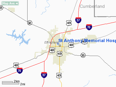
St Anthony Memorial Hospital Heliport |
|
|
Location
& QuickFacts
|
FAA
Information Effective: |
2007-12-20 |
|
Airport
Identifier: |
11IS |
|
Airport
Status: |
Operational |
|
Longitude/Latitude: |
088-33-02.0000W/39-07-30.0000N
-88.550556/39.125000 (Estimated) |
|
Elevation: |
593 ft / 180.75 m (Estimated) |
|
Land: |
0 acres |
|
From nearest
city: |
0 nautical miles N of Effingham, IL |
|
Location: |
Effingham County, IL |
|
Magnetic
Variation: |
00E (1985) |
Owner
& Manager
|
Ownership: |
Privately
owned |
|
Owner: |
St Anthony Memorial Hospital |
|
Address: |
503 N. Maple St
Effingham, IL 62401 |
|
Phone
number: |
217-342-2121 |
|
Manager: |
Don Borries |
|
Address: |
St Anthony Meml Hospital, 503 N. Maple St
Effingham, IL 62401 |
|
Phone
number: |
217-342-2121 |
Airport
Operations and Facilities
|
Airport
Use: |
Private
MEDICAL USE. |
|
Wind indicator: |
Yes |
|
Segmented
Circle: |
Yes |
|
Control
Tower: |
No |
|
Lighting
Schedule: |
PHONE REQ
FOR ROTG BCN & PERIMETER LGTS CALL 217-342-2121. |
|
Beacon
Color: |
Clear-Green-Yellow (heliport) |
|
Landing
fee charge: |
No |
|
Sectional
chart: |
St Louis |
|
Region: |
AGL - Great Lakes |
|
Boundary
ARTCC: |
ZKC - Kansas City |
|
Tie-in
FSS: |
STL - Saint Louis |
|
FSS on
Airport: |
No |
|
FSS Toll
Free: |
1-800-WX-BRIEF |
|
Runway Information
Helipad H1
|
Dimension: |
40 x 40 ft /
12.2 x 12.2 m |
|
Surface: |
CONC, |
|
|
Runway H1 |
Runway |
|
Traffic
Pattern: |
Left |
Left |
|
Radio Navigation
Aids
|
ID |
Type |
Name |
Ch |
Freq |
Var |
Dist |
|
SYZ |
NDB |
Shelbyville |
|
365.00 |
01E |
21.7 nm |
|
MT |
NDB |
Zebre |
|
347.00 |
00E |
25.9 nm |
|
CZB |
NDB |
Casey |
|
359.00 |
00E |
27.8 nm |
|
FOA |
NDB |
Elm River |
|
353.00 |
00E |
27.8 nm |
|
OLY |
NDB |
Olney |
|
272.00 |
00W |
30.2 nm |
|
SLO |
NDB |
Salem |
|
400.00 |
01W |
34.9 nm |
|
PLX |
NDB |
Palestine |
|
391.00 |
00W |
43.0 nm |
|
TAZ |
NDB |
Taylorville |
|
395.00 |
00E |
43.6 nm |
|
FWC |
NDB |
Wayne County |
|
257.00 |
01E |
45.3 nm |
|
AJG |
NDB |
Mount Carmel |
|
524.00 |
02W |
49.4 nm |
|
MTO |
VOR/DME |
Mattoon |
031X |
109.40 |
03E |
24.5 nm |
|
RSV |
VOR/DME |
Robinson |
021X |
108.40 |
02E |
42.6 nm |
|
SAM |
VOR/DME |
Samsville |
113X |
116.60 |
03E |
44.2 nm |
|
VNN |
VOR/DME |
Mount Vernon |
085X |
113.80 |
02E |
47.4 nm |
|
LWV |
VOR/DME |
Lawrenceville |
025X |
108.80 |
01W |
49.1 nm |
|
BIB |
VORTAC |
Bible Grove |
027X |
109.00 |
03E |
12.7 nm |
|
VLA |
VORTAC |
Vandalia |
090X |
114.30 |
04E |
28.6 nm |
|
DEC |
VORTAC |
Decatur |
119X |
117.20 |
03E |
39.5 nm |
Remarks
- ALL
APCH/DEP 090 CLKWS TO 110 & 260 CLKWS TO 290; AREA IS MKD; WIND
INDICATOR IS MAINTAINED.
Based Aircraft
|
Aircraft
based on field: |
1 |
|
Helicopters: |
1 |
St Anthony Memorial Hospital Heliport
Address:
Effingham County, IL
Tel:
217-342-2121
Images
and information placed above are from
http://www.airport-data.com/airport/11IS/
We
thank them for the data!
| General
Info |
| Country |
United
States |
| State |
ILLINOIS
|
| FAA ID |
11IS |
| Latitude |
39-07-30.000N
|
| Longitude |
088-33-02.000W
|
| Elevation |
593 feet
|
| Near City |
EFFINGHAM
|
We don't guarantee the information is fresh and accurate. The data may
be wrong or outdated.
For more up-to-date information please refer to other sources.
|
|


