 |
|
Sparta Community - Hunter Field Airport |
|
|
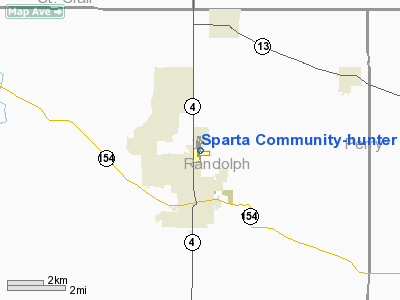
Location
& QuickFacts
|
FAA
Information Effective: |
2007-12-20 |
|
Airport
Identifier: |
SAR |
|
Airport
Status: |
Operational |
|
Longitude/Latitude: |
089-41-55.3550W/38-08-56.1780N
-89.698710/38.148938 (Estimated) |
|
Elevation: |
538 ft / 163.98 m (Surveyed) |
|
Land: |
200 acres |
|
From nearest
city: |
2 nautical miles N of Sparta, IL |
|
Location: |
Randolph County, IL |
|
Magnetic
Variation: |
01E (1990) |
Owner
& Manager
|
Ownership: |
Publicly
owned |
|
Owner: |
Sparta Community Airport |
|
Address: |
1800 N. Market
Sparta, IL 62286 |
|
Phone
number: |
618-443-2002 |
|
Manager: |
Marvin Campbell |
|
Address: |
1800 N. Market
Sparta, IL 62286 |
|
Phone
number: |
618-443-2002 |
Airport
Operations and Facilities
|
Airport
Use: |
Open
to public |
|
Wind indicator: |
Yes |
|
Segmented
Circle: |
Yes |
|
Control
Tower: |
No |
|
Lighting
Schedule: |
DUSK-DAWN
MIRL RY 18/36 & WIND INDICATOR PRESET ON LOW INTST;
TO INCR INTST & ACTVT REIL RY 18 & TWY A - CTAF. |
|
Beacon
Color: |
Clear-Green (lighted land airport) |
|
Landing
fee charge: |
No |
|
Sectional
chart: |
St Louis |
|
Region: |
AGL - Great Lakes |
|
Traffic
Pattern Alt: |
800 ft |
|
Boundary
ARTCC: |
ZKC - Kansas City |
|
Tie-in
FSS: |
STL - Saint Louis |
|
FSS on
Airport: |
No |
|
FSS Toll
Free: |
1-800-WX-BRIEF |
|
NOTAMs
Facility: |
SAR (NOTAM-d service avaliable) |
|
Federal
Agreements: |
NGY |
Airport
Communications
|
CTAF: |
123.075 |
|
Unicom: |
123.075
|
Airport
Services
|
Fuel
available: |
100LLA
SELF SVC FUEL AVBL 24 HRS WITH CREDIT CARD. |
|
Airframe
Repair: |
MAJOR |
|
Power
Plant Repair: |
MAJOR |
|
Bottled
Oxygen: |
NONE |
|
Bulk Oxygen: |
NONE |
|
Runway Information
Runway 09/27
|
Dimension: |
2450 x 135 ft
/ 746.8 x 41.1 m |
|
Surface: |
TURF, Good Condition |
|
|
Runway 09 |
Runway 27 |
|
Longitude: |
089-42-05.8550W |
089-41-35.3540W |
|
Latitude: |
38-08-50.6770N |
38-08-50.6780N |
|
Elevation: |
532.00 ft |
519.00 ft |
|
Traffic
Pattern: |
Left |
Left |
|
Runway End
Identifier: |
No |
No |
|
Centerline
Lights: |
No |
No |
|
Touchdown
Lights: |
No |
No |
|
Obstruction: |
31 ft bldg, 673.0 ft from runway, 75 ft right
of centerline, 21:1 slope to clear |
54 ft tree, 1284.0 ft from runway, 200 ft left
of centerline, 23:1 slope to clear |
|
Runway 18/36
|
Dimension: |
4001 x 60 ft
/ 1219.5 x 18.3 m |
|
Surface: |
ASPH, Good Condition |
|
Weight Limit: |
Single wheel: 5000 lbs. |
|
Edge Lights: |
Medium |
|
|
Runway 18 |
Runway 36 |
|
Longitude: |
089-41-58.1030W |
089-41-58.3180W |
|
Latitude: |
38-09-19.4420N |
38-08-39.9270N |
|
Elevation: |
538.00 ft |
523.00 ft |
|
Alignment: |
127 |
0 |
|
Traffic
Pattern: |
Left |
Left |
|
Markings: |
Non-precision instrument, Poor Condition
RUNWAY MARKINGS ON 18/36 ARE POOR DUE TO 80% OF PAINT GONE. |
Non-precision instrument, Poor Condition |
|
Crossing
Height: |
20.00 ft |
20.00 ft |
|
VASI: |
4-light PAPI on left side |
4-light PAPI on left side |
|
Visual Glide
Angle: |
3.00° |
3.00° |
|
Runway End
Identifier: |
Yes |
No |
|
Centerline
Lights: |
No |
No |
|
Touchdown
Lights: |
No |
No |
|
Obstruction: |
52 ft tree, 1539.0 ft from runway, 329 ft right
of centerline, 25:1 slope to clear |
64 ft tree, 1802.0 ft from runway, 41 ft left
of centerline, 25:1 slope to clear |
|
Radio Navigation
Aids
|
ID |
Type |
Name |
Ch |
Freq |
Var |
Dist |
|
SAR |
NDB |
Sparta |
|
239.00 |
01E |
0.3 nm |
|
PJY |
NDB |
Pinckneyville |
|
215.00 |
00E |
19.0 nm |
|
BL |
NDB |
Belleville |
|
362.00 |
02E |
19.2 nm |
|
FES |
NDB |
Festus |
|
269.00 |
01E |
32.7 nm |
|
PRI |
NDB |
Perrine |
|
367.00 |
02E |
41.6 nm |
|
SLO |
NDB |
Salem |
|
400.00 |
01W |
45.5 nm |
|
CVM |
NDB |
Civic Memorial |
|
263.00 |
02E |
47.7 nm |
|
SKE |
TACAN |
Scott |
059X |
|
02E |
24.9 nm |
|
MWA |
VOR/DME |
Marion |
041X |
110.40 |
04E |
40.3 nm |
|
VNN |
VOR/DME |
Mount Vernon |
085X |
113.80 |
02E |
44.0 nm |
|
CSX |
VOR/DME |
Cardinal |
111Y |
116.45 |
00E |
47.8 nm |
|
ENL |
VORTAC |
Centralia |
097X |
115.00 |
04E |
30.2 nm |
|
TOY |
VORTAC |
Troy |
107X |
116.00 |
04E |
37.0 nm |
|
FAM |
VORTAC |
Farmington |
104X |
115.70 |
01E |
38.2 nm |
|
STL |
VOT |
St Louis Lambert |
|
111.00 |
|
47.7 nm |
Remarks
- MIGRATORY
WATERFOWL NW OF RY 18/36.
- THERE
IS A 60 FT BY 60 FT CONC PAD E OF FUELING AREA FOR HELI PARKING.
Based Aircraft
|
Aircraft
based on field: |
36 |
|
Single Engine
Airplanes: |
29 |
|
Multi Engine Airplanes: |
2 |
|
Helicopters: |
1 |
|
Ultralights: |
4 |
Operational Statistics
Time
Period: 2006-09-01 - 2007-08-31
|
Aircraft
Operations: |
94/Day |
|
Air Taxi: |
17.6% |
|
General Aviation
Local: |
29.4% |
|
General Aviation
Itinerant: |
45.6% |
|
Military: |
7.4% |
Sparta Community-hunter Field Airport
Address:
Randolph County, IL
Tel:
618-443-2002
Images
and information placed above are from
http://www.airport-data.com/airport/SAR/
We
thank them for the data!
| General
Info |
| Country |
United
States |
| State |
ILLINOIS
|
| FAA ID |
SAR |
| Latitude |
38-08-56.178N
|
| Longitude |
089-41-55.355W
|
| Elevation |
538 feet
|
| Near City |
SPARTA
|
We don't guarantee the information is fresh and accurate. The data may
be wrong or outdated.
For more up-to-date information please refer to other sources.
|
|


