 |
|
|
|
|
|
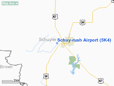
Location
& QuickFacts
|
FAA
Information Effective: |
2007-12-20 |
|
Airport
Identifier: |
5K4 |
|
Airport
Status: |
Operational |
|
Longitude/Latitude: |
090-35-25.4590W/40-07-03.1680N
-90.590405/40.117547 (Estimated) |
|
Elevation: |
665 ft / 202.69 m (Surveyed) |
|
Land: |
27 acres |
|
From nearest
city: |
1 nautical miles W of Rushville, IL |
|
Location: |
Schuyler County, IL |
|
Magnetic
Variation: |
02E (1985) |
Owner
& Manager
|
Ownership: |
Publicly
owned |
|
Owner: |
City Of Rushville |
|
Address: |
220 W Washington St
Rushville, IL 62681 |
|
Phone
number: |
309-333-0347 |
|
Manager: |
Mike Paisley |
|
Address: |
220 W Washington St
Rushville, IL 62681 |
|
Phone
number: |
217-322-3833 |
Airport
Operations and Facilities
|
Airport
Use: |
Open
to public |
|
Wind indicator: |
Yes |
|
Segmented
Circle: |
No |
|
Control
Tower: |
No |
|
Lighting
Schedule: |
RDO-CTL
ACTVT LIRL RY 09/27 - CTAF. |
|
Landing
fee charge: |
No |
|
Sectional
chart: |
Chicago |
|
Region: |
AGL - Great Lakes |
|
Traffic
Pattern Alt: |
800 ft |
|
Boundary
ARTCC: |
ZKC - Kansas City |
|
Tie-in
FSS: |
STL - Saint Louis |
|
FSS on
Airport: |
No |
|
FSS Toll
Free: |
1-800-WX-BRIEF |
|
NOTAMs
Facility: |
STL (NOTAM-d service avaliable) |
Airport
Communications
|
CTAF: |
123.000 |
|
Unicom: |
123.000
|
Airport
Services
|
Airframe
Repair: |
NONE |
|
Power
Plant Repair: |
NONE |
|
Bottled
Oxygen: |
NONE |
|
Bulk Oxygen: |
NONE |
|
Runway Information
Runway 09/27
|
Dimension: |
3565 x 100 ft
/ 1086.6 x 30.5 m |
|
Surface: |
TURF, Good Condition |
|
Edge Lights: |
Non-standard lighting system
NSTD LIRL DUE TO SPACING. RY 09 FIRST 305 FT UNLGTD; RY 27 FIRST
260 FT UNLGTD. |
|
|
Runway 09 |
Runway 27 |
|
Longitude: |
090-35-43.4600W |
090-34-57.5700W |
|
Latitude: |
40-07-02.1700N |
40-07-02.1700N |
|
Elevation: |
665.00 ft |
665.00 ft |
|
Traffic
Pattern: |
Left |
Left |
|
Displaced
threshold: |
305.00 ft
09/27 DSPLCD THR MARKED WITH WHITE GRAVEL AT BOTH ENDS OF
RY. |
463.00 ft |
|
Runway End
Identifier: |
No |
No |
|
Centerline
Lights: |
No |
No |
|
Touchdown
Lights: |
No |
No |
|
Obstruction: |
15 ft road, 10.0 ft from runway
APCH RATIO 21:1 TO DSPLCD THLD. |
53 ft tree, 494.0 ft from runway, 121 ft right
of centerline, 9:1 slope to clear
RWY 27 APCH RATIO 18:1 TO DSPLCD THLD. |
|
Radio Navigation
Aids
|
ID |
Type |
Name |
Ch |
Freq |
Var |
Dist |
|
JZY |
NDB |
Macomb |
|
251.00 |
01E |
24.1 nm |
|
PPQ |
NDB |
Pittsfield |
|
344.00 |
02E |
30.0 nm |
|
UI |
NDB |
Quincy |
|
293.00 |
02E |
33.5 nm |
|
CTK |
NDB |
Canton |
|
236.00 |
02E |
35.8 nm |
|
SP |
NDB |
Huskk |
|
382.00 |
01W |
43.5 nm |
|
EOK |
NDB |
Keokuk |
|
366.00 |
02E |
43.9 nm |
|
HAE |
NDB |
Hannibal |
|
411.00 |
03E |
46.0 nm |
|
LQ |
NDB |
Licol |
|
375.00 |
01W |
47.1 nm |
|
IJX |
VOR/DME |
Jacksonville |
023X |
108.60 |
02E |
26.1 nm |
|
GBG |
VOR/DME |
Galesburg |
035X |
109.80 |
03E |
49.8 nm |
|
UIN |
VORTAC |
Quincy |
083X |
113.60 |
05E |
35.6 nm |
|
BRL |
VORTAC |
Burlington |
051X |
111.40 |
05E |
39.5 nm |
|
SPI |
VORTAC |
Spinner |
74X |
112.70 |
01W |
45.2 nm |
|
CAP |
VORTAC |
Capital |
074X |
112.70 |
04E |
46.4 nm |
|
PIA |
VORTAC |
Peoria |
099X |
115.20 |
04E |
49.8 nm |
Based Aircraft
|
Aircraft
based on field: |
4 |
|
Single Engine
Airplanes: |
3 |
|
Ultralights: |
1 |
Operational Statistics
Time
Period: 2006-01-01 - 2006-12-31
|
Aircraft
Operations: |
20/Week |
|
General Aviation
Local: |
60.0% |
|
General Aviation
Itinerant: |
40.0% |
Schuy-rush Airport
Address:
Schuyler County, IL
Tel:
309-333-0347,
217-322-3833
Images
and information placed above are from
http://www.airport-data.com/airport/5K4/
We
thank them for the data!
| General
Info |
| Country |
United
States |
| State |
ILLINOIS
|
| FAA ID |
5K4 |
| Latitude |
40-07-03.168N
|
| Longitude |
090-35-25.459W
|
| Elevation |
665 feet
|
| Near City |
RUSHVILLE
|
We don't guarantee the information is fresh and accurate. The data may
be wrong or outdated.
For more up-to-date information please refer to other sources.
|
|


