 |
|
|
|
|
|
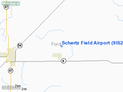
Location
& QuickFacts
|
FAA
Information Effective: |
2007-12-20 |
|
Airport
Identifier: |
9IS2 |
|
Airport
Status: |
Operational |
|
Longitude/Latitude: |
088-16-03.2000W/40-28-55.8000N
-88.267556/40.482167 (Estimated) |
|
Elevation: |
758 ft / 231.04 m (Surveyed) |
|
Land: |
160 acres |
|
From nearest
city: |
5 nautical miles NE of Gibson City, IL |
|
Location: |
Ford County, IL |
|
Magnetic
Variation: |
02W (2000) |
Owner
& Manager
|
Ownership: |
Privately
owned |
|
Owner: |
Richard Schertz |
|
Address: |
574 North 1000 East
Gibson City, IL 60936 |
|
Phone
number: |
217-749-2293 |
|
Manager: |
Richard Schertz |
|
Address: |
574 North 1000 East
Gibson City, IL 60936 |
|
Phone
number: |
217-749-2293 |
Airport
Operations and Facilities
|
Airport
Use: |
Private |
|
Wind indicator: |
Yes |
|
Segmented
Circle: |
No |
|
Control
Tower: |
No |
|
Lighting
Schedule: |
PHONE REQ
PPR FOR RY LGTS - CALL 217-749-2293. |
|
Landing
fee charge: |
No |
|
Sectional
chart: |
Chicago |
|
Region: |
AGL - Great Lakes |
|
Boundary
ARTCC: |
ZAU - Chicago |
|
Tie-in
FSS: |
STL - Saint Louis |
|
FSS
on Airport: |
No |
|
FSS
Toll Free: |
1-800-WX-BRIEF |
|
Federal
Agreements: |
N |
Airport
Services
|
Fuel
available: |
100LLMOGAS |
|
Airframe
Repair: |
MINOR |
|
Power
Plant Repair: |
MINOR |
|
Bottled
Oxygen: |
NONE |
|
Bulk Oxygen: |
NONE |
|
Runway Information
Runway 18/36
|
Dimension: |
3177 x 100 ft / 968.3 x 30.5 m
581 FT BY 100 FT TURF ON S END.
CENTER 30 FT PORTION IS ASPH & 35 FT ON EITHER SIDE IS TURF. |
|
Surface: |
ASPH-TURF, Fair Condition |
|
Edge Lights: |
Non-standard lighting system
FIXTURE SPACING & LGT INTST VARIES. |
|
|
Runway 18 |
Runway 36 |
|
Longitude: |
088-16-03.2183W |
088-16-03.1989W |
|
Latitude: |
40-29-11.5064N |
40-28-40.1092N |
|
Elevation: |
750.00 ft |
755.00 ft |
|
Alignment: |
127 |
127 |
|
Traffic
Pattern: |
Left |
Left |
|
Markings: |
Basic, Poor Condition
18/36 MARKINGS FADED & UNREADABLE. |
Basic, Poor Condition |
|
Displaced
threshold: |
174.00 ft |
0.00 ft |
|
Obstruction: |
, 50:1 slope to clear
APCH SLOPE 16:1 TO DSPLCD THLD.
+15 FT ROAD 30 FT FM RY END. |
53 ft pole, 2667.0 ft from runway, 128 ft left
of centerline, 46:1 slope to clear |
|
Radio Navigation
Aids
|
ID |
Type |
Name |
Ch |
Freq |
Var |
Dist |
|
HMJ |
NDB |
Homer |
|
281.00 |
01E |
31.0 nm |
|
RBS |
VOR/DME |
Roberts |
115X |
116.80 |
02E |
7.6 nm |
|
PNT |
VOR/DME |
Pontiac |
033X |
109.60 |
03E |
29.4 nm |
|
BMI |
VOR/DME |
Bloomington |
019X |
108.20 |
03E |
30.3 nm |
|
IKK |
VOR/DME |
Kankakee |
053X |
111.60 |
00E |
40.4 nm |
|
CMI |
VORTAC |
Champaign |
037X |
110.00 |
03E |
26.9 nm |
|
DNV |
VORTAC |
Danville |
047X |
111.00 |
02E |
34.4 nm |
Based Aircraft
|
Aircraft
based on field: |
11 |
|
Single Engine
Airplanes: |
6 |
|
Multi Engine Airplanes: |
1 |
|
Ultralights: |
4 |
Operational Statistics
Time
Period: 1996-07-29 - 1997-07-28
|
Aircraft
Operations: |
43/Week |
|
Air Taxi: |
9.1% |
|
General Aviation
Local: |
68.2% |
|
General Aviation
Itinerant: |
22.7% |
Schertz Field Airport
Address:
Ford County, IL
Tel:
217-749-2293
Images
and information placed above are from
http://www.airport-data.com/airport/9IS2/
We
thank them for the data!
| General
Info |
| Country |
United
States |
| State |
ILLINOIS
|
| FAA ID |
9IS2 |
| Latitude |
40-28-55.800N
|
| Longitude |
088-16-03.200W
|
| Elevation |
758 feet
|
| Near City |
GIBSON
CITY |
We don't guarantee the information is fresh and accurate. The data may
be wrong or outdated.
For more up-to-date information please refer to other sources.
|
|


