 |
|
Location
& QuickFacts
|
FAA
Information Effective: |
2007-12-20 |
|
Airport
Identifier: |
76LL |
|
Airport
Status: |
Operational |
|
Longitude/Latitude: |
088-08-30.2710W/42-04-08.0950N
-88.141742/42.068915 (Estimated) |
|
Elevation: |
827 ft / 252.07 m (Estimated) |
|
Land: |
0 acres |
|
From nearest
city: |
0 nautical miles N of Barrington, IL |
|
Location: |
Cook County, IL |
|
Magnetic
Variation: |
01W (1985) |
Owner
& Manager
|
Ownership: |
Privately
owned |
|
Owner: |
Rose Packing Company |
|
Address: |
65 S Barrington Road
Barrington, IL 60010 |
|
Phone
number: |
847-381-5700 |
|
Manager: |
W. R. Meier |
|
Address: |
65 S Barrington Road
Barrington, IL 60010 |
|
Phone
number: |
847-381-5700 |
Airport
Operations and Facilities
|
Airport
Use: |
Private |
|
Wind indicator: |
Yes |
|
Segmented
Circle: |
No |
|
Control
Tower: |
No |
|
Landing
fee charge: |
No |
|
Sectional
chart: |
Chicago |
|
Region: |
AGL - Great Lakes |
|
Boundary
ARTCC: |
ZAU - Chicago |
|
Tie-in
FSS: |
IKK - Kankakee |
|
FSS on
Airport: |
No |
|
FSS Toll
Free: |
1-800-WX-BRIEF |
|
Runway Information
Helipad H1
|
Dimension: |
75 x 75 ft /
22.9 x 22.9 m |
|
Surface: |
TURF, |
|
|
Runway H1 |
Runway |
|
Traffic
Pattern: |
Left |
Left |
|
Radio Navigation
Aids
|
ID |
Type |
Name |
Ch |
Freq |
Var |
Dist |
|
ME |
NDB |
Deana |
|
350.00 |
00E |
8.0 nm |
|
HK |
NDB |
Ermin |
|
332.00 |
01W |
25.1 nm |
|
DKB |
NDB |
Dekalb |
|
209.00 |
02W |
26.5 nm |
|
MX |
NDB |
Kedzi |
|
248.00 |
01W |
28.2 nm |
|
RA |
NDB |
Paser |
|
206.00 |
00E |
38.4 nm |
|
LVV |
NDB |
Lake Lawn |
|
404.00 |
00W |
42.8 nm |
|
ORD |
VOR/DME |
Chicago O'hare |
086X |
113.90 |
02E |
11.6 nm |
|
OBK |
VOR/DME |
Northbrook |
077X |
113.00 |
02W |
12.5 nm |
|
DPA |
VOR/DME |
Dupage |
021X |
108.40 |
02E |
14.2 nm |
|
ENW |
VOR/DME |
Kenosha |
029X |
109.20 |
02W |
33.2 nm |
|
BUU |
VOR/DME |
Burbun |
092X |
114.50 |
01W |
38.0 nm |
|
HRK |
VOR/DME |
Horlick |
124X |
117.70 |
02W |
44.1 nm |
|
RFD |
VOR/DME |
Rockford |
045X |
110.80 |
01E |
48.1 nm |
|
JOT |
VORTAC |
Joliet |
070X |
112.30 |
02E |
32.4 nm |
|
CGT |
VORTAC |
Chicago Heights |
089X |
114.20 |
02E |
42.2 nm |
|
ORD |
VOT |
Chicago O'hare Intl |
|
112.00 |
|
11.7 nm |
|
MDW |
VOT |
Chicago Midway |
|
111.00 |
|
24.3 nm |
Remarks
- PRVDD
ALL APP/DEP OPNS ARE CONDD IN AREAS 360-060 &150-255 DEG CLKWS USING
PAD AS CNTR OF A COMPASS ROSE, TKOF/LNDG AREA APROPLY MKD & A NON-OBSTG
WIND INDCR INSTALLED ADJ TO TKOF/LNDG AREA.
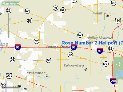
Rose Number 2 Heliport
Address:
Cook County, IL
Tel:
847-381-5700
Images
and information placed above are from
http://www.airport-data.com/airport/76LL/
We
thank them for the data!
| General
Info |
| Country |
United
States |
| State |
ILLINOIS
|
| FAA ID |
76LL |
| Latitude |
42-04-08.095N
|
| Longitude |
088-08-30.271W
|
| Elevation |
827 feet
|
| Near City |
BARRINGTON
|
We don't guarantee the information is fresh and accurate. The data may
be wrong or outdated.
For more up-to-date information please refer to other sources.
|
|


