 |
|
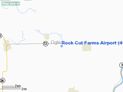
Location
& QuickFacts
|
FAA
Information Effective: |
2007-12-20 |
|
Airport
Identifier: |
48LL |
|
Airport
Status: |
Operational |
|
Longitude/Latitude: |
089-27-32.3990W/42-07-31.0930N
-89.459000/42.125304 (Estimated) |
|
Elevation: |
812 ft / 247.50 m (Surveyed) |
|
Land: |
0 acres |
|
From nearest
city: |
3 nautical miles W of Leaf River, IL |
|
Location: |
Ogle County, IL |
|
Magnetic
Variation: |
00E (1985) |
Owner & Manager
|
Ownership: |
Privately
owned |
|
Owner: |
Glen Borneman |
|
Address: |
Leaf River, IL 61047 |
|
Phone
number: |
815-738-2842 |
|
Manager: |
Glen Borneman |
|
Address: |
Leaf River, IL 61047 |
|
Phone
number: |
815-738-2842 |
Airport
Operations and Facilities
|
Airport
Use: |
Private |
|
Wind indicator: |
No |
|
Segmented
Circle: |
No |
|
Control
Tower: |
No |
|
Sectional
chart: |
Chicago |
|
Region: |
AGL - Great Lakes |
|
Boundary
ARTCC: |
ZAU - Chicago |
|
Tie-in
FSS: |
IKK - Kankakee |
|
FSS on
Airport: |
No |
|
FSS Toll
Free: |
1-800-WX-BRIEF |
|
Runway Information
Runway 09/27
|
Dimension: |
2300 x 200 ft
/ 701.0 x 61.0 m |
|
Surface: |
TURF, |
|
|
Runway 09 |
Runway 27 |
|
Traffic
Pattern: |
Left |
Left |
|
Radio Navigation
Aids
|
ID |
Type |
Name |
Ch |
Freq |
Var |
Dist |
|
FEP |
NDB |
Freeport |
|
335.00 |
00E |
9.2 nm |
|
BOZ |
NDB |
Whiteside |
|
254.00 |
01E |
28.9 nm |
|
JVL |
NDB |
Janesville |
|
375.00 |
03E |
34.8 nm |
|
DKB |
NDB |
Dekalb |
|
209.00 |
02W |
35.5 nm |
|
CWI |
NDB |
Clinton |
|
377.00 |
01E |
42.7 nm |
|
VYS |
NDB |
Valley |
|
230.00 |
00W |
48.4 nm |
|
PLL |
VOR/DME |
Polo |
049X |
111.20 |
03E |
10.0 nm |
|
RFD |
VOR/DME |
Rockford |
045X |
110.80 |
01E |
13.0 nm |
|
JVL |
VOR/DME |
Janesville |
090X |
114.30 |
03E |
30.4 nm |
Remarks
- PROVIDED
ALL TRAFFIC PATTERN OPERATIONS ARE CONDUCTED NORTH OF RWY 09/27 IE;
A LEFT-HAND PATTERN FOR ALL RWY 09 ARRIVALS AND DEPARTURES. AND A RIGHT-HAND
PATTERN FOR ALL RWY 27 ARRIVALS AND DEPARTURES.
Rock Cut Farms Airport
Address:
Ogle County, IL
Tel:
815-738-2842
Images
and information placed above are from
http://www.airport-data.com/airport/48LL/
We
thank them for the data!
| General
Info |
| Country |
United
States |
| State |
ILLINOIS
|
| FAA ID |
48LL |
| Latitude |
42-07-31.093N
|
| Longitude |
089-27-32.399W
|
| Elevation |
812 feet
|
| Near City |
LEAF RIVER
|
We don't guarantee the information is fresh and accurate. The data may
be wrong or outdated.
For more up-to-date information please refer to other sources.
|
|


