 |
|
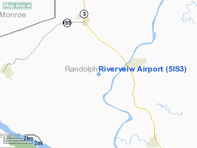
Location
& QuickFacts
|
FAA
Information Effective: |
2007-12-20 |
|
Airport
Identifier: |
5IS3 |
|
Airport
Status: |
Operational |
|
Longitude/Latitude: |
089-58-46.3910W/38-04-42.1850N
-89.979553/38.078385 (Estimated) |
|
Elevation: |
490 ft / 149.35 m (Estimated) |
|
Land: |
3 acres |
|
From nearest
city: |
2 nautical miles SW of Evansville, IL |
|
Location: |
Randolph County, IL |
|
Magnetic
Variation: |
02E (1985) |
Owner & Manager
|
Ownership: |
Privately
owned |
|
Owner: |
Kenneth Scherle |
|
Address: |
4345 Sr 155
Red Bud, IL 62278 |
|
Phone
number: |
618-282-3378 |
|
Manager: |
Kenneth Scherle |
|
Address: |
4345 Sr 155
Red Bud, IL 62278 |
|
Phone
number: |
618-282-3378 |
Airport
Operations and Facilities
|
Airport
Use: |
Private |
|
Wind indicator: |
Yes |
|
Segmented
Circle: |
No |
|
Control
Tower: |
No |
|
Lighting
Schedule: |
NONE |
|
Sectional
chart: |
St Louis |
|
Region: |
AGL - Great Lakes |
|
Boundary
ARTCC: |
ZKC - Kansas City |
|
Tie-in
FSS: |
COU - Columbia |
|
FSS on
Airport: |
No |
|
FSS Toll
Free: |
1-800-WX-BRIEF |
|
Runway Information
Runway 09/27
|
Dimension: |
1825 x 80 ft
/ 556.3 x 24.4 m |
|
Surface: |
TURF, |
|
|
Runway 09 |
Runway 27 |
|
Traffic
Pattern: |
Left |
Right |
|
Obstruction: |
|
15 ft road, 0.0 ft from runway |
|
Radio Navigation
Aids
|
ID |
Type |
Name |
Ch |
Freq |
Var |
Dist |
|
SAR |
NDB |
Sparta |
|
239.00 |
01E |
13.7 nm |
|
FES |
NDB |
Festus |
|
269.00 |
01E |
20.5 nm |
|
BL |
NDB |
Belleville |
|
362.00 |
02E |
25.5 nm |
|
PRI |
NDB |
Perrine |
|
367.00 |
02E |
28.5 nm |
|
PJY |
NDB |
Pinckneyville |
|
215.00 |
00E |
29.8 nm |
|
CVM |
NDB |
Civic Memorial |
|
263.00 |
02E |
49.1 nm |
|
LM |
NDB |
Oblio |
|
338.00 |
00E |
49.3 nm |
|
SKE |
TACAN |
Scott |
059X |
|
02E |
28.7 nm |
|
CSX |
VOR/DME |
Cardinal |
111Y |
116.45 |
00E |
44.3 nm |
|
MWA |
VOR/DME |
Marion |
041X |
110.40 |
04E |
49.9 nm |
|
FAM |
VORTAC |
Farmington |
104X |
115.70 |
01E |
27.2 nm |
|
TOY |
VORTAC |
Troy |
107X |
116.00 |
04E |
39.8 nm |
|
ENL |
VORTAC |
Centralia |
097X |
115.00 |
04E |
43.8 nm |
|
STL |
VOT |
St Louis Lambert |
|
111.00 |
|
44.1 nm |
|
SUS |
VOT |
Spirit Of St Louis |
|
112.20 |
|
47.3 nm |
Remarks
- PRVDD
OBSTNS IN APCH SFC ARE REMOVED/LOWERED OR THRS DSPLCD TO PRVD 20:1 CLRNC.
Based Aircraft
|
Aircraft
based on field: |
1 |
|
Single Engine
Airplanes: |
1 |
Riverveiw Airport
Address:
Randolph County, IL
Tel:
618-282-3378
Images
and information placed above are from
http://www.airport-data.com/airport/5IS3/
We
thank them for the data!
| General
Info |
| Country |
United
States |
| State |
ILLINOIS
|
| FAA ID |
5IS3 |
| Latitude |
38-04-42.185N
|
| Longitude |
089-58-46.391W
|
| Elevation |
490 feet
|
| Near City |
EVANSVILLE
|
We don't guarantee the information is fresh and accurate. The data may
be wrong or outdated.
For more up-to-date information please refer to other sources.
|
|


