 |
|
|
|
|
|
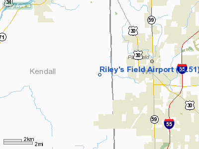
Location
& QuickFacts
|
FAA
Information Effective: |
2007-12-20 |
|
Airport
Identifier: |
LL51 |
|
Airport
Status: |
Operational |
|
Longitude/Latitude: |
088-16-25.2400W/41-36-15.1070N
-88.273678/41.604196 (Estimated) |
|
Elevation: |
663 ft / 202.08 m (Estimated) |
|
Land: |
6 acres |
|
From nearest
city: |
3 nautical miles W of Plainfield, IL |
|
Location: |
Kendall County, IL |
|
Magnetic
Variation: |
01W (1985) |
Owner
& Manager
|
Ownership: |
Privately
owned |
|
Owner: |
Gilbert L. Niznik |
|
Address: |
727 Main Street, Po Box 85
Plainfield,
IL 60544 |
|
Phone
number: |
815-436-3835 |
|
Manager: |
Gilbert L. Niznik |
|
Address: |
727 Main Street, Po Box 85
Plainfield,
IL 60544 |
|
Phone
number: |
815-436-3835 |
Airport Operations
and Facilities
|
Airport
Use: |
Private |
|
Wind indicator: |
Yes |
|
Segmented
Circle: |
No |
|
Control
Tower: |
No |
|
Lighting
Schedule: |
PHONE REQ
FOR MIRL RY N/S CALL 815-436-3835. |
|
Landing
fee charge: |
No |
|
Sectional
chart: |
Chicago |
|
Region: |
AGL - Great Lakes |
|
Boundary
ARTCC: |
ZAU - Chicago |
|
Tie-in
FSS: |
IKK - Kankakee |
|
FSS on
Airport: |
No |
|
FSS Toll
Free: |
1-800-WX-BRIEF |
Airport Services
|
Airframe
Repair: |
NONE |
|
Power
Plant Repair: |
NONE |
|
Runway Information
Runway N/S
|
Dimension: |
2000 x 100 ft
/ 609.6 x 30.5 m |
|
Surface: |
TURF, |
|
Edge Lights: |
Medium |
|
|
Runway N |
Runway S |
|
Traffic
Pattern: |
Left |
Right |
|
Radio Navigation
Aids
|
ID |
Type |
Name |
Ch |
Freq |
Var |
Dist |
|
HK |
NDB |
Ermin |
|
332.00 |
01W |
20.8 nm |
|
ME |
NDB |
Deana |
|
350.00 |
00E |
24.5 nm |
|
MX |
NDB |
Kedzi |
|
248.00 |
01W |
27.5 nm |
|
DKB |
NDB |
Dekalb |
|
209.00 |
02W |
27.8 nm |
|
OIX |
NDB |
Ottawa |
|
266.00 |
01E |
29.9 nm |
|
VYS |
NDB |
Valley |
|
230.00 |
00W |
42.1 nm |
|
DPA |
VOR/DME |
Dupage |
021X |
108.40 |
02E |
17.5 nm |
|
ORD |
VOR/DME |
Chicago O'hare |
086X |
113.90 |
02E |
28.4 nm |
|
IKK |
VOR/DME |
Kankakee |
053X |
111.60 |
00E |
37.1 nm |
|
OBK |
VOR/DME |
Northbrook |
077X |
113.00 |
02W |
39.8 nm |
|
JOT |
VORTAC |
Joliet |
070X |
112.30 |
02E |
4.0 nm |
|
EON |
VORTAC |
Peotone |
079X |
113.20 |
02E |
29.6 nm |
|
CGT |
VORTAC |
Chicago Heights |
089X |
114.20 |
02E |
32.1 nm |
|
MDW |
VOT |
Chicago Midway |
|
111.00 |
|
25.8 nm |
|
ORD |
VOT |
Chicago O'hare Intl |
|
112.00 |
|
28.1 nm |
Based Aircraft
|
Aircraft
based on field: |
8 |
|
Single Engine
Airplanes: |
7 |
|
Multi Engine Airplanes: |
1 |
Riley's Field Airport
Address:
Kendall County, IL
Tel:
815-436-3835
Images
and information placed above are from
http://www.airport-data.com/airport/LL51/
We
thank them for the data!
| General
Info |
| Country |
United
States |
| State |
ILLINOIS
|
| FAA ID |
LL51 |
| Latitude |
41-36-15.107N
|
| Longitude |
088-16-25.240W
|
| Elevation |
663 feet
|
| Near City |
PLAINFIELD
|
We don't guarantee the information is fresh and accurate. The data may
be wrong or outdated.
For more up-to-date information please refer to other sources.
|
|


