 |
|
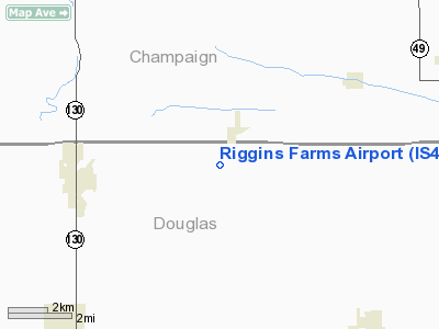
Location
& QuickFacts
|
FAA
Information Effective: |
2007-12-20 |
|
Airport
Identifier: |
IS43 |
|
Airport
Status: |
Operational |
|
Longitude/Latitude: |
088-04-30.0000W/39-52-12.0000N
-88.075000/39.870000 (Estimated) |
|
Elevation: |
699 ft / 213.06 m (Estimated) |
|
Land: |
0 acres |
|
From nearest
city: |
2 nautical miles E of Villa Glove, IL |
|
Location: |
Douglas County, IL |
|
Magnetic
Variation: |
01W (1995) |
Owner & Manager
|
Ownership: |
Privately
owned |
|
Owner: |
Steve Riggins |
|
Address: |
Rr 1 Box 61
Newman, IL |
|
Phone
number: |
217-369-0342 |
|
Manager: |
Steve Riggins |
|
Address: |
Rr 1 Box 61
Newman, IL 61942 |
|
Phone
number: |
217-369-0342 |
Airport
Operations and Facilities
|
Airport
Use: |
Private |
|
Segmented
Circle: |
No |
|
Control
Tower: |
No |
|
Sectional
chart: |
St Louis |
|
Region: |
AGL - Great Lakes |
|
Boundary
ARTCC: |
ZAU - Chicago |
|
Tie-in
FSS: |
STL - Saint Louis |
|
FSS Toll
Free: |
1-800-WX-BRIEF |
|
Runway Information
Runway 18/36
|
Dimension: |
2950 x 70 ft
/ 899.2 x 21.3 m |
|
Surface: |
TURF, |
|
|
Runway 18 |
Runway 36 |
|
Traffic
Pattern: |
Left |
Left |
|
Obstruction: |
|
20 ft road, 350.0 ft from runway |
|
Radio Navigation
Aids
|
ID |
Type |
Name |
Ch |
Freq |
Var |
Dist |
|
HMJ |
NDB |
Homer |
|
281.00 |
01E |
11.0 nm |
|
PRG |
NDB |
Paris |
|
341.00 |
01E |
21.2 nm |
|
MT |
NDB |
Zebre |
|
347.00 |
00E |
26.1 nm |
|
CZB |
NDB |
Casey |
|
359.00 |
00E |
34.1 nm |
|
HU |
NDB |
Yinno |
|
245.00 |
02W |
42.7 nm |
|
SYZ |
NDB |
Shelbyville |
|
365.00 |
01E |
45.2 nm |
|
MTO |
VOR/DME |
Mattoon |
031X |
109.40 |
03E |
25.5 nm |
|
RBS |
VOR/DME |
Roberts |
115X |
116.80 |
02E |
43.0 nm |
|
CMI |
VORTAC |
Champaign |
037X |
110.00 |
03E |
13.6 nm |
|
DNV |
VORTAC |
Danville |
047X |
111.00 |
02E |
34.9 nm |
|
DEC |
VORTAC |
Decatur |
119X |
117.20 |
03E |
37.0 nm |
|
TTH |
VORTAC |
Terre Haute |
100X |
115.30 |
02E |
44.5 nm |
Remarks
- RY
18/36 HAS 350 FT STWY S END.
- PRVDD
OBSTN LOWERED OR REMOVED TO PRVD A CLEAR 20:1 APCH SLOPE, AREA 125 FT
EITHER SIDE OF RY & 200 FT OFF RY END IS CLEAR, AREA 60 FT EITHER
SIDE OF RY & 240 FT OFF RY ENDS IS GRADED WITH NO BUMPS OR DEPRESSIONS.
Based Aircraft
|
Aircraft
based on field: |
1 |
|
Single Engine
Airplanes: |
1 |
Riggins Farms Airport
Address:
Douglas County, IL
Tel:
217-369-0342
Images
and information placed above are from
http://www.airport-data.com/airport/IS43/
We
thank them for the data!
| General
Info |
| Country |
United
States |
| State |
ILLINOIS
|
| FAA ID |
IS43 |
| Latitude |
39-52-12.000N
|
| Longitude |
088-04-30.000W
|
| Elevation |
699 feet
|
| Near City |
VILLA
GLOVE |
We don't guarantee the information is fresh and accurate. The data may
be wrong or outdated.
For more up-to-date information please refer to other sources.
|
|


