 |
|
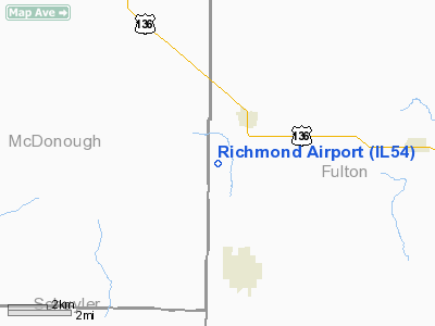
Location
& QuickFacts
|
FAA
Information Effective: |
2007-12-20 |
|
Airport
Identifier: |
IL54 |
|
Airport
Status: |
Operational |
|
Longitude/Latitude: |
090-26-34.0000W/40-20-39.0000N
-90.442778/40.344167 (Estimated) |
|
Elevation: |
680 ft / 207.26 m (Estimated) |
|
Land: |
0 acres |
|
From nearest
city: |
2 nautical miles SS of Table Grove, IL |
|
Location: |
Fulton County, IL |
|
Magnetic
Variation: |
() |
Owner
& Manager
|
Ownership: |
Privately
owned |
|
Owner: |
Curtiss Richmond |
|
Address: |
495 East County Hwy 3
Table Grove, IL 61482-8451 |
|
Phone
number: |
309-758-5579 |
|
Manager: |
Curtiss Richmond |
|
Address: |
495 East County Hwy 3
Table Grove, IL 61482-8451 |
|
Phone
number: |
309-758-5579 |
Airport Operations
and Facilities
|
Airport
Use: |
Private |
|
Wind indicator: |
Yes |
|
Control
Tower: |
No |
|
Sectional
chart: |
Chicago |
|
Region: |
AGL - Great Lakes |
|
Boundary
ARTCC: |
ZAU - Chicago |
|
Tie-in
FSS: |
IKK - Kankakee |
|
FSS Toll
Free: |
1-800-WX-BRIEF |
|
Runway Information
Runway 09/27
|
Dimension: |
2220 x 100 ft
/ 676.7 x 30.5 m |
|
Surface: |
TURF, |
|
|
Runway 09 |
Runway 27 |
|
Traffic
Pattern: |
Left |
Left |
|
Displaced
threshold: |
200.00 ft
DSPLCD THLDS RY 09 AND 27 MARKED WITH TIRES. |
300.00 ft
DSPLCD THLDS RY 09 AND 27 MARKED WITH TIRES. |
|
Obstruction: |
10 ft road |
50 ft tree |
|
Radio Navigation
Aids
|
ID |
Type |
Name |
Ch |
Freq |
Var |
Dist |
|
JZY |
NDB |
Macomb |
|
251.00 |
01E |
11.8 nm |
|
CTK |
NDB |
Canton |
|
236.00 |
02E |
21.4 nm |
|
PI |
NDB |
Tungg |
|
356.00 |
01E |
41.9 nm |
|
PPQ |
NDB |
Pittsfield |
|
344.00 |
02E |
45.1 nm |
|
EOK |
NDB |
Keokuk |
|
366.00 |
02E |
45.9 nm |
|
UI |
NDB |
Quincy |
|
293.00 |
02E |
46.3 nm |
|
LQ |
NDB |
Licol |
|
375.00 |
01W |
46.5 nm |
|
SP |
NDB |
Huskk |
|
382.00 |
01W |
46.5 nm |
|
IJX |
VOR/DME |
Jacksonville |
023X |
108.60 |
02E |
35.4 nm |
|
GBG |
VOR/DME |
Galesburg |
035X |
109.80 |
03E |
35.7 nm |
|
BRL |
VORTAC |
Burlington |
051X |
111.40 |
05E |
31.7 nm |
|
PIA |
VORTAC |
Peoria |
099X |
115.20 |
04E |
35.9 nm |
|
CAP |
VORTAC |
Capital |
074X |
112.70 |
04E |
46.4 nm |
|
SPI |
VORTAC |
Spinner |
74X |
112.70 |
01W |
46.4 nm |
|
UIN |
VORTAC |
Quincy |
083X |
113.60 |
05E |
48.7 nm |
Remarks
- PROVIDED
RY 9 THLD 200 FT EAST, AND THE ROAD WEST OF RY 9 IS A PVT ROAD AND NOT
A PUB ROAD.
Based Aircraft
|
Aircraft
based on field: |
2 |
|
Single Engine
Airplanes: |
2 |
Richmond Airport
Address:
Fulton County, IL
Tel:
309-758-5579
Images
and information placed above are from
http://www.airport-data.com/airport/IL54/
We
thank them for the data!
We don't guarantee the information is fresh and accurate. The data may
be wrong or outdated.
For more up-to-date information please refer to other sources.
|
|


