 |
|
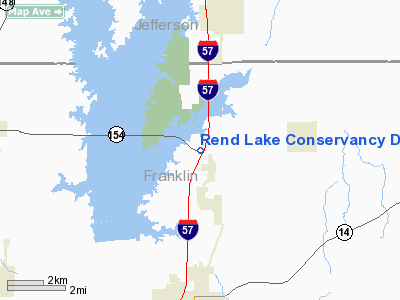
Rend Lake Conservancy District Heliport |
Location
& QuickFacts
|
FAA
Information Effective: |
2007-12-20 |
|
Airport
Identifier: |
IS50 |
|
Airport
Status: |
Operational |
|
Longitude/Latitude: |
088-55-01.2430W/38-04-55.1780N
-88.917012/38.081994 (Estimated) |
|
Elevation: |
450 ft / 137.16 m (Estimated) |
|
Land: |
0 acres |
|
From nearest
city: |
7 nautical miles S of Benton, IL |
|
Location: |
Franklin County, IL |
|
Magnetic
Variation: |
01E (1985) |
Owner & Manager
|
Ownership: |
Privately
owned |
|
Owner: |
Rend Lake Conservancy Distric |
|
Address: |
Box 907
Benton,
IL 62812 |
|
Phone
number: |
618-439-4321 |
|
Manager: |
Kevin E. Davis |
|
Address: |
Po Box 907
Benton,
IL 62812 |
|
Phone
number: |
618-439-4321 |
Airport
Operations and Facilities
|
Airport
Use: |
Private |
|
Wind indicator: |
Yes |
|
Segmented
Circle: |
No |
|
Control
Tower: |
No |
|
Sectional
chart: |
St Louis |
|
Region: |
AGL - Great Lakes |
|
Boundary
ARTCC: |
ZKC - Kansas City |
|
Tie-in
FSS: |
COU - Columbia |
|
FSS on
Airport: |
No |
|
FSS Toll
Free: |
1-800-WX-BRIEF |
|
Runway Information
Helipad H1
|
Dimension: |
300 x 300 ft
/ 91.4 x 91.4 m
DIAMETER OF CIRCULAR LNDG AREA. |
|
Surface: |
CONC, |
|
|
Runway H1 |
Runway |
|
Traffic
Pattern: |
Left |
Left |
|
Radio Navigation
Aids
|
ID |
Type |
Name |
Ch |
Freq |
Var |
Dist |
|
PJY |
NDB |
Pinckneyville |
|
215.00 |
00E |
22.1 nm |
|
HSB |
NDB |
Harrisburg-raleigh |
|
230.00 |
00E |
24.0 nm |
|
FWC |
NDB |
Wayne County |
|
257.00 |
01E |
29.9 nm |
|
SLO |
NDB |
Salem |
|
400.00 |
01W |
33.9 nm |
|
SAR |
NDB |
Sparta |
|
239.00 |
01E |
37.3 nm |
|
CUL |
NDB |
Carmi |
|
332.00 |
01W |
37.7 nm |
|
FOA |
NDB |
Elm River |
|
353.00 |
00E |
41.5 nm |
|
BL |
NDB |
Belleville |
|
362.00 |
02E |
45.8 nm |
|
VNN |
VOR/DME |
Mount Vernon |
085X |
113.80 |
02E |
17.6 nm |
|
MWA |
VOR/DME |
Marion |
041X |
110.40 |
04E |
20.2 nm |
|
SAM |
VOR/DME |
Samsville |
113X |
116.60 |
03E |
46.1 nm |
|
ENL |
VORTAC |
Centralia |
097X |
115.00 |
04E |
23.3 nm |
Remarks
- PRVDD
ALL APP/DEP RTE HELI OPNS ARE CONDD ONLY ON A BRG OF 180 & 360 DEG
FM HELI USING THE TD PAD AS CNTR OF A COMPASS ROSE, TKOF/LNDG AREA IS
APROPLY MKD/LGTD, NON-OBSTG WIND INDCR MAINTD ADJ TO TKOF/LNDG AREA.
Rend Lake Conservancy District Heliport
Address:
Franklin County, IL
Tel:
618-439-4321
Images
and information placed above are from
http://www.airport-data.com/airport/IS50/
We
thank them for the data!
| General
Info |
| Country |
United
States |
| State |
ILLINOIS
|
| FAA ID |
IS50 |
| Latitude |
38-04-55.178N
|
| Longitude |
088-55-01.243W
|
| Elevation |
450 feet
|
| Near City |
BENTON
|
We don't guarantee the information is fresh and accurate. The data may
be wrong or outdated.
For more up-to-date information please refer to other sources.
|
|


