 |
|
Location
& QuickFacts
|
FAA
Information Effective: |
2007-12-20 |
|
Airport
Identifier: |
LL49 |
|
Airport
Status: |
Operational |
|
Longitude/Latitude: |
090-16-20.0000W/39-03-44.0000N
-90.272222/39.062222 (Estimated) |
|
Elevation: |
658 ft / 200.56 m (Estimated) |
|
Land: |
0 acres |
|
From nearest
city: |
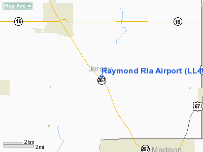
4 nautical miles SE of Jerseyville, IL |
|
Location: |
Jersey County, IL |
|
Magnetic
Variation: |
01E (1995) |
Owner & Manager
|
Ownership: |
Privately
owned |
|
Owner: |
Patrick Raymond |
|
Address: |
Rr1 Box 54
Kane, IL 62054 |
|
Phone
number: |
618-498-4028 |
|
Manager: |
Patrick Raymond |
|
Address: |
Rr 1 Box 54
Kane, IL 62054 |
|
Phone
number: |
618-498-4028 |
Airport
Operations and Facilities
|
Airport
Use: |
Private |
|
Segmented
Circle: |
No |
|
Control
Tower: |
No |
|
Sectional
chart: |
St Louis |
|
Region: |
AGL - Great Lakes |
|
Boundary
ARTCC: |
ZKC - Kansas City |
|
Tie-in
FSS: |
STL - Saint Louis |
|
FSS Toll
Free: |
1-800-WX-BRIEF |
|
Runway Information
Runway 02/20
|
Dimension: |
1600 x 100 ft
/ 487.7 x 30.5 m |
|
Surface: |
TURF, |
|
|
Runway 02 |
Runway 20 |
|
Traffic
Pattern: |
Right |
Left |
|
Displaced
threshold: |
200.00 ft |
0.00 ft |
|
Obstruction: |
25 ft pline, 180.0 ft from runway |
23 ft rr, 350.0 ft from runway |
|
Radio Navigation
Aids
|
ID |
Type |
Name |
Ch |
Freq |
Var |
Dist |
|
CVM |
NDB |
Civic Memorial |
|
263.00 |
02E |
14.4 nm |
|
LM |
NDB |
Oblio |
|
338.00 |
00E |
18.4 nm |
|
LTD |
NDB |
Litchfield |
|
371.00 |
01E |
28.5 nm |
|
PPQ |
NDB |
Pittsfield |
|
344.00 |
02E |
42.1 nm |
|
BL |
NDB |
Belleville |
|
362.00 |
02E |
43.3 nm |
|
SP |
NDB |
Huskk |
|
382.00 |
01W |
48.9 nm |
|
SKE |
TACAN |
Scott |
059X |
|
02E |
36.8 nm |
|
CSX |
VOR/DME |
Cardinal |
111Y |
116.45 |
00E |
19.1 nm |
|
IJX |
VOR/DME |
Jacksonville |
023X |
108.60 |
02E |
43.0 nm |
|
STL |
VORTAC |
St Louis |
121X |
117.40 |
01E |
15.6 nm |
|
TOY |
VORTAC |
Troy |
107X |
116.00 |
04E |
25.5 nm |
|
FTZ |
VORTAC |
Foristell |
045X |
110.80 |
05E |
39.5 nm |
|
STL |
VOT |
St Louis Lambert |
|
111.00 |
|
19.3 nm |
|
SUS |
VOT |
Spirit Of St Louis |
|
112.20 |
|
29.9 nm |
Remarks
- PRVDD
CLEAR 20:1 APCH, AREA 125 FT EITHER SIDE OF RY CNTRLN & 200 FT OFF
RY ENDS IS CLEAR, AREA 60 FT EITHER SIDE OF RY CNTRLN & 240 FT OFF
RY ENDS IS GRADED WITH NO RUTS.
Raymond Rla Airport
Address:
Jersey County, IL
Tel:
618-498-4028
Images
and information placed above are from
http://www.airport-data.com/airport/LL49/
We
thank them for the data!
| General
Info |
| Country |
United
States |
| State |
ILLINOIS
|
| FAA ID |
LL49 |
| Latitude |
39-03-44.000N
|
| Longitude |
090-16-20.000W
|
| Elevation |
658 feet
|
| Near City |
JERSEYVILLE
|
We don't guarantee the information is fresh and accurate. The data may
be wrong or outdated.
For more up-to-date information please refer to other sources.
|
|


