 |
|
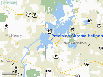
Precision Chrome Heliport |
Location
& QuickFacts
|
FAA
Information Effective: |
2007-12-20 |
|
Airport
Identifier: |
64IS |
|
Airport
Status: |
Operational |
|
Longitude/Latitude: |
088-10-53.3060W/42-23-23.0750N
-88.181474/42.389743 (Estimated) |
|
Elevation: |
745 ft / 227.08 m (Estimated) |
|
Land: |
0 acres |
|
From nearest
city: |
1 nautical miles SE of Fox Lake, IL |
|
Location: |
Lake County, IL |
|
Magnetic
Variation: |
01W (1985) |
Owner
& Manager
|
Ownership: |
Privately
owned |
|
Owner: |
Precision Chrome Inc |
|
Address: |
105 Precision Rd
Fox Lake, IL 60020 |
|
Phone
number: |
847-587-115 |
|
Manager: |
Donald Hjortland |
|
Address: |
105 Precision Rd
Fox Lake, IL 60020 |
Airport
Operations and Facilities
|
Airport
Use: |
Private |
|
Wind indicator: |
Yes |
|
Segmented
Circle: |
Yes |
|
Control
Tower: |
No |
|
Sectional
chart: |
Chicago |
|
Region: |
AGL - Great Lakes |
|
Boundary
ARTCC: |
ZAU - Chicago |
|
Tie-in
FSS: |
IKK - Kankakee |
|
FSS Toll
Free: |
1-800-WX-BRIEF |
|
Runway Information
Helipad H1
|
Dimension: |
12 x 12 ft /
3.7 x 3.7 m |
|
Surface: |
CONC, |
|
|
Runway H1 |
Runway |
|
Traffic
Pattern: |
Left |
Left |
|
Radio Navigation
Aids
|
ID |
Type |
Name |
Ch |
Freq |
Var |
Dist |
|
RA |
NDB |
Paser |
|
206.00 |
00E |
21.6 nm |
|
LVV |
NDB |
Lake Lawn |
|
404.00 |
00W |
26.0 nm |
|
ME |
NDB |
Deana |
|
350.00 |
00E |
26.3 nm |
|
GM |
NDB |
Teels |
|
242.00 |
02W |
31.8 nm |
|
DKB |
NDB |
Dekalb |
|
209.00 |
02W |
36.0 nm |
|
UES |
NDB |
Waukesha |
|
359.00 |
01W |
39.4 nm |
|
JVL |
NDB |
Janesville |
|
375.00 |
03E |
40.4 nm |
|
BL |
NDB |
Yanks |
|
260.00 |
02W |
42.5 nm |
|
HK |
NDB |
Ermin |
|
332.00 |
01W |
43.2 nm |
|
MX |
NDB |
Kedzi |
|
248.00 |
01W |
44.7 nm |
|
OBK |
VOR/DME |
Northbrook |
077X |
113.00 |
02W |
14.4 nm |
|
ENW |
VOR/DME |
Kenosha |
029X |
109.20 |
02W |
16.8 nm |
|
BUU |
VOR/DME |
Burbun |
092X |
114.50 |
01W |
18.8 nm |
|
ORD |
VOR/DME |
Chicago O'hare |
086X |
113.90 |
02E |
27.1 nm |
|
HRK |
VOR/DME |
Horlick |
124X |
117.70 |
02W |
27.6 nm |
|
DPA |
VOR/DME |
Dupage |
021X |
108.40 |
02E |
30.9 nm |
|
JVL |
VOR/DME |
Janesville |
090X |
114.30 |
03E |
42.2 nm |
|
LJT |
VOR/DME |
Timmerman |
072X |
112.50 |
02W |
43.7 nm |
|
RFD |
VOR/DME |
Rockford |
045X |
110.80 |
01E |
46.3 nm |
|
BAE |
VORTAC |
Badger |
111X |
116.40 |
02E |
43.9 nm |
|
ORD |
VOT |
Chicago O'hare Intl |
|
112.00 |
|
27.4 nm |
|
MKE |
VOT |
Milwaukee |
|
109.00 |
|
35.8 nm |
|
MDW |
VOT |
Chicago Midway |
|
111.00 |
|
41.0 nm |
Remarks
- PROVIDED
APCH/DEP OPERATIONS ARE FROM 330 TO 185 DEG; AREA IS MKD; WIND INDICATOR
IS MAINTAINED; NO NIGHT OPERATIONS UNLESS PAD & INDICATOR ARE LIGHTED.
Precision Chrome Heliport
Address:
Lake County, IL
Tel:
847-587-115
Images
and information placed above are from
http://www.airport-data.com/airport/64IS/
We
thank them for the data!
| General
Info |
| Country |
United
States |
| State |
ILLINOIS
|
| FAA ID |
64IS |
| Latitude |
42-23-23.075N
|
| Longitude |
088-10-53.306W
|
| Elevation |
745 feet
|
| Near City |
FOX LAKE
|
We don't guarantee the information is fresh and accurate. The data may
be wrong or outdated.
For more up-to-date information please refer to other sources.
|
|


