 |
|
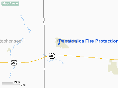
Pecatonica Fire Protection District Heliport |
Location
& QuickFacts
|
FAA
Information Effective: |
2007-12-20 |
|
Airport
Identifier: |
IS58 |
|
Airport
Status: |
Operational |
|
Longitude/Latitude: |
089-21-45.0000W/42-18-26.0000N
-89.362500/42.307222 (Estimated) |
|
Elevation: |
774 ft / 235.92 m (Estimated) |
|
Land: |
0 acres |
|
From nearest
city: |
1 nautical miles S of Pecatonica, IL |
|
Location: |
Winnebago County, IL |
|
Magnetic
Variation: |
01W (1995) |
Owner & Manager
|
Ownership: |
Privately
owned |
|
Owner: |
Pecatonica Fire Protection District |
|
Address: |
Box 307
Pecatonica, IL 61063-0307 |
|
Phone
number: |
815-239-2513 |
|
Manager: |
Linda Buss |
|
Address: |
Box 307
Pecatonica, IL 61603-0307 |
|
Phone
number: |
815-971-4733 |
Airport
Operations and Facilities
|
Airport
Use: |
Private |
|
Wind indicator: |
Yes |
|
Segmented
Circle: |
No |
|
Control
Tower: |
No |
|
Lighting
Schedule: |
PHONE REQ
FOR PERIMETER LGTS CALL 815-239-2513. |
|
Sectional
chart: |
Chicago |
|
Region: |
AGL - Great Lakes |
|
Boundary
ARTCC: |
ZAU - Chicago |
|
Tie-in
FSS: |
IKK - Kankakee |
|
FSS Toll
Free: |
1-800-WX-BRIEF |
|
Runway Information
Helipad H1
|
Dimension: |
100 x 100 ft
/ 30.5 x 30.5 m |
|
Surface: |
CONC, |
|
|
Runway H1 |
Runway |
|
Traffic
Pattern: |
Left |
Left |
|
Radio Navigation
Aids
|
ID |
Type |
Name |
Ch |
Freq |
Var |
Dist |
|
FEP |
NDB |
Freeport |
|
335.00 |
00E |
10.6 nm |
|
JVL |
NDB |
Janesville |
|
375.00 |
03E |
23.4 nm |
|
DKB |
NDB |
Dekalb |
|
209.00 |
02W |
36.8 nm |
|
BOZ |
NDB |
Whiteside |
|
254.00 |
01E |
40.5 nm |
|
LVV |
NDB |
Lake Lawn |
|
404.00 |
00W |
41.4 nm |
|
MS |
NDB |
Monah |
|
400.00 |
00E |
45.4 nm |
|
RFD |
VOR/DME |
Rockford |
045X |
110.80 |
01E |
8.8 nm |
|
JVL |
VOR/DME |
Janesville |
090X |
114.30 |
03E |
18.9 nm |
|
PLL |
VOR/DME |
Polo |
049X |
111.20 |
03E |
21.8 nm |
Remarks
- SEE
AIRSPACE CASE 97-AGL-279-NRA.
Pecatonica Fire Protection District Heliport
Address:
Winnebago County, IL
Tel:
815-239-2513,
815-971-4733
Images
and information placed above are from
http://www.airport-data.com/airport/IS58/
We
thank them for the data!
| General
Info |
| Country |
United
States |
| State |
ILLINOIS
|
| FAA ID |
IS58 |
| Latitude |
42-18-26.000N
|
| Longitude |
089-21-45.000W
|
| Elevation |
774 feet
|
| Near City |
PECATONICA
|
We don't guarantee the information is fresh and accurate. The data may
be wrong or outdated.
For more up-to-date information please refer to other sources.
|
|


