 |
|
|
|
|
|
Location
& QuickFacts
|
FAA
Information Effective: |
2007-12-20 |
|
Airport
Identifier: |
1C1 |
|
Airport
Status: |
Operational |
|
Longitude/Latitude: |
088-07-39.8570W/40-26-56.3240N
-88.127738/40.448979 (Estimated) |
|
Elevation: |
779 ft / 237.44 m (Surveyed) |
|
Land: |
58 acres |
|
From nearest
city: |
2 nautical miles SW of Paxton, IL |
|
Location: |
Ford County, IL |
|
Magnetic
Variation: |
02E (1970) |
Owner
& Manager
|
Ownership: |
Publicly
owned |
|
Owner: |
City Of Paxton |
|
Address: |
City Hall
Paxton, IL 60957 |
|
Phone
number: |
217-379-4022 |
|
Manager: |
Randy Swan |
|
Address: |
1065 W. Ottawa
Paxton, IL 60957 |
|
Phone
number: |
217-379-4022 |
Airport
Operations and Facilities
|
Airport
Use: |
Open
to public |
|
Wind indicator: |
Yes |
|
Segmented
Circle: |
No |
|
Control
Tower: |
No |
|
Lighting
Schedule: |
DUSK-DAWN |
|
Beacon
Color: |
Clear-Green (lighted land airport) |
|
Landing
fee charge: |
No |
|
Sectional
chart: |
Chicago |
|
Region: |
AGL - Great Lakes |
|
Traffic
Pattern Alt: |
800 ft |
|
Boundary
ARTCC: |
ZAU - Chicago |
|
Tie-in
FSS: |
STL - Saint Louis |
|
FSS on
Airport: |
No |
|
FSS Toll
Free: |
1-800-WX-BRIEF |
|
NOTAMs
Facility: |
STL (NOTAM-d service avaliable) |
Airport Communications
|
CTAF: |
122.800 |
|
Unicom: |
122.800
|
Airport Services
|
Fuel
available: |
100LLMOGAS |
|
Airframe
Repair: |
MAJOR
MAINT ON CALL PHONE 217-249-2296. |
|
Power
Plant Repair: |
MAJOR |
|
Bottled
Oxygen: |
NONE |
|
Bulk Oxygen: |
NONE |
|
Runway Information
Runway 18/36
|
Dimension: |
3409 x 50 ft
/ 1039.1 x 15.2 m |
|
Surface: |
ASPH, Fair Condition |
|
Weight Limit: |
Single wheel: 12500 lbs. |
|
Edge Lights: |
Non-standard lighting system
NSTD MIRL - FIXTURE SPACING & LGT INTSTY VARIES. |
|
|
Runway 18 |
Runway 36 |
|
Longitude: |
088-07-39.9370W |
088-07-39.7990W |
|
Latitude: |
40-27-13.1610N |
40-26-39.4790N |
|
Elevation: |
779.00 ft |
755.00 ft |
|
Alignment: |
127 |
127 |
|
Traffic
Pattern: |
Left |
Left |
|
Markings: |
Non-precision instrument, Good Condition |
Numbers only, Good Condition |
|
Crossing
Height: |
50.00 ft |
50.00 ft |
|
Displaced
threshold: |
800.00 ft
DSPLCD THLD PAINTED WHITE LINE ACROSS RY. |
0.00 ft |
|
VASI: |
tri-color on left side |
tri-color on left side |
|
Visual Glide
Angle: |
3.00° |
3.00° |
|
Runway End
Identifier: |
Yes |
|
|
Obstruction: |
56 ft tree, 606.0 ft from runway, 131 ft left
of centerline, 7:1 slope to clear
RWY 18 APCH RATIO 25:1 TO DSPLCD THLD.
27 FT BLDG 157 FT FM RY END. |
24 ft tree, 1398.0 ft from runway, 241 ft right
of centerline, 49:1 slope to clear |
|
Radio Navigation
Aids
|
ID |
Type |
Name |
Ch |
Freq |
Var |
Dist |
|
HMJ |
NDB |
Homer |
|
281.00 |
01E |
26.6 nm |
|
PRG |
NDB |
Paris |
|
341.00 |
01E |
49.7 nm |
|
RBS |
VOR/DME |
Roberts |
115X |
116.80 |
02E |
8.2 nm |
|
PNT |
VOR/DME |
Pontiac |
033X |
109.60 |
03E |
35.6 nm |
|
BMI |
VOR/DME |
Bloomington |
019X |
108.20 |
03E |
36.8 nm |
|
IKK |
VOR/DME |
Kankakee |
053X |
111.60 |
00E |
39.7 nm |
|
CMI |
VORTAC |
Champaign |
037X |
110.00 |
03E |
25.8 nm |
|
DNV |
VORTAC |
Danville |
047X |
111.00 |
02E |
27.7 nm |
|
BVT |
VORTAC |
Boiler |
098X |
115.10 |
01E |
48.8 nm |
Remarks
- ALL
OPNS TO BE CONDD ON E SIDE OF N/S RWY.
Based Aircraft
|
Aircraft
based on field: |
18 |
|
Single Engine
Airplanes: |
12 |
|
Ultralights: |
6 |
Operational Statistics
Time
Period: 2006-01-01 - 2006-12-31
|
Aircraft
Operations: |
77/Week |
|
Air Taxi: |
5.0% |
|
General Aviation
Local: |
45.0% |
|
General Aviation
Itinerant: |
50.0% |
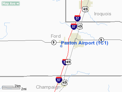
Paxton Airport
Address:
Ford County, IL
Tel:
217-379-4022
Images
and information placed above are from
http://www.airport-data.com/airport/1C1/
We
thank them for the data!
| General
Info |
| Country |
United
States |
| State |
ILLINOIS
|
| FAA ID |
1C1 |
| Latitude |
40-26-56.324N
|
| Longitude |
088-07-39.857W
|
| Elevation |
779 feet
|
| Near City |
PAXTON
|
We don't guarantee the information is fresh and accurate. The data may
be wrong or outdated.
For more up-to-date information please refer to other sources.
|
|


