 |
|
Location
& QuickFacts
|
FAA Information
Effective: |
2007-12-20 |
|
Airport
Identifier: |
8IL5 |
|
Airport
Status: |
Operational |
|
Longitude/Latitude: |
089-21-15.0000W/42-22-05.0000N
-89.354167/42.368056 (Estimated) |
|
Elevation: |
900 ft / 274.32 m (Estimated) |
|
Land: |
0 acres |
|
From nearest
city: |
4 nautical
miles N of Pecatonica, IL |
|
Location: |
Winnebago
County, IL |
|
Magnetic
Variation: |
01W (2000) |
Owner
& Manager
|
Ownership: |
Privately
owned |
|
Owner: |
Ken Schroepfer |
|
Address: |
7975 N. Pecatonica Rd.
Pecatonica, IL 61063 |
|
Phone
number: |
815-239-1262 |
|
Manager: |
Ken Schroepfer |
|
Address: |
7975 N. Pecatonica Rd.
Pecatonica, IL 61063 |
|
Phone
number: |
815-239-1262 |
Airport Operations
and Facilities
|
Airport
Use: |
Private |
|
Segmented
Circle: |
No |
|
Control
Tower: |
No |
|
Sectional
chart: |
Chicago |
|
Region: |
AGL - Great Lakes |
|
Boundary
ARTCC: |
ZAU - Chicago |
|
Tie-in
FSS: |
IKK - Kankakee |
|
FSS Toll
Free: |
1-800-WX-BRIEF |
|
Runway Information
Runway 09/27
|
Dimension: |
1800 x 70 ft
/ 548.6 x 21.3 m |
|
Surface: |
TURF, |
|
|
Runway 09 |
Runway 27 |
|
Traffic
Pattern: |
Left |
Left |
|
Obstruction: |
35 ft pline, 700.0 ft from runway |
|
|
Radio Navigation
Aids
|
ID |
Type |
Name |
Ch |
Freq |
Var |
Dist |
|
FEP |
NDB |
Freeport |
|
335.00 |
00E |
12.7 nm |
|
JVL |
NDB |
Janesville |
|
375.00 |
03E |
20.3 nm |
|
DKB |
NDB |
Dekalb |
|
209.00 |
02W |
38.9 nm |
|
LVV |
NDB |
Lake Lawn |
|
404.00 |
00W |
39.1 nm |
|
MS |
NDB |
Monah |
|
400.00 |
00E |
41.8 nm |
|
BOZ |
NDB |
Whiteside |
|
254.00 |
01E |
43.9 nm |
|
MRJ |
NDB |
Mineral Point |
|
365.00 |
00W |
49.7 nm |
|
RFD |
VOR/DME |
Rockford |
045X |
110.80 |
01E |
11.0 nm |
|
JVL |
VOR/DME |
Janesville |
090X |
114.30 |
03E |
15.9 nm |
|
PLL |
VOR/DME |
Polo |
049X |
111.20 |
03E |
25.3 nm |
|
MSN |
VORTAC |
Madison |
023X |
108.60 |
03E |
46.7 nm |
Remarks
- PROVIDED
CLEAR OBSTACLE FREE ZONE, AND CLEAR 20:1 APPROVAL, ESPECIALLY THE TREES
AND FENCE LINE E OF THE RWY AND TREES AND POWERLINE W OF THE RWY.
Based Aircraft
|
Aircraft
based on field: |
1 |
|
Single Engine
Airplanes: |
1 |
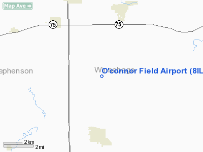
O'connor Field Airport
Address:
Winnebago County, IL
Tel:
815-239-1262
Images
and information placed above are from
http://www.airport-data.com/airport/8IL5/
We
thank them for the data!
| General
Info |
| Country |
United
States |
| State |
ILLINOIS
|
| FAA ID |
8IL5 |
| Latitude |
42-22-05.000N
|
| Longitude |
089-21-15.000W
|
| Elevation |
900 feet
|
| Near City |
PECATONICA
|
We don't guarantee the information is fresh and accurate. The data may
be wrong or outdated.
For more up-to-date information please refer to other sources.
|
|


