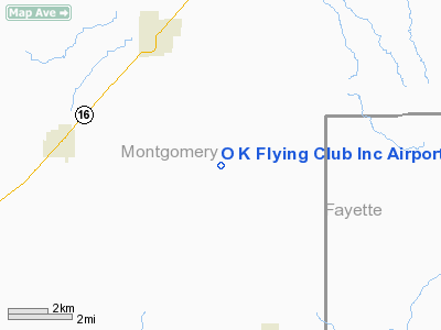
O K Flying Club Incorporated Airport |
Location
& QuickFacts
|
FAA
Information Effective: |
2007-12-20 |
|
Airport
Identifier: |
28IS |
|
Airport
Status: |
Operational |
|
Longitude/Latitude: |
089-18-42.2970W/39-11-41.1640N
-89.311749/39.194768 (Estimated) |
|
Elevation: |
665 ft / 202.69 m (Surveyed) |
|
Land: |
0 acres |
|
From nearest
city: |
4 nautical miles NW of Fillmore, IL |
|
Location: |
Montgomery County, IL |
|
Magnetic
Variation: |
01E (1985) |
Owner & Manager
|
Ownership: |
Privately
owned |
|
Owner: |
Eugene Knodle |
|
Address: |
Fillmore, IL 62032 |
|
Phone
number: |
217-538-2085 |
|
Address: |
|
Airport Operations
and Facilities
|
Airport Use: |
Private |
|
Wind
indicator: |
Yes |
|
Segmented
Circle: |
No |
|
Control
Tower: |
No |
|
Landing
fee charge: |
No |
|
Sectional
chart: |
St Louis |
|
Region: |
AGL - Great Lakes |
|
Boundary
ARTCC: |
ZKC - Kansas City |
|
Tie-in
FSS: |
STL - Saint Louis |
|
FSS on
Airport: |
No |
|
FSS Toll
Free: |
1-800-WX-BRIEF |
Airport Services
|
Fuel
available: |
80 |
|
Airframe
Repair: |
NONE |
|
Power
Plant Repair: |
NONE |
|
Runway Information
Runway N/S
|
Dimension: |
2000 x 80 ft
/ 609.6 x 24.4 m |
|
Surface: |
TURF, |
|
|
Runway N |
Runway S |
|
Traffic
Pattern: |
Left |
Left |
|
Radio Navigation
Aids
|
ID |
Type |
Name |
Ch |
Freq |
Var |
Dist |
|
LTD |
NDB |
Litchfield |
|
371.00 |
01E |
17.0 nm |
|
TAZ |
NDB |
Taylorville |
|
395.00 |
00E |
20.5 nm |
|
SYZ |
NDB |
Shelbyville |
|
365.00 |
01E |
25.2 nm |
|
SLO |
NDB |
Salem |
|
400.00 |
01W |
36.8 nm |
|
CVM |
NDB |
Civic Memorial |
|
263.00 |
02E |
39.2 nm |
|
SP |
NDB |
Huskk |
|
382.00 |
01W |
40.5 nm |
|
LQ |
NDB |
Licol |
|
375.00 |
01W |
45.2 nm |
|
BL |
NDB |
Belleville |
|
362.00 |
02E |
48.6 nm |
|
SKE |
TACAN |
Scott |
059X |
|
02E |
46.5 nm |
|
VLA |
VORTAC |
Vandalia |
090X |
114.30 |
04E |
9.2 nm |
|
DEC |
VORTAC |
Decatur |
119X |
117.20 |
03E |
38.9 nm |
|
TOY |
VORTAC |
Troy |
107X |
116.00 |
04E |
39.4 nm |
|
BIB |
VORTAC |
Bible Grove |
027X |
109.00 |
03E |
42.1 nm |
|
SPI |
VORTAC |
Spinner |
74X |
112.70 |
01W |
42.3 nm |
|
CAP |
VORTAC |
Capital |
074X |
112.70 |
04E |
44.4 nm |
|
ENL |
VORTAC |
Centralia |
097X |
115.00 |
04E |
47.1 nm |
Based Aircraft
|
Aircraft
based on field: |
1 |
|
Single Engine
Airplanes: |
1 |
O K Flying Club Incorporated Airport
Address:
Montgomery County, IL
Tel:
217-538-2085
Images
and information placed above are from
http://www.airport-data.com/airport/28IS/
We
thank them for the data!
| General
Info |
| Country |
United
States |
| State |
ILLINOIS
|
| FAA ID |
28IS |
| Latitude |
39-11-41.164N
|
| Longitude |
089-18-42.297W
|
| Elevation |
665 feet
|
| Near City |
FILLMORE
|
We don't guarantee the information is fresh and accurate. The data may
be wrong or outdated.
For more up-to-date information please refer to other sources.
|


