 |
|
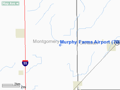
Location
& QuickFacts
|
FAA
Information Effective: |
2007-12-20 |
|
Airport
Identifier: |
70IL |
|
Airport
Status: |
Operational |
|
Longitude/Latitude: |
089-34-06.0000W/39-25-25.0000N
-89.568333/39.423611 (Estimated) |
|
Elevation: |
645 ft / 196.60 m (Estimated) |
|
Land: |
0 acres |
|
From nearest
city: |
5 nautical miles E of Farmersville, IL |
|
Location: |
Montgomery County, IL |
|
Magnetic
Variation: |
00E (1995) |
Owner & Manager
|
Ownership: |
Privately
owned |
|
Owner: |
Donald Murphy |
|
Address: |
7051 Morrisonville Ave
Harvel,
IL 62538-4041 |
|
Phone
number: |
217-229-3566 |
|
Manager: |
Donald Murphy |
|
Address: |
7051 Morrisonville Ave
Harvel,
IL 62538-4041 |
|
Phone
number: |
217-229-3566 |
Airport
Operations and Facilities
|
Airport
Use: |
Private
ULTRALIGHT/STOL USE. |
|
Wind indicator: |
Yes |
|
Segmented
Circle: |
No |
|
Control
Tower: |
No |
|
Sectional
chart: |
St Louis |
|
Region: |
AGL - Great Lakes |
|
Boundary
ARTCC: |
ZKC - Kansas City |
|
Tie-in
FSS: |
STL - Saint Louis |
|
FSS on
Airport: |
No |
|
FSS Toll
Free: |
1-800-WX-BRIEF |
|
Runway Information
Runway 17/35
|
Dimension: |
1205 x 70 ft
/ 367.3 x 21.3 m
295 FT STWY SOUTH END. |
|
Surface: |
TURF, |
|
|
Runway 17 |
Runway 35 |
|
Traffic
Pattern: |
Left |
Left |
|
Obstruction: |
|
25 ft pline, 295.0 ft from runway |
|
Radio Navigation
Aids
|
ID |
Type |
Name |
Ch |
Freq |
Var |
Dist |
|
TAZ |
NDB |
Taylorville |
|
395.00 |
00E |
13.2 nm |
|
LTD |
NDB |
Litchfield |
|
371.00 |
01E |
16.3 nm |
|
SP |
NDB |
Huskk |
|
382.00 |
01W |
22.8 nm |
|
LQ |
NDB |
Licol |
|
375.00 |
01W |
29.4 nm |
|
SYZ |
NDB |
Shelbyville |
|
365.00 |
01E |
33.7 nm |
|
CVM |
NDB |
Civic Memorial |
|
263.00 |
02E |
39.2 nm |
|
AAA |
NDB |
Abraham |
|
329.00 |
00E |
45.5 nm |
|
IJX |
VOR/DME |
Jacksonville |
023X |
108.60 |
02E |
37.6 nm |
|
SPI |
VORTAC |
Spinner |
74X |
112.70 |
01W |
25.5 nm |
|
VLA |
VORTAC |
Vandalia |
090X |
114.30 |
04E |
27.4 nm |
|
CAP |
VORTAC |
Capital |
074X |
112.70 |
04E |
28.3 nm |
|
DEC |
VORTAC |
Decatur |
119X |
117.20 |
03E |
38.0 nm |
|
TOY |
VORTAC |
Troy |
107X |
116.00 |
04E |
44.3 nm |
Remarks
- OBSTNS
REMOVED/LOWERED TO ACHIEVE 20:1 APCH; 125 FT EITHER SIDE OF RY &
200 FT OFF RY END CLEARED OF OBSTNS; 60 FT EITHER SIDE OF RY & 240
FT OFF RY END CLEARED & GRADED.
Based Aircraft
|
Aircraft
based on field: |
1 |
|
Single Engine
Airplanes: |
1 |
Murphy Farms Airport
Address:
Montgomery County, IL
Tel:
217-229-3566
Images
and information placed above are from
http://www.airport-data.com/airport/70IL/
We
thank them for the data!
| General
Info |
| Country |
United
States |
| State |
ILLINOIS
|
| FAA ID |
70IL |
| Latitude |
39-25-25.000N
|
| Longitude |
089-34-06.000W
|
| Elevation |
645 feet
|
| Near City |
FARMERSVILLE
|
We don't guarantee the information is fresh and accurate. The data may
be wrong or outdated.
For more up-to-date information please refer to other sources.
|
|


