|
|
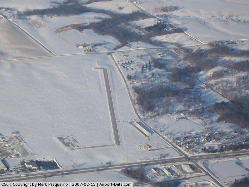
Monmouth Municipal Airport |
|
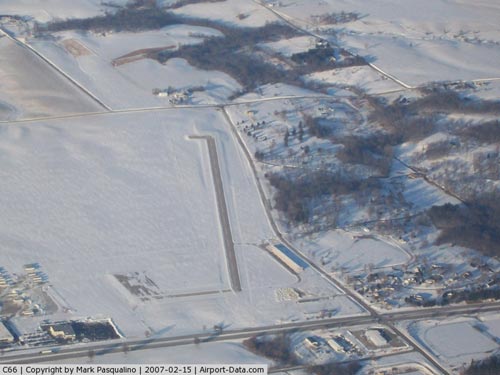 |
(Click on the photo to enlarge) |
Location
& QuickFacts
|
FAA
Information Effective: |
2007-12-20 |
|
Airport
Identifier: |
C66 |
|
Airport
Status: |
Operational |
|
Longitude/Latitude: |
090-37-51.9860W/40-55-46.9360N
-90.631107/40.929704 (Estimated) |
|
Elevation: |
753 ft / 229.51 m (Surveyed) |
|
Land: |
105 acres |
|
From nearest
city: |
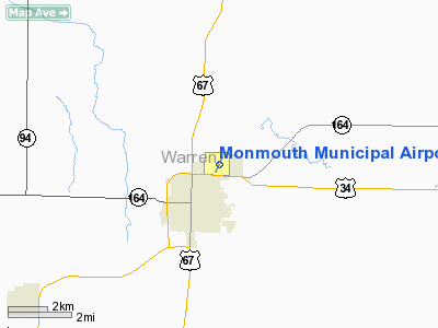
2 nautical miles N of Monmouth, IL |
|
Location: |
Warren County, IL |
|
Magnetic
Variation: |
03E (1980) |
Owner & Manager
|
Ownership: |
Publicly
owned |
|
Owner: |
City Of Monmouth |
|
Address: |
100 E. Broadway
Monmouth, IL 61462-1764 |
|
Phone
number: |
309-734-2141 |
|
Manager: |
Janet Themanson |
|
Address: |
100 E. Broadway
Monmouth, IL 61462-1764 |
|
Phone
number: |
309-734-3411 |
Airport
Operations and Facilities
|
Airport
Use: |
Open
to public |
|
Wind indicator: |
Yes |
|
Segmented
Circle: |
Yes |
|
Control
Tower: |
No |
|
Lighting
Schedule: |
DUSK-DAWN
MIRL RY 02/20 PRESET LOW INTST; TO INCR INTST & ACTVT
VASI RYS 02 & 20 - CTAF. |
|
Beacon
Color: |
Clear-Green (lighted land airport) |
|
Landing
fee charge: |
No |
|
Sectional
chart: |
Chicago |
|
Region: |
AGL - Great Lakes |
|
Traffic
Pattern Alt: |
800 ft |
|
Boundary
ARTCC: |
ZAU - Chicago |
|
Tie-in
FSS: |
IKK - Kankakee |
|
FSS on
Airport: |
No |
|
FSS Toll
Free: |
1-800-WX-BRIEF |
|
NOTAMs
Facility: |
IKK (NOTAM-d service avaliable) |
|
Federal
Agreements: |
NGY |
Airport Communications
|
CTAF: |
122.800 |
|
Unicom: |
122.800
|
Airport
Services
|
Fuel
available: |
100LLMOGAS
FOR FUEL AFTER HRS CALL 309-734-5091. |
|
Airframe
Repair: |
NONE |
|
Power
Plant Repair: |
NONE |
|
Bottled
Oxygen: |
NONE |
|
Bulk Oxygen: |
NONE |
|
Runway Information
Runway 02/20
|
Dimension: |
2899 x 60 ft
/ 883.6 x 18.3 m |
|
Surface: |
ASPH, Good Condition
PAVEMENT POOR ON EAST RAMP & TWY. |
|
Weight Limit: |
Single wheel: 10000 lbs. |
|
Edge Lights: |
Medium |
|
|
Runway 02 |
Runway 20 |
|
Longitude: |
090-37-59.4910W |
090-37-44.4950W |
|
Latitude: |
40-55-33.8350N |
40-56-00.1240N |
|
Elevation: |
753.00 ft |
748.00 ft |
|
Alignment: |
23 |
127 |
|
Traffic
Pattern: |
Left |
Left |
|
Markings: |
Basic, Fair Condition |
Basic, Fair Condition |
|
Crossing
Height: |
40.00 ft |
25.00 ft |
|
VASI: |
2-box on left side
VASI RYS 02 & 20 OTS INDEFLY. |
2-box on left side |
|
Visual Glide
Angle: |
3.00° |
3.00° |
|
Runway End
Identifier: |
No |
No |
|
Centerline
Lights: |
No |
No |
|
Touchdown
Lights: |
No |
No |
|
Obstruction: |
38 ft tree, 677.0 ft from runway, 109 ft right
of centerline, 12:1 slope to clear |
23 ft tree, 770.0 ft from runway, 133 ft right
of centerline, 24:1 slope to clear |
|
Radio Navigation
Aids
|
ID |
Type |
Name |
Ch |
Freq |
Var |
Dist |
|
JZY |
NDB |
Macomb |
|
251.00 |
01E |
24.9 nm |
|
CTK |
NDB |
Canton |
|
236.00 |
02E |
33.4 nm |
|
EZI |
NDB |
Kewanee |
|
245.00 |
01E |
34.5 nm |
|
MPZ |
NDB |
Mount Pleasant |
|
212.00 |
02E |
39.9 nm |
|
EOK |
NDB |
Keokuk |
|
366.00 |
02E |
46.0 nm |
|
GBG |
VOR/DME |
Galesburg |
035X |
109.80 |
03E |
8.9 nm |
|
DDD |
VOR/DME |
Port City |
112X |
116.50 |
01E |
35.2 nm |
|
BRL |
VORTAC |
Burlington |
051X |
111.40 |
05E |
18.3 nm |
|
MZV |
VORTAC |
Moline |
091X |
114.40 |
05E |
23.5 nm |
|
PIA |
VORTAC |
Peoria |
099X |
115.20 |
04E |
41.0 nm |
|
CVA |
VORTAC |
Davenport |
085X |
113.80 |
04E |
47.3 nm |
|
BDF |
VORTAC |
Bradford |
094X |
114.70 |
00E |
49.3 nm |
|
DVN |
VOT |
Davenport Municipal |
|
111.80 |
|
41.0 nm |
Based Aircraft
|
Aircraft
based on field: |
5 |
|
Single Engine
Airplanes: |
4 |
|
Ultralights: |
1 |
Operational Statistics
Time
Period: 2005-01-01 - 2005-12-31
|
Aircraft
Operations: |
97/Week |
|
Air Taxi: |
4.0% |
|
General Aviation
Local: |
60.0% |
|
General Aviation
Itinerant: |
36.0% |
Monmouth Municipal Airport
Address:
Warren County, IL
Tel:
309-734-2141,
309-734-3411
Images
and information placed above are from
http://www.airport-data.com/airport/C66/
We
thank them for the data!
| General
Info |
| Country |
United
States |
| State |
ILLINOIS
|
| FAA ID |
C66 |
| Latitude |
40-55-46.936N
|
| Longitude |
090-37-51.986W
|
| Elevation |
753 feet
|
| Near City |
MONMOUTH
|
We don't guarantee the information is fresh and accurate. The data may
be wrong or outdated.
For more up-to-date information please refer to other sources.
|
|