 |
|
Methodist Medical Center Of Illinois Heliport |
|
|
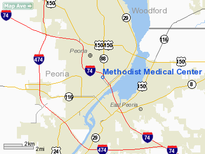
Location
& QuickFacts
|
FAA
Information Effective: |
2007-12-20 |
|
Airport
Identifier: |
IL04 |
|
Airport
Status: |
Operational |
|
Longitude/Latitude: |
089-35-41.3510W/40-42-02.1350N
-89.594820/40.700593 (Estimated) |
|
Elevation: |
631 ft / 192.33 m (Estimated) |
|
Land: |
0 acres |
|
From nearest
city: |
0 nautical miles N of Peoria, IL |
|
Location: |
Peoria County, IL |
|
Magnetic
Variation: |
01E (1985) |
Owner
& Manager
|
Ownership: |
Privately
owned |
|
Owner: |
The Methodist Med Cent Of Ill |
|
Address: |
221 Northeast Elen Oak Ave
Peoria,
IL 61636 |
|
Phone
number: |
309-672-5522 |
|
Manager: |
R.g. Kauffman |
|
Address: |
221 Northeast Glen Oak Ave
Peoria,
IL 61636 |
|
Phone
number: |
309-672-4932 |
Airport Operations
and Facilities
|
Airport
Use: |
Private
MEDICAL USE. |
|
Wind indicator: |
Yes |
|
Segmented
Circle: |
No |
|
Control
Tower: |
No |
|
Lighting
Schedule: |
24 HRS |
|
Beacon
Color: |
Clear-Green-Yellow (heliport) |
|
Sectional
chart: |
Chicago |
|
Region: |
AGL - Great Lakes |
|
Boundary
ARTCC: |
ZAU - Chicago |
|
Tie-in
FSS: |
IKK - Kankakee |
|
FSS Toll
Free: |
1-800-WX-BRIEF |
|
Runway Information
Helipad H1
|
Dimension: |
30 x 30 ft /
9.1 x 9.1 m |
|
Surface: |
CONC, |
|
|
Runway H1 |
Runway |
|
Traffic
Pattern: |
Left |
Left |
|
Radio Navigation
Aids
|
ID |
Type |
Name |
Ch |
Freq |
Var |
Dist |
|
PI |
NDB |
Tungg |
|
356.00 |
01E |
5.7 nm |
|
CTK |
NDB |
Canton |
|
236.00 |
02E |
23.4 nm |
|
EZI |
NDB |
Kewanee |
|
245.00 |
01E |
34.3 nm |
|
AAA |
NDB |
Abraham |
|
329.00 |
00E |
34.5 nm |
|
VYS |
NDB |
Valley |
|
230.00 |
00W |
44.2 nm |
|
JZY |
NDB |
Macomb |
|
251.00 |
01E |
45.4 nm |
|
LQ |
NDB |
Licol |
|
375.00 |
01W |
47.4 nm |
|
BMI |
VOR/DME |
Bloomington |
019X |
108.20 |
03E |
33.0 nm |
|
PNT |
VOR/DME |
Pontiac |
033X |
109.60 |
03E |
39.9 nm |
|
GBG |
VOR/DME |
Galesburg |
035X |
109.80 |
03E |
40.8 nm |
|
PIA |
VORTAC |
Peoria |
099X |
115.20 |
04E |
9.1 nm |
|
BDF |
VORTAC |
Bradford |
094X |
114.70 |
00E |
27.6 nm |
|
CAP |
VORTAC |
Capital |
074X |
112.70 |
04E |
48.6 nm |
Remarks
- PROVIDED
ALL APP/DEP FM 060 TO 090 DEGREES, AND FM 180 TO 220 DEGREES; &
FM 240 TO 270 DEGREES; AREA IS MARKED; WIND INDICATOR IS MAINTAINED.
Methodist Medical Center Of Illinois Heliport
Address:
Peoria County, IL
Tel:
309-672-5522,
309-672-4932
Images
and information placed above are from
http://www.airport-data.com/airport/IL04/
We
thank them for the data!
| General
Info |
| Country |
United
States |
| State |
ILLINOIS
|
| FAA ID |
IL04 |
| Latitude |
40-42-02.135N
|
| Longitude |
089-35-41.351W
|
| Elevation |
631 feet
|
| Near City |
PEORIA
|
We don't guarantee the information is fresh and accurate. The data may
be wrong or outdated.
For more up-to-date information please refer to other sources.
|
|


