 |
|
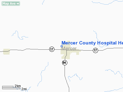
Mercer County Hospital Heliport |
Location
& QuickFacts
|
FAA
Information Effective: |
2007-12-20 |
|
Airport
Identifier: |
12IS |
|
Airport
Status: |
Operational |
|
Longitude/Latitude: |
090-45-35.5030W/41-12-21.1230N
-90.759862/41.205867 (Estimated) |
|
Elevation: |
729 ft / 222.20 m (Estimated) |
|
Land: |
0 acres |
|
From nearest
city: |
1 nautical miles N of Aledo, IL |
|
Location: |
Mercer County, IL |
|
Magnetic
Variation: |
02E (1980) |
Owner
& Manager
|
Ownership: |
Publicly
owned |
|
Owner: |
Mercer County Hospital |
|
Address: |
409 Nw 9th Ave
Aledo,
IL 61231 |
|
Phone
number: |
309-582-5301 |
|
Manager: |
Bruce D. Peterson |
|
Address: |
409 Nw 9th Ave
Aledo,
IL 61231 |
|
Phone
number: |
309-582-5301
EXT 159. |
Airport Operations
and Facilities
|
Airport
Use: |
Private
MEDICAL USE. |
|
Wind indicator: |
Yes |
|
Segmented
Circle: |
No |
|
Control
Tower: |
No |
|
Lighting
Schedule: |
DUSK-DAWN |
|
Beacon
Color: |
Clear-Green-Yellow (heliport) |
|
Sectional
chart: |
Chicago |
|
Region: |
AGL - Great Lakes |
|
Boundary
ARTCC: |
ZAU - Chicago |
|
Tie-in
FSS: |
IKK - Kankakee |
|
FSS Toll
Free: |
1-800-WX-BRIEF |
|
Runway Information
Helipad H1
|
Dimension: |
50 x 50 ft /
15.2 x 15.2 m |
|
Surface: |
CONC, |
|
|
Runway H1 |
Runway |
|
Traffic
Pattern: |
Left |
Left |
|
Radio Navigation
Aids
|
ID |
Type |
Name |
Ch |
Freq |
Var |
Dist |
|
EZI |
NDB |
Kewanee |
|
245.00 |
01E |
36.2 nm |
|
MPZ |
NDB |
Mount Pleasant |
|
212.00 |
02E |
37.5 nm |
|
AWG |
NDB |
Washington |
|
219.00 |
02E |
41.5 nm |
|
CWI |
NDB |
Clinton |
|
377.00 |
01E |
42.2 nm |
|
JZY |
NDB |
Macomb |
|
251.00 |
01E |
42.3 nm |
|
CTK |
NDB |
Canton |
|
236.00 |
02E |
49.4 nm |
|
DDD |
VOR/DME |
Port City |
112X |
116.50 |
01E |
20.1 nm |
|
GBG |
VOR/DME |
Galesburg |
035X |
109.80 |
03E |
21.9 nm |
|
MZV |
VORTAC |
Moline |
091X |
114.40 |
05E |
8.8 nm |
|
BRL |
VORTAC |
Burlington |
051X |
111.40 |
05E |
30.0 nm |
|
CVA |
VORTAC |
Davenport |
085X |
113.80 |
04E |
32.7 nm |
|
IOW |
VORTAC |
Iowa City |
109X |
116.20 |
05E |
42.9 nm |
|
DVN |
VOT |
Davenport Municipal |
|
111.80 |
|
25.6 nm |
Remarks
- OPNS
CONDUCTED FM 080 DEG TO 110 DEG & FM 200 DEG TO 260 DEG; AREA MKD;
WIND INDICATOR MNTD; NO NGT OPNS UNLESS AREA IS LGTD.
Mercer County Hospital Heliport
Address:
Mercer County, IL
Tel:
309-582-5301
Images
and information placed above are from
http://www.airport-data.com/airport/12IS/
We
thank them for the data!
| General
Info |
| Country |
United
States |
| State |
ILLINOIS
|
| FAA ID |
12IS |
| Latitude |
41-12-21.123N
|
| Longitude |
090-45-35.503W
|
| Elevation |
729 feet
|
| Near City |
ALEDO
|
We don't guarantee the information is fresh and accurate. The data may
be wrong or outdated.
For more up-to-date information please refer to other sources.
|
|


