 |
|
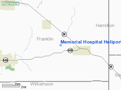
Memorial Hospital Randolph Heliport |
|
|
Location
& QuickFacts
|
FAA
Information Effective: |
2007-12-20 |
|
Airport
Identifier: |
4IS2 |
|
Airport
Status: |
Operational |
|
Longitude/Latitude: |
088-48-22.2280W/37-55-25.1760N
-88.806174/37.923660 (Estimated) |
|
Elevation: |
620 ft / 188.98 m (Estimated) |
|
Land: |
0 acres |
|
From nearest
city: |
0 nautical miles N of Chester, IL |
|
Location: |
Randolph County, IL |
|
Magnetic
Variation: |
01E (1984) |
Owner & Manager
|
Ownership: |
Publicly
owned |
|
Owner: |
Memorial Hospital |
|
Address: |
1900 State Street
Chester,
IL 62233 |
|
Phone
number: |
618-826-4581 |
|
Manager: |
Eric Freeburg |
|
Address: |
1900 State Street
Chester,
IL 62233 |
|
Phone
number: |
618-826-4581 |
Airport
Operations and Facilities
|
Airport
Use: |
Private
MEDICAL USE. |
|
Wind indicator: |
Yes |
|
Segmented
Circle: |
No |
|
Control
Tower: |
No |
|
Lighting
Schedule: |
PHONE REQ
FOR HELIPAD PERIMETER LIGHTS CALL 618-826-4581. |
|
Landing
fee charge: |
No |
|
Sectional
chart: |
St Louis |
|
Region: |
AGL - Great Lakes |
|
Boundary
ARTCC: |
ZKC - Kansas City |
|
Tie-in
FSS: |
COU - Columbia |
|
FSS on
Airport: |
No |
|
FSS Toll
Free: |
1-800-WX-BRIEF |
|
Runway Information
Helipad H1
|
Dimension: |
41 x 41 ft /
12.5 x 12.5 m |
|
Surface: |
CONC, |
|
|
Runway H1 |
Runway |
|
Traffic
Pattern: |
Left |
Left |
|
Radio Navigation
Aids
|
ID |
Type |
Name |
Ch |
Freq |
Var |
Dist |
|
HSB |
NDB |
Harrisburg-raleigh |
|
230.00 |
00E |
14.1 nm |
|
PJY |
NDB |
Pinckneyville |
|
215.00 |
00E |
26.6 nm |
|
FWC |
NDB |
Wayne County |
|
257.00 |
01E |
33.2 nm |
|
CUL |
NDB |
Carmi |
|
332.00 |
01W |
34.1 nm |
|
SLO |
NDB |
Salem |
|
400.00 |
01W |
44.0 nm |
|
SAR |
NDB |
Sparta |
|
239.00 |
01E |
44.5 nm |
|
BDD |
NDB |
Bellgrade |
|
254.00 |
00E |
47.2 nm |
|
FOA |
NDB |
Elm River |
|
353.00 |
00E |
47.8 nm |
|
TWT |
NDB |
Tradewater |
|
276.00 |
00E |
49.2 nm |
|
GVA |
NDB |
Geneva |
|
224.00 |
01W |
49.7 nm |
|
MWA |
VOR/DME |
Marion |
041X |
110.40 |
04E |
14.1 nm |
|
VNN |
VOR/DME |
Mount Vernon |
085X |
113.80 |
02E |
26.3 nm |
|
SAM |
VOR/DME |
Samsville |
113X |
116.60 |
03E |
47.9 nm |
|
ENL |
VORTAC |
Centralia |
097X |
115.00 |
04E |
34.2 nm |
|
PXV |
VORTAC |
Pocket City |
080X |
113.30 |
03E |
49.5 nm |
Remarks
- PROVIDED
INGRESS/EGRESS ROUTES ARE ESTABLISHED TO THE NORTHEAST & SOUTH ONLY.
Memorial Hospital Randolph Heliport
Address:
Randolph County, IL
Tel:
618-826-4581
Images
and information placed above are from
http://www.airport-data.com/airport/4IS2/
We
thank them for the data!
| General
Info |
| Country |
United
States |
| State |
ILLINOIS
|
| FAA ID |
4IS2 |
| Latitude |
37-55-25.176N
|
| Longitude |
088-48-22.228W
|
| Elevation |
620 feet
|
| Near City |
CHESTER
|
We don't guarantee the information is fresh and accurate. The data may
be wrong or outdated.
For more up-to-date information please refer to other sources.
|
|


