 |
|
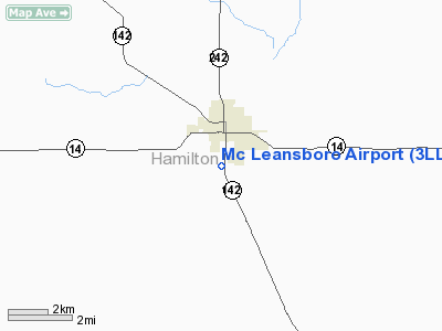
Location
& QuickFacts
|
FAA
Information Effective: |
2007-12-20 |
|
Airport
Identifier: |
3LL8 |
|
Airport
Status: |
Operational |
|
Longitude/Latitude: |
088-32-15.1870W/38-04-27.1720N
-88.537552/38.074214 (Estimated) |
|
Elevation: |
415 ft / 126.49 m (Surveyed) |
|
Land: |
41 acres |
|
From nearest
city: |
2 nautical miles S of Mc Leansboro, IL |
|
Location: |
Hamilton County, IL |
|
Magnetic
Variation: |
01E (1985) |
Owner
& Manager
|
Ownership: |
Publicly
owned |
|
Owner: |
City Of Mc Leansboro |
|
Address: |
Mc Leansboro, IL 62859 |
|
Phone
number: |
618-643-2723 |
|
Manager: |
Dick Dietz, Mayor |
|
Address: |
City Of Mc Leansboro
Mc Leansboro, IL 62859 |
|
Phone
number: |
618-643-2723 |
Airport Operations
and Facilities
|
Airport
Use: |
Private |
|
Wind indicator: |
No |
|
Segmented
Circle: |
No |
|
Control
Tower: |
No |
|
Landing
fee charge: |
No |
|
Sectional
chart: |
St Louis |
|
Region: |
AGL - Great Lakes |
|
Boundary
ARTCC: |
ZKC - Kansas City |
|
Tie-in
FSS: |
STL - Saint Louis |
|
FSS on
Airport: |
No |
|
FSS Toll
Free: |
1-800-WX-BRIEF |
|
Runway Information
Runway 18/36
|
Dimension: |
1800 x 60 ft
/ 548.6 x 18.3 m |
|
Surface: |
ASPH, Poor Condition |
|
|
Runway 18 |
Runway 36 |
|
Traffic
Pattern: |
Left |
Left |
|
Runway End
Identifier: |
No |
No |
|
Touchdown
Lights: |
No |
No |
|
Obstruction: |
45 ft trees, 201.0 ft from runway, 100 ft right
of centerline |
45 ft trees, 201.0 ft from runway, 80 ft left
of centerline |
|
Radio Navigation
Aids
|
ID |
Type |
Name |
Ch |
Freq |
Var |
Dist |
|
HSB |
NDB |
Harrisburg-raleigh |
|
230.00 |
00E |
15.8 nm |
|
FWC |
NDB |
Wayne County |
|
257.00 |
01E |
19.3 nm |
|
CUL |
NDB |
Carmi |
|
332.00 |
01W |
19.8 nm |
|
FOA |
NDB |
Elm River |
|
353.00 |
00E |
36.0 nm |
|
PJY |
NDB |
Pinckneyville |
|
215.00 |
00E |
39.5 nm |
|
SLO |
NDB |
Salem |
|
400.00 |
01W |
39.8 nm |
|
GVA |
NDB |
Geneva |
|
224.00 |
01W |
39.8 nm |
|
OLY |
NDB |
Olney |
|
272.00 |
00W |
42.3 nm |
|
TWT |
NDB |
Tradewater |
|
276.00 |
00E |
46.1 nm |
|
PDW |
NDB |
Evansville |
|
284.00 |
00E |
47.7 nm |
|
VNN |
VOR/DME |
Mount Vernon |
085X |
113.80 |
02E |
21.5 nm |
|
MWA |
VOR/DME |
Marion |
041X |
110.40 |
04E |
29.6 nm |
|
SAM |
VOR/DME |
Samsville |
113X |
116.60 |
03E |
32.6 nm |
|
ENL |
VORTAC |
Centralia |
097X |
115.00 |
04E |
36.0 nm |
|
PXV |
VORTAC |
Pocket City |
080X |
113.30 |
03E |
37.7 nm |
Remarks
Based Aircraft
|
Aircraft
based on field: |
2 |
|
Single Engine
Airplanes: |
2 |
Operational Statistics
Time
Period: 1989-08-28 - 1990-08-27
|
Aircraft
Operations: |
20/Week |
|
General Aviation
Itinerant: |
100.0% |
Mc Leansboro Airport
Address:
Hamilton County, IL
Tel:
618-643-2723
Images
and information placed above are from
http://www.airport-data.com/airport/3LL8/
We
thank them for the data!
| General
Info |
| Country |
United
States |
| State |
ILLINOIS
|
| FAA ID |
3LL8 |
| Latitude |
38-04-27.172N
|
| Longitude |
088-32-15.187W
|
| Elevation |
415 feet
|
| Near City |
MC LEANSBORO
|
We don't guarantee the information is fresh and accurate. The data may
be wrong or outdated.
For more up-to-date information please refer to other sources.
|
|


