 |
|
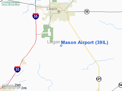
Location
& QuickFacts
|
FAA
Information Effective: |
2007-12-20 |
|
Airport
Identifier: |
39IL |
|
Airport
Status: |
Operational |
|
Longitude/Latitude: |
089-21-46.3450W/40-05-38.1590N
-89.362874/40.093933 (Estimated) |
|
Elevation: |
591 ft / 180.14 m (Surveyed) |
|
Land: |
0 acres |
|
From nearest
city: |
3 nautical miles S of Lincoln, IL |
|
Location: |
Logan County, IL |
|
Magnetic
Variation: |
01E (1985) |
Owner & Manager
|
Ownership: |
Privately
owned |
|
Owner: |
William H. Mason |
|
Address: |
Rr 3
Lincoln, IL 62656 |
|
Phone
number: |
217-732-4044 |
|
Manager: |
William H. Mason |
|
Address: |
Rr 3
Lincoln, IL 62656 |
|
Phone
number: |
217-732-4044 |
Airport Operations
and Facilities
|
Airport Use: |
Private |
|
Wind
indicator: |
Yes |
|
Segmented
Circle: |
No |
|
Control
Tower: |
No |
|
Landing
fee charge: |
No |
|
Sectional
chart: |
Chicago |
|
Region: |
AGL - Great Lakes |
|
Boundary
ARTCC: |
ZAU - Chicago |
|
Tie-in
FSS: |
STL - Saint Louis |
|
FSS on
Airport: |
No |
|
FSS Toll
Free: |
1-800-WX-BRIEF |
Airport Services
|
Airframe
Repair: |
NONE |
|
Power
Plant Repair: |
NONE |
|
Runway Information
Runway 18/36
|
Dimension: |
1500 x 100 ft
/ 457.2 x 30.5 m |
|
Surface: |
TURF, |
|
|
Runway 18 |
Runway 36 |
|
Traffic
Pattern: |
Left |
Left |
|
Radio Navigation
Aids
|
ID |
Type |
Name |
Ch |
Freq |
Var |
Dist |
|
AAA |
NDB |
Abraham |
|
329.00 |
00E |
4.1 nm |
|
LQ |
NDB |
Licol |
|
375.00 |
01W |
15.6 nm |
|
SP |
NDB |
Huskk |
|
382.00 |
01W |
26.6 nm |
|
PI |
NDB |
Tungg |
|
356.00 |
01E |
32.5 nm |
|
TAZ |
NDB |
Taylorville |
|
395.00 |
00E |
33.6 nm |
|
CTK |
NDB |
Canton |
|
236.00 |
02E |
43.3 nm |
|
SYZ |
NDB |
Shelbyville |
|
365.00 |
01E |
47.8 nm |
|
BMI |
VOR/DME |
Bloomington |
019X |
108.20 |
03E |
30.5 nm |
|
IJX |
VOR/DME |
Jacksonville |
023X |
108.60 |
02E |
44.7 nm |
|
CAP |
VORTAC |
Capital |
074X |
112.70 |
04E |
17.1 nm |
|
SPI |
VORTAC |
Spinner |
74X |
112.70 |
01W |
21.1 nm |
|
DEC |
VORTAC |
Decatur |
119X |
117.20 |
03E |
31.7 nm |
|
PIA |
VORTAC |
Peoria |
099X |
115.20 |
04E |
40.4 nm |
Remarks
Mason Airport
Address:
Logan County, IL
Tel:
217-732-4044
Images
and information placed above are from
http://www.airport-data.com/airport/39IL/
We
thank them for the data!
| General
Info |
| Country |
United
States |
| State |
ILLINOIS
|
| FAA ID |
39IL |
| Latitude |
40-05-38.159N
|
| Longitude |
089-21-46.345W
|
| Elevation |
591 feet
|
| Near City |
LINCOLN
|
We don't guarantee the information is fresh and accurate. The data may
be wrong or outdated.
For more up-to-date information please refer to other sources.
|
|


