 |
|
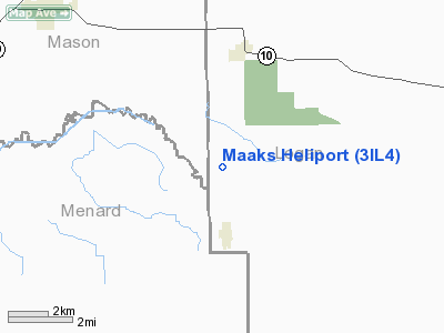
Location
& QuickFacts
|
FAA
Information Effective: |
2007-12-20 |
|
Airport
Identifier: |
3IL4 |
|
Airport
Status: |
Operational |
|
Longitude/Latitude: |
089-35-35.5000W/40-07-53.0400N
-89.593194/40.131400 (Estimated) |
|
Elevation: |
527 ft / 160.63 m () |
|
Land: |
0 acres |
|
From nearest
city: |
4 nautical miles N of Middletown, IL |
|
Location: |
Logan County, IL |
|
Magnetic
Variation: |
00W (1995) |
Owner
& Manager
|
Ownership: |
Privately
owned |
|
Owner: |
Michael Maaks |
|
Address: |
1469 50th Ave
New Holland, IL 62671 |
|
Phone
number: |
217-445-2478 |
|
Manager: |
Michael Maaks |
|
Address: |
1469 50th Ave
New Holland, IL 62671 |
|
Phone
number: |
217-445-2478 |
Airport Operations
and Facilities
|
Airport
Use: |
Private |
|
Wind indicator: |
No |
|
Segmented
Circle: |
No |
|
Control
Tower: |
No |
|
Sectional
chart: |
Chicago |
|
Region: |
AGL - Great Lakes |
|
Boundary
ARTCC: |
ZAU - Chicago |
|
Tie-in
FSS: |
STL - Saint Louis |
|
FSS Toll
Free: |
1-800-WX-BRIEF |
|
Runway Information
Helipad H1
|
Dimension: |
100 x 100 ft
/ 30.5 x 30.5 m |
|
Surface: |
TURF, |
|
|
Runway H1 |
Runway |
|
Traffic
Pattern: |
Left |
Left |
|
Radio Navigation
Aids
|
ID |
Type |
Name |
Ch |
Freq |
Var |
Dist |
|
AAA |
NDB |
Abraham |
|
329.00 |
00E |
11.9 nm |
|
LQ |
NDB |
Licol |
|
375.00 |
01W |
13.2 nm |
|
SP |
NDB |
Huskk |
|
382.00 |
01W |
22.9 nm |
|
PI |
NDB |
Tungg |
|
356.00 |
01E |
28.5 nm |
|
CTK |
NDB |
Canton |
|
236.00 |
02E |
34.3 nm |
|
TAZ |
NDB |
Taylorville |
|
395.00 |
00E |
37.9 nm |
|
IJX |
VOR/DME |
Jacksonville |
023X |
108.60 |
02E |
36.6 nm |
|
BMI |
VOR/DME |
Bloomington |
019X |
108.20 |
03E |
36.9 nm |
|
CAP |
VORTAC |
Capital |
074X |
112.70 |
04E |
14.5 nm |
|
SPI |
VORTAC |
Spinner |
74X |
112.70 |
01W |
18.0 nm |
|
PIA |
VORTAC |
Peoria |
099X |
115.20 |
04E |
34.2 nm |
|
DEC |
VORTAC |
Decatur |
119X |
117.20 |
03E |
41.4 nm |
Remarks
- PRVDD
ALL DEP/APCH FM 160-360, AREA IS MKD, WIND INDICATOR MAINTAINED &
COMPLY WITH FAR 14 CFR 91.123(B)(2).
Based
Aircraft
|
Aircraft
based on field: |
1 |
|
Helicopters: |
1 |
Maaks Heliport
Address:
Logan County, IL
Tel:
217-445-2478
Images
and information placed above are from
http://www.airport-data.com/airport/3IL4/
We
thank them for the data!
| General
Info |
| Country |
United
States |
| State |
ILLINOIS
|
| FAA ID |
3IL4 |
| Latitude |
40-07-53.040N
|
| Longitude |
089-35-35.500W
|
| Elevation |
527 feet
|
| Near City |
MIDDLETOWN
|
We don't guarantee the information is fresh and accurate. The data may
be wrong or outdated.
For more up-to-date information please refer to other sources.
|
|


