 |
|
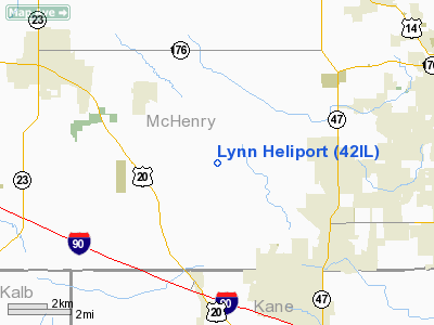
Location
& QuickFacts
|
FAA
Information Effective: |
2007-12-20 |
|
Airport
Identifier: |
42IL |
|
Airport
Status: |
Operational |
|
Longitude/Latitude: |
088-29-51.0000W/42-12-12.0000N
-88.497500/42.203333 (Estimated) |
|
Elevation: |
870 ft / 265.18 m (Estimated) |
|
Land: |
0 acres |
|
From nearest
city: |
3 nautical miles SE of Union, IL |
|
Location: |
Mc Henry County, IL |
|
Magnetic
Variation: |
() |
Owner
& Manager
|
Ownership: |
Privately
owned |
|
Owner: |
Timothy Lynn |
|
Address: |
8619 Seeman Road
Union, IL 60180 |
|
Phone
number: |
847-833-3830 |
|
Manager: |
Timothy Lynn |
|
Address: |
8619 Seeman Road
Union, IL 60180 |
|
Phone
number: |
847-833-3830 |
Airport
Operations and Facilities
|
Airport
Use: |
Private |
|
Wind indicator: |
Yes |
|
Control
Tower: |
No |
|
Sectional
chart: |
Chicago |
|
Region: |
AGL - Great Lakes |
|
Boundary
ARTCC: |
ZAU - Chicago |
|
Tie-in
FSS: |
IKK - Kankakee |
|
FSS Toll
Free: |
1-800-WX-BRIEF |
|
Runway Information
Helipad H1
|
Dimension: |
100 x 100 ft
/ 30.5 x 30.5 m |
|
Surface: |
TURF, Good Condition |
|
|
Runway H1 |
Runway |
|
Traffic
Pattern: |
Left |
Left |
|
Radio Navigation
Aids
|
ID |
Type |
Name |
Ch |
Freq |
Var |
Dist |
|
DKB |
NDB |
Dekalb |
|
209.00 |
02W |
18.7 nm |
|
ME |
NDB |
Deana |
|
350.00 |
00E |
25.3 nm |
|
LVV |
NDB |
Lake Lawn |
|
404.00 |
00W |
30.1 nm |
|
JVL |
NDB |
Janesville |
|
375.00 |
03E |
34.6 nm |
|
RA |
NDB |
Paser |
|
206.00 |
00E |
39.2 nm |
|
HK |
NDB |
Ermin |
|
332.00 |
01W |
41.5 nm |
|
MX |
NDB |
Kedzi |
|
248.00 |
01W |
45.5 nm |
|
GM |
NDB |
Teels |
|
242.00 |
02W |
47.0 nm |
|
FEP |
NDB |
Freeport |
|
335.00 |
00E |
48.5 nm |
|
DPA |
VOR/DME |
Dupage |
021X |
108.40 |
02E |
19.9 nm |
|
OBK |
VOR/DME |
Northbrook |
077X |
113.00 |
02W |
24.3 nm |
|
ORD |
VOR/DME |
Chicago O'hare |
086X |
113.90 |
02E |
29.4 nm |
|
BUU |
VOR/DME |
Burbun |
092X |
114.50 |
01W |
30.5 nm |
|
RFD |
VOR/DME |
Rockford |
045X |
110.80 |
01E |
31.3 nm |
|
JVL |
VOR/DME |
Janesville |
090X |
114.30 |
03E |
34.4 nm |
|
ENW |
VOR/DME |
Kenosha |
029X |
109.20 |
02W |
34.6 nm |
|
HRK |
VOR/DME |
Horlick |
124X |
117.70 |
02W |
45.2 nm |
|
PLL |
VOR/DME |
Polo |
049X |
111.20 |
03E |
48.0 nm |
|
JOT |
VORTAC |
Joliet |
070X |
112.30 |
02E |
40.3 nm |
|
ORD |
VOT |
Chicago O'hare Intl |
|
112.00 |
|
29.5 nm |
|
MDW |
VOT |
Chicago Midway |
|
111.00 |
|
41.7 nm |
Remarks
- PRVDD
TFC STAYS BLO TPA OF (5LL7); APCH USING 050 & 160 DEG; DEP USING
230 & 340 DEG; AREA IS APPROPRIATELY MARKED; WIND INDICATOR IS MAINTAINED;
COMPLY WITH CFR 91.126 (B)(2).
Lynn Heliport
Address:
Mc Henry County, IL
Tel:
847-833-3830
Images
and information placed above are from
http://www.airport-data.com/airport/42IL/
We
thank them for the data!
We don't guarantee the information is fresh and accurate. The data may
be wrong or outdated.
For more up-to-date information please refer to other sources.
|
|


