 |
|
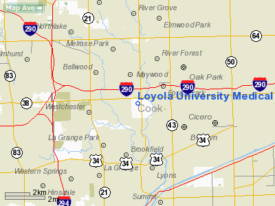
Loyola University Medical Center Heliport |
|
|
Location
& QuickFacts
|
FAA
Information Effective: |
2007-12-20 |
|
Airport
Identifier: |
0IL1 |
|
Airport
Status: |
Operational |
|
Longitude/Latitude: |
087-50-11.2130W/41-51-39.1130N
-87.836448/41.860865 (Estimated) |
|
Elevation: |
623 ft / 189.89 m (Estimated) |
|
Land: |
0 acres |
|
From nearest
city: |
0 nautical miles SE of Broadview, IL |
|
Location: |
Cook County, IL |
|
Magnetic
Variation: |
01W (1985) |
Owner
& Manager
|
Ownership: |
Privately
owned |
|
Owner: |
Loyola University Med Center |
|
Address: |
2160 S 1st Avenue
Maywood, IL 60153 |
|
Phone
number: |
708-216-5862 |
|
Manager: |
Loyola Lifestar |
|
Address: |
2160 S 1st Avenue
Maywood, IL 60153 |
|
Phone
number: |
708-216-5862 |
Airport Operations
and Facilities
|
Airport Use: |
Private
MEDICAL USE. |
|
Wind
indicator: |
Yes |
|
Segmented
Circle: |
No |
|
Control
Tower: |
No |
|
Lighting
Schedule: |
24 HRS |
|
Beacon
Color: |
Clear-Green-Yellow (heliport) |
|
Sectional
chart: |
Chicago |
|
Region: |
AGL - Great Lakes |
|
Boundary
ARTCC: |
ZAU - Chicago |
|
Tie-in
FSS: |
IKK - Kankakee |
|
FSS Toll
Free: |
1-800-WX-BRIEF |
Airport
Communications
|
Runway Information
Helipad H1
|
Dimension: |
90 x 90 ft /
27.4 x 27.4 m |
|
Surface: |
CONC, |
|
|
Runway H1 |
Runway |
|
Traffic
Pattern: |
Left |
Left |
|
Radio Navigation
Aids
|
ID |
Type |
Name |
Ch |
Freq |
Var |
Dist |
|
HK |
NDB |
Ermin |
|
332.00 |
01W |
8.5 nm |
|
MX |
NDB |
Kedzi |
|
248.00 |
01W |
9.7 nm |
|
ME |
NDB |
Deana |
|
350.00 |
00E |
10.7 nm |
|
DKB |
NDB |
Dekalb |
|
209.00 |
02W |
39.2 nm |
|
MGC |
NDB |
Michigan City |
|
203.00 |
01W |
46.6 nm |
|
RA |
NDB |
Paser |
|
206.00 |
00E |
49.5 nm |
|
VP |
NDB |
Sedly |
|
212.00 |
02W |
49.6 nm |
|
ORD |
VOR/DME |
Chicago O'hare |
086X |
113.90 |
02E |
8.2 nm |
|
OBK |
VOR/DME |
Northbrook |
077X |
113.00 |
02W |
22.3 nm |
|
DPA |
VOR/DME |
Dupage |
021X |
108.40 |
02E |
23.1 nm |
|
ENW |
VOR/DME |
Kenosha |
029X |
109.20 |
02W |
44.6 nm |
|
IKK |
VOR/DME |
Kankakee |
053X |
111.60 |
00E |
47.3 nm |
|
CGT |
VORTAC |
Chicago Heights |
089X |
114.20 |
02E |
24.2 nm |
|
JOT |
VORTAC |
Joliet |
070X |
112.30 |
02E |
28.7 nm |
|
EON |
VORTAC |
Peotone |
079X |
113.20 |
02E |
35.6 nm |
|
MDW |
VOT |
Chicago Midway |
|
111.00 |
|
5.9 nm |
|
ORD |
VOT |
Chicago O'hare Intl |
|
112.00 |
|
8.0 nm |
Remarks
- PROVIDED
APP/DEP OPERATIONS ARE FROM 260 TO 10 DEGS; AREA IS MARKED, WIND INDICATOR
IS MAINTAINED.
Based Aircraft
|
Aircraft
based on field: |
2 |
|
Multi Engine Airplanes: |
1 |
|
Helicopters: |
1 |
Loyola University Medical Center Heliport
Address:
Cook County, IL
Tel:
708-216-5862
Images
and information placed above are from
http://www.airport-data.com/airport/0IL1/
We
thank them for the data!
| General
Info |
| Country |
United
States |
| State |
ILLINOIS
|
| FAA ID |
0IL1 |
| Latitude |
41-51-39.113N
|
| Longitude |
087-50-11.213W
|
| Elevation |
623 feet
|
| Near City |
BROADVIEW
|
We don't guarantee the information is fresh and accurate. The data may
be wrong or outdated.
For more up-to-date information please refer to other sources.
|
|


