 |
|
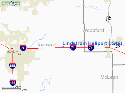
Location
& QuickFacts
|
FAA
Information Effective: |
2007-12-20 |
|
Airport
Identifier: |
IS42 |
|
Airport
Status: |
Operational |
|
Longitude/Latitude: |
089-22-23.3250W/40-37-26.1350N
-89.373146/40.623926 (Estimated) |
|
Elevation: |
705 ft / 214.88 m (Estimated) |
|
Land: |
0 acres |
|
From
nearest city: |
1 nautical miles W of Morton, IL |
|
Location: |
Tazewell County, IL |
|
Magnetic Variation: |
01E (1985) |
Owner
& Manager
|
Ownership: |
Privately
owned |
|
Owner: |
Kenneth Lindstrom |
|
Address: |
109 Pin Oak Dr
Morton, IL 61550 |
|
Phone number: |
309-263-2271 |
|
Manager: |
Kenneth Lindstrom |
|
Address: |
29 Jasper Dr.
Morton, IL 61550 |
|
Phone number: |
309-263-2271 |
Airport
Operations and Facilities
|
Airport
Use: |
Private |
|
Wind
indicator: |
Yes |
|
Segmented Circle: |
Yes |
|
Control
Tower: |
No |
|
Sectional chart: |
Chicago |
|
Region: |
AGL - Great Lakes |
|
Boundary
ARTCC: |
ZAU - Chicago |
|
Tie-in
FSS: |
IKK - Kankakee |
|
FSS
on Airport: |
No |
|
FSS
Toll Free: |
1-800-WX-BRIEF |
|
Runway Information
Helipad H1
|
Dimension: |
40 x 40 ft / 12.2 x 12.2 m
40' X 40' CONC TOUCHDOWN AREA WITHIN 150' X 150' TURF LNDG/TKOF
AREA. |
|
Surface: |
CONC, |
|
|
Runway H1 |
Runway |
|
Traffic
Pattern: |
Left |
Left |
|
Radio Navigation
Aids
|
ID |
Type |
Name |
Ch |
Freq |
Var |
Dist |
|
PI |
NDB |
Tungg |
|
356.00 |
01E |
10.1 nm |
|
AAA |
NDB |
Abraham |
|
329.00 |
00E |
27.9 nm |
|
CTK |
NDB |
Canton |
|
236.00 |
02E |
32.3 nm |
|
EZI |
NDB |
Kewanee |
|
245.00 |
01E |
43.7 nm |
|
LQ |
NDB |
Licol |
|
375.00 |
01W |
44.1 nm |
|
VYS |
NDB |
Valley |
|
230.00 |
00W |
45.1 nm |
|
BMI |
VOR/DME |
Bloomington |
019X |
108.20 |
03E |
21.9 nm |
|
PNT |
VOR/DME |
Pontiac |
033X |
109.60 |
03E |
31.5 nm |
|
PIA |
VORTAC |
Peoria |
099X |
115.20 |
04E |
19.4 nm |
|
BDF |
VORTAC |
Bradford |
094X |
114.70 |
00E |
33.7 nm |
|
CAP |
VORTAC |
Capital |
074X |
112.70 |
04E |
45.5 nm |
|
SPI |
VORTAC |
Spinner |
74X |
112.70 |
01W |
49.2 nm |
Remarks
- (E111-2)
POWERLINES RUNNING OVER HELI MUST BE REMOVED BEFORE OPNS ARE CONDUCTED.
- PRVDD
ALL APCH/DEP RTE HEL OPNS ARE CONDUCTED IN AN AREA FROM 130 DEGS CLKWS
TO 150 DEGS & FROM 350 DEGS CLKWS TO 360 DEGS USING.... TD PAD AS
THE CNTR OF A COMPASS ROSE; TKOF/LNDG AREA IS APROPLY MARKED & LGTD;
NON-OBSTRUCTING WIND INDCR MAINTD ADJ TO TKOF/LNDG AREA;
Based
Aircraft
|
Aircraft
based on field: |
1 |
|
Helicopters: |
1 |
Lindstrom Heliport
Address:
Tazewell County, IL
Tel:
309-263-2271
Images
and information placed above are from
http://www.airport-data.com/airport/IS42/
We
thank them for the data!
| General
Info |
| Country |
United
States |
| State |
ILLINOIS
|
| FAA ID |
IS42 |
| Latitude |
40-37-26.135N
|
| Longitude |
089-22-23.325W
|
| Elevation |
705 feet
|
| Near City |
MORTON
|
We don't guarantee the information is fresh and accurate. The data may
be wrong or outdated.
For more up-to-date information please refer to other sources.
|
|


