 |
|
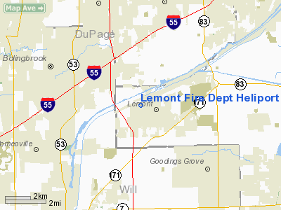
Lemont Fire Dept Heliport |
Location
& QuickFacts
|
FAA
Information Effective: |
2007-12-20 |
|
Airport
Identifier: |
6IS2 |
|
Airport
Status: |
Operational |
|
Longitude/Latitude: |
088-00-15.2140W/41-40-20.1110N
-88.004226/41.672253 (Estimated) |
|
Elevation: |
590 ft / 179.83 m (Estimated) |
|
Land: |
2 acres |
|
From
nearest city: |
0 nautical miles N of Lemont, IL |
|
Location: |
Cook County, IL |
|
Magnetic Variation: |
01W (1985) |
Owner
& Manager
|
Ownership: |
Publicly
owned |
|
Owner: |
Lemont Fire Protection Dist |
|
Address: |
40 E New Ave
Lemont, IL 60439 |
|
Phone
number: |
708-257-2376 |
|
Manager: |
Terry Drcogan |
|
Address: |
40 E New Ave
Lemont, IL 60439 |
|
Phone number: |
708-257-2376 |
Airport Operations and Facilities
|
Airport
Use: |
Private |
|
Wind
indicator: |
Yes |
|
Segmented Circle: |
No |
|
Control
Tower: |
No |
|
Lighting
Schedule: |
DUSK-DAWN
HELIPAD LGTD WITH PERIMETER LGTS. |
|
Sectional chart: |
Chicago |
|
Region: |
AGL - Great Lakes |
|
Boundary
ARTCC: |
ZAU - Chicago |
|
Tie-in
FSS: |
IKK - Kankakee |
|
FSS
on Airport: |
No |
|
FSS
Toll Free: |
1-800-WX-BRIEF |
|
Runway Information
Helipad H1
|
Dimension: |
36
x 36 ft / 11.0 x 11.0 m |
|
Surface: |
CONC, |
|
Edge
Lights: |
Low |
|
|
Runway H1 |
Runway |
|
Traffic
Pattern: |
Left |
Left |
|
Radio Navigation
Aids
|
ID |
Type |
Name |
Ch |
Freq |
Var |
Dist |
|
HK |
NDB |
Ermin |
|
332.00 |
01W |
8.0 nm |
|
MX |
NDB |
Kedzi |
|
248.00 |
01W |
14.7 nm |
|
ME |
NDB |
Deana |
|
350.00 |
00E |
17.8 nm |
|
DKB |
NDB |
Dekalb |
|
209.00 |
02W |
35.2 nm |
|
OIX |
NDB |
Ottawa |
|
266.00 |
01E |
42.5 nm |
|
ORD |
VOR/DME |
Chicago O'hare |
086X |
113.90 |
02E |
19.5 nm |
|
DPA |
VOR/DME |
Dupage |
021X |
108.40 |
02E |
20.3 nm |
|
OBK |
VOR/DME |
Northbrook |
077X |
113.00 |
02W |
33.1 nm |
|
IKK |
VOR/DME |
Kankakee |
053X |
111.60 |
00E |
36.6 nm |
|
JOT |
VORTAC |
Joliet |
070X |
112.30 |
02E |
16.0 nm |
|
CGT |
VORTAC |
Chicago Heights |
089X |
114.20 |
02E |
21.8 nm |
|
EON |
VORTAC |
Peotone |
079X |
113.20 |
02E |
26.0 nm |
|
MDW |
VOT |
Chicago Midway |
|
111.00 |
|
13.2 nm |
|
ORD |
VOT |
Chicago O'hare Intl |
|
112.00 |
|
19.1 nm |
Remarks
- PRVDD
ALL OPNS ARE CONDD FM 80-90 & 280-290 DEG, AREA IS MKD, WIND INDCR
IS MAINTD, ANT IS OBSTN LGTD.
Lemont Fire Dept Heliport
Address:
Cook County, IL
Tel:
708-257-2376
Images
and information placed above are from
http://www.airport-data.com/airport/6IS2/
We
thank them for the data!
| General
Info |
| Country |
United
States |
| State |
ILLINOIS
|
| FAA ID |
6IS2 |
| Latitude |
41-40-20.111N
|
| Longitude |
088-00-15.214W
|
| Elevation |
590 feet
|
| Near City |
LEMONT
|
We don't guarantee the information is fresh and accurate. The data may
be wrong or outdated.
For more up-to-date information please refer to other sources.
|
|


