 |
|
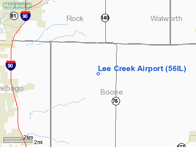
Location
& QuickFacts
|
FAA
Information Effective: |
2007-12-20 |
|
Airport
Identifier: |
56IL |
|
Airport
Status: |
Operational |
|
Longitude/Latitude: |
088-52-30.0000W/42-27-45.0000N
-88.875000/42.462500 (Estimated) |
|
Elevation: |
965 ft / 294.13 m (Estimated) |
|
Land: |
0 acres |
|
From
nearest city: |
6 nautical miles N of Caledonia, IL |
|
Location: |
Boone County, IL |
|
Magnetic Variation: |
01W (1995) |
Owner
& Manager
|
Ownership: |
Privately
owned |
|
Owner: |
Dominic Ruscitti |
|
Address: |
21355 Grade School Rd
Caledonia, IL 61011 |
|
Phone
number: |
815-292-3519 |
|
Manager: |
Dominic Ruscitti |
|
Address: |
21355 Grade School Rd
Caledonia, IL 61011 |
|
Phone number: |
815-292-3519 |
Airport Operations and Facilities
|
Airport
Use: |
Private |
|
Segmented Circle: |
No |
|
Control
Tower: |
No |
|
Sectional chart: |
Chicago |
|
Region: |
AGL - Great Lakes |
|
Boundary
ARTCC: |
ZAU - Chicago |
|
Tie-in
FSS: |
IKK - Kankakee |
|
FSS
on Airport: |
No |
|
FSS
Toll Free: |
1-800-WX-BRIEF |
|
Runway Information
Runway 09/27
|
Dimension: |
2200 x 70 ft / 670.6 x 21.3 m
300 FT STWY WEST END. |
|
Surface: |
TURF, Fair Condition |
|
|
Runway 09 |
Runway 27 |
|
Traffic
Pattern: |
Left |
Right |
|
Obstruction: |
15 ft pline, 400.0 ft from runway |
75 ft trees, 2000.0 ft from runway |
|
Radio Navigation
Aids
|
ID |
Type |
Name |
Ch |
Freq |
Var |
Dist |
|
JVL |
NDB |
Janesville |
|
375.00 |
03E |
11.8
nm |
|
LVV |
NDB |
Lake
Lawn |
|
404.00 |
00W |
18.9
nm |
|
DKB |
NDB |
Dekalb |
|
209.00 |
02W |
32.6
nm |
|
FEP |
NDB |
Freeport |
|
335.00 |
00E |
34.2
nm |
|
MS |
NDB |
Monah |
|
400.00 |
00E |
41.6
nm |
|
RYV |
NDB |
Rock
River |
|
371.00 |
01W |
43.3
nm |
|
UES |
NDB |
Waukesha |
|
359.00 |
01W |
45.0
nm |
|
RA |
NDB |
Paser |
|
206.00 |
00E |
45.2
nm |
|
GM |
NDB |
Teels |
|
242.00 |
02W |
45.6
nm |
|
ME |
NDB |
Deana |
|
350.00 |
00E |
48.1
nm |
|
JVL |
VOR/DME |
Janesville |
090X |
114.30 |
03E |
11.7
nm |
|
RFD |
VOR/DME |
Rockford |
045X |
110.80 |
01E |
20.3
nm |
|
BUU |
VOR/DME |
Burbun |
092X |
114.50 |
01W |
28.8
nm |
|
PLL |
VOR/DME |
Polo |
049X |
111.20 |
03E |
41.6
nm |
|
DPA |
VOR/DME |
Dupage |
021X |
108.40 |
02E |
41.6
nm |
|
ENW |
VOR/DME |
Kenosha |
029X |
109.20 |
02W |
42.6
nm |
|
OBK |
VOR/DME |
Northbrook |
077X |
113.00 |
02W |
43.5
nm |
|
MSN |
VORTAC |
Madison |
023X |
108.60 |
03E |
45.8
nm |
|
BAE |
VORTAC |
Badger |
111X |
116.40 |
02E |
47.2
nm |
Remarks
- 125
FT EITHER SIDE OF RWY & 200 FT OFF RWY END CLEAR OF OBSTN; OBSTN
REMOVED/LOWERED FOR 20:1 APCH; MAINTAIN TRAFFIC NORTH OF ARPT.
Lee Creek Airport
Address:
Boone County, IL
Tel:
815-292-3519
Images
and information placed above are from
http://www.airport-data.com/airport/56IL/
We
thank them for the data!
| General
Info |
| Country |
United
States |
| State |
ILLINOIS
|
| FAA ID |
56IL |
| Latitude |
42-27-45.000N
|
| Longitude |
088-52-30.000W
|
| Elevation |
965 feet
|
| Near City |
CALEDONIA
|
We don't guarantee the information is fresh and accurate. The data may
be wrong or outdated.
For more up-to-date information please refer to other sources.
|
|


