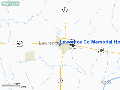
Lawrence Company Memorial Hospital Heliport |
Location
& QuickFacts
|
FAA
Information Effective: |
2007-12-20 |
|
Airport
Identifier: |
1LL1 |
|
Airport
Status: |
Operational |
|
Longitude/Latitude: |
087-41-41.0950W/38-43-41.1690N
-87.694749/38.728102 (Estimated) |
|
Elevation: |
470 ft / 143.26 m (Estimated) |
|
Land: |
0 acres |
|
From
nearest city: |
4 nautical miles W of Lawrenceville, IL |
|
Location: |
Lawrence County, IL |
|
Magnetic Variation: |
00W (1985) |
Owner
& Manager
|
Ownership: |
Publicly
owned |
|
Address: |
|
|
Manager: |
Gerald E. Waldroup |
|
Address: |
W State St
Lawrenceville, IL 62439 |
|
Phone number: |
618-943-1000 |
Airport Operations and Facilities
|
Airport Use: |
Private
MEDICAL USE. |
|
Wind indicator: |
Yes |
|
Segmented Circle: |
No |
|
Control Tower: |
No |
|
Landing fee charge: |
No |
|
Sectional chart: |
St Louis |
|
Region: |
AGL - Great Lakes |
|
Boundary ARTCC: |
ZID - Indianapolis |
|
Tie-in FSS: |
COU - Columbia |
|
FSS on Airport: |
No |
|
FSS Toll Free: |
1-800-WX-BRIEF |
Airport Services
|
Airframe
Repair: |
NONE |
|
Power
Plant Repair: |
NONE |
|
Runway Information
Helipad H1
|
Dimension: |
100
x 100 ft / 30.5 x 30.5 m |
|
Surface: |
TURF, |
|
|
Runway H1 |
Runway |
|
Traffic
Pattern: |
Left |
Left |
|
Radio Navigation
Aids
|
ID |
Type |
Name |
Ch |
Freq |
Var |
Dist |
|
OEA |
NDB |
Vincennes |
|
251.00 |
00E |
6.9
nm |
|
AJG |
NDB |
Mount
Carmel |
|
524.00 |
02W |
7.1
nm |
|
PLX |
NDB |
Palestine |
|
391.00 |
00W |
17.3
nm |
|
OLY |
NDB |
Olney |
|
272.00 |
00W |
22.4
nm |
|
SIV |
NDB |
Sullivan |
|
326.00 |
02W |
25.9
nm |
|
DCY |
NDB |
Washington |
|
212.00 |
03W |
26.4
nm |
|
FOA |
NDB |
Elm
River |
|
353.00 |
00E |
35.8
nm |
|
CZB |
NDB |
Casey |
|
359.00 |
00E |
37.5
nm |
|
FWC |
NDB |
Wayne
County |
|
257.00 |
01E |
39.6
nm |
|
HU |
NDB |
Yinno |
|
245.00 |
02W |
42.0
nm |
|
PDW |
NDB |
Evansville |
|
284.00 |
00E |
42.1
nm |
|
CUL |
NDB |
Carmi |
|
332.00 |
01W |
43.1
nm |
|
MT |
NDB |
Zebre |
|
347.00 |
00E |
48.4
nm |
|
FNZ |
NDB |
Ferdinand |
|
239.00 |
00E |
49.6
nm |
|
LWV |
VOR/DME |
Lawrenceville |
025X |
108.80 |
01W |
4.9
nm |
|
RSV |
VOR/DME |
Robinson |
021X |
108.40 |
02E |
17.6
nm |
|
SAM |
VOR/DME |
Samsville |
113X |
116.60 |
03E |
23.5
nm |
|
HNB |
VOR/DME |
Huntingburg |
029X |
109.20 |
00E |
45.1
nm |
|
BIB |
VORTAC |
Bible
Grove |
027X |
109.00 |
03E |
38.6
nm |
|
PXV |
VORTAC |
Pocket
City |
080X |
113.30 |
03E |
48.2
nm |
Remarks
- HELIPORT
ONLY USED FOR EMERGENCY MEDICAL SERVICE PROGRAM.
- PROVIDED
INGRESS/EGRESS OPNS CONDUCTED S & NNW OF HELIPORT.
Lawrence Company Memorial Hospital Heliport
Address:
Lawrence County, IL
Tel:
618-943-1000
Images
and information placed above are from
http://www.airport-data.com/airport/1LL1/
We
thank them for the data!
| General
Info |
| Country |
United
States |
| State |
ILLINOIS
|
| FAA ID |
1LL1 |
| Latitude |
38-43-41.169N
|
| Longitude |
087-41-41.095W
|
| Elevation |
470 feet
|
| Near City |
LAWRENCEVILLE
|
We don't guarantee the information is fresh and accurate. The data may
be wrong or outdated.
For more up-to-date information please refer to other sources.
|


