 |
|
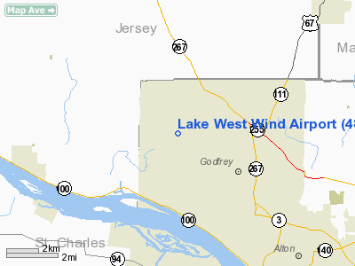
Location
& QuickFacts
|
FAA
Information Effective: |
2007-12-20 |
|
Airport
Identifier: |
48IL |
|
Airport
Status: |
Operational |
|
Longitude/Latitude: |
090-14-50.0000W/38-58-12.0000N
-90.247222/38.970000 (Estimated) |
|
Elevation: |
601 ft / 183.18 m (Estimated) |
|
Land: |
0 acres |
|
From
nearest city: |
3 nautical miles NW of Godfrey, IL |
|
Location: |
Madison County, IL |
|
Magnetic Variation: |
01E (1995) |
Owner & Manager
|
Ownership: |
Privately owned |
|
Owner: |
William J Preis |
|
Address: |
3400 Riverview Ct
Godfrey, IL 62035 |
|
Phone number: |
618-466-1919 |
|
Manager: |
William J Preis |
|
Address: |
3400 Riverview Ct
Godfrey, IL 62035 |
|
Phone number: |
618-466-1919 |
Airport
Operations and Facilities
|
Airport
Use: |
Private |
|
Segmented Circle: |
No |
|
Control
Tower: |
No |
|
Sectional chart: |
St Louis |
|
Region: |
AGL - Great Lakes |
|
Boundary
ARTCC: |
ZKC - Kansas City |
|
Tie-in
FSS: |
STL - Saint Louis |
|
FSS
on Airport: |
No |
|
FSS
Toll Free: |
1-800-WX-BRIEF |
|
Runway Information
Runway 17/35
|
Dimension: |
2152 x 102 ft / 655.9 x 31.1 m
HAS A 450 FT STWY AT N END. |
|
Surface: |
TURF, Good Condition |
|
|
Runway 17 |
Runway 35 |
|
Traffic
Pattern: |
Left |
Left |
|
Radio Navigation
Aids
|
ID |
Type |
Name |
Ch |
Freq |
Var |
Dist |
|
CVM |
NDB |
Civic
Memorial |
|
263.00 |
02E |
10.1
nm |
|
LM |
NDB |
Oblio |
|
338.00 |
00E |
14.7
nm |
|
LTD |
NDB |
Litchfield |
|
371.00 |
01E |
29.2
nm |
|
BL |
NDB |
Belleville |
|
362.00 |
02E |
38.1
nm |
|
FES |
NDB |
Festus |
|
269.00 |
01E |
47.0
nm |
|
PPQ |
NDB |
Pittsfield |
|
344.00 |
02E |
47.4
nm |
|
SKE |
TACAN |
Scott |
059X |
|
02E |
31.5
nm |
|
CSX |
VOR/DME |
Cardinal |
111Y |
116.45 |
00E |
14.1
nm |
|
IJX |
VOR/DME |
Jacksonville |
023X |
108.60 |
02E |
48.5
nm |
|
STL |
VORTAC |
St
Louis |
121X |
117.40 |
01E |
12.8
nm |
|
TOY |
VORTAC |
Troy |
107X |
116.00 |
04E |
20.7
nm |
|
FTZ |
VORTAC |
Foristell |
045X |
110.80 |
05E |
37.7
nm |
|
STL |
VOT |
St
Louis Lambert |
|
111.00 |
|
14.4
nm |
|
SUS |
VOT |
Spirit
Of St Louis |
|
112.20 |
|
26.5
nm |
Remarks
- PRVDD
OBSTN (WIRES N OF RY) ARE LOWERED OR REMOVED TO PRVD A CLEAR 20:1 APCH;
AREA 125 FT EITHER SIDE OF RY CENTERLINE IS CLEAR.
Lake West Wind Airport
Address:
Madison County, IL
Tel:
618-466-1919
Images
and information placed above are from
http://www.airport-data.com/airport/48IL/
We
thank them for the data!
| General
Info |
| Country |
United
States |
| State |
ILLINOIS
|
| FAA ID |
48IL |
| Latitude |
38-50-12.000N
|
| Longitude |
090-14-50.000W
|
| Elevation |
601 feet
|
| Near City |
GODFREY
|
We don't guarantee the information is fresh and accurate. The data may
be wrong or outdated.
For more up-to-date information please refer to other sources.
|
|


