 |
|
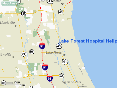
Lake Forest Hospital Heliport |
|
|
Location
& QuickFacts
|
FAA
Information Effective: |
2007-12-20 |
|
Airport
Identifier: |
45IL |
|
Airport
Status: |
Operational |
|
Longitude/Latitude: |
087-51-49.2530W/42-15-13.0830N
-87.863681/42.253634 (Estimated) |
|
Elevation: |
680 ft / 207.26 m (Estimated) |
|
Land: |
0 acres |
|
From
nearest city: |
3 nautical miles W of Lake Forest, IL |
|
Location: |
Lake County, IL |
|
Magnetic Variation: |
01W (1985) |
Owner
& Manager
|
Ownership: |
Privately
owned |
|
Owner: |
Lake Forest Hospital |
|
Address: |
660 N. Westmoreland Road
Lake Forest, IL 60045 |
|
Phone
number: |
708-234-5600 |
|
Manager: |
Roger Wojtowicz |
|
Address: |
660 N. Westmoreland Road
Lake Forest, IL 60045 |
|
Phone number: |
708-234-5600 |
Airport Operations and Facilities
|
Airport
Use: |
Private
MEDICAL USE. |
|
Wind
indicator: |
Yes |
|
Segmented Circle: |
No |
|
Control
Tower: |
No |
|
Lighting
Schedule: |
PHONE REQ
FOR PERIMETER LGTS CALL
708-234-5600. |
|
Sectional chart: |
Chicago |
|
Region: |
AGL - Great Lakes |
|
Boundary
ARTCC: |
ZAU - Chicago |
|
Tie-in
FSS: |
IKK - Kankakee |
|
FSS
on Airport: |
No |
|
FSS
Toll Free: |
1-800-WX-BRIEF |
|
Runway Information
Helipad H1
|
Dimension: |
50
x 50 ft / 15.2 x 15.2 m |
|
Surface: |
CONC, |
|
|
Runway H1 |
Runway |
|
Traffic
Pattern: |
Left |
Left |
|
Radio Navigation
Aids
|
ID |
Type |
Name |
Ch |
Freq |
Var |
Dist |
|
ME |
NDB |
Deana |
|
350.00 |
00E |
18.7
nm |
|
RA |
NDB |
Paser |
|
206.00 |
00E |
25.8
nm |
|
MX |
NDB |
Kedzi |
|
248.00 |
01W |
31.7
nm |
|
HK |
NDB |
Ermin |
|
332.00 |
01W |
32.2
nm |
|
GM |
NDB |
Teels |
|
242.00 |
02W |
40.2
nm |
|
LVV |
NDB |
Lake
Lawn |
|
404.00 |
00W |
42.0
nm |
|
DKB |
NDB |
Dekalb |
|
209.00 |
02W |
42.2
nm |
|
BL |
NDB |
Yanks |
|
260.00 |
02W |
48.5
nm |
|
OBK |
VOR/DME |
Northbrook |
077X |
113.00 |
02W |
4.4
nm |
|
ORD |
VOR/DME |
Chicago
O'hare |
086X |
113.90 |
02E |
16.1
nm |
|
ENW |
VOR/DME |
Kenosha |
029X |
109.20 |
02W |
21.0
nm |
|
HRK |
VOR/DME |
Horlick |
124X |
117.70 |
02W |
30.6
nm |
|
DPA |
VOR/DME |
Dupage |
021X |
108.40 |
02E |
30.8
nm |
|
BUU |
VOR/DME |
Burbun |
092X |
114.50 |
01W |
32.6
nm |
|
CGT |
VORTAC |
Chicago
Heights |
089X |
114.20 |
02E |
46.6
nm |
|
JOT |
VORTAC |
Joliet |
070X |
112.30 |
02E |
47.1
nm |
|
ORD |
VOT |
Chicago
O'hare Intl |
|
112.00 |
|
16.4
nm |
|
MDW |
VOT |
Chicago
Midway |
|
111.00 |
|
28.5
nm |
|
MKE |
VOT |
Milwaukee |
|
109.00 |
|
41.8
nm |
Remarks
- PRVDD
APP/DEP OPNS ARE CONDUCTED FM 170 DEGS TO 320 DEGS; AREA IS MARKED;
WIND INDICATOR IS MAINTAINED; TREES & LIGHTS ARE REMOVED/LOWERED;
PILOTS BE ADVISED OF TALL TOWER NE.
Lake Forest Hospital Heliport
Address:
Lake County, IL
Tel:
708-234-5600
Images
and information placed above are from
http://www.airport-data.com/airport/45IL/
We
thank them for the data!
| General
Info |
| Country |
United
States |
| State |
ILLINOIS
|
| FAA ID |
45IL |
| Latitude |
42-15-13.083N
|
| Longitude |
087-51-49.253W
|
| Elevation |
680 feet
|
| Near City |
LAKE FOREST |
We don't guarantee the information is fresh and accurate. The data may
be wrong or outdated.
For more up-to-date information please refer to other sources.
|
|


