 |
|
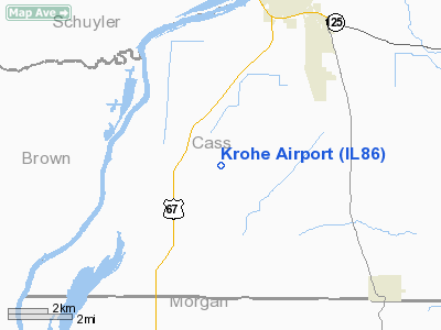
Location
& QuickFacts
|
FAA
Information Effective: |
2007-12-20 |
|
Airport
Identifier: |
IL86 |
|
Airport
Status: |
Operational |
|
Longitude/Latitude: |
090-28-00.4510W/39-56-10.1720N
-90.466792/39.936159 (Estimated) |
|
Elevation: |
450 ft / 137.16 m (Estimated) |
|
Land: |
0 acres |
|
From
nearest city: |
5 nautical miles SW of Beardstown, IL |
|
Location: |
Cass County, IL |
|
Magnetic Variation: |
02E (1985) |
Owner & Manager
|
Ownership: |
Privately owned |
|
Owner: |
Marvin Krohe |
|
Address: |
7221 Us Hwy 67
Beardstown, IL 62618 |
|
Phone number: |
217-323-2366 |
|
Address: |
|
Airport
Operations and Facilities
|
Airport
Use: |
Private |
|
Wind
indicator: |
No |
|
Segmented Circle: |
No |
|
Control
Tower: |
No |
|
Landing
fee charge: |
No |
|
Sectional chart: |
St Louis |
|
Region: |
AGL - Great Lakes |
|
Boundary ARTCC: |
ZKC - Kansas City |
|
Tie-in FSS: |
STL - Saint Louis |
|
FSS on Airport: |
No |
|
FSS Toll Free: |
1-800-WX-BRIEF |
Airport Services
|
Airframe
Repair: |
NONE |
|
Power
Plant Repair: |
NONE |
|
Runway Information
Runway E/W
|
Dimension: |
2500
x 50 ft / 762.0 x 15.2 m |
|
Surface: |
TURF, |
|
|
Runway E |
Runway W |
|
Traffic
Pattern: |
Left |
Left |
|
Radio Navigation
Aids
|
ID |
Type |
Name |
Ch |
Freq |
Var |
Dist |
|
PPQ |
NDB |
Pittsfield |
|
344.00 |
02E |
23.0
nm |
|
SP |
NDB |
Huskk |
|
382.00 |
01W |
34.1
nm |
|
JZY |
NDB |
Macomb |
|
251.00 |
01E |
35.3
nm |
|
UI |
NDB |
Quincy |
|
293.00 |
02E |
36.4
nm |
|
LQ |
NDB |
Licol |
|
375.00 |
01W |
39.8
nm |
|
CTK |
NDB |
Canton |
|
236.00 |
02E |
41.9
nm |
|
HAE |
NDB |
Hannibal |
|
411.00 |
03E |
47.0
nm |
|
IJX |
VOR/DME |
Jacksonville |
023X |
108.60 |
02E |
14.2
nm |
|
SPI |
VORTAC |
Spinner |
74X |
112.70 |
01W |
36.9
nm |
|
UIN |
VORTAC |
Quincy |
083X |
113.60 |
05E |
37.8
nm |
|
CAP |
VORTAC |
Capital |
074X |
112.70 |
04E |
38.9
nm |
Remarks
Based
Aircraft
|
Aircraft
based on field: |
1 |
|
Single
Engine Airplanes: |
1 |
Krohe Airport
Address:
Cass County, IL
Tel:
217-323-2366
Images
and information placed above are from
http://www.airport-data.com/airport/IL86/
We
thank them for the data!
| General
Info |
| Country |
United
States |
| State |
ILLINOIS
|
| FAA ID |
IL86 |
| Latitude |
39-56-10.172N
|
| Longitude |
090-28-00.451W
|
| Elevation |
450 feet
|
| Near City |
BEARDSTOWN
|
We don't guarantee the information is fresh and accurate. The data may
be wrong or outdated.
For more up-to-date information please refer to other sources.
|
|


